
Interstate 8-32 C
Midland County, operated by Diamondback E&P LLC
- Their interest
- Royaltydecimal 0.00312500
- Paying now
- $4,434 a monthour estimate, from the state's newest months
- On the state's map
- 5 wellsringed on the map below
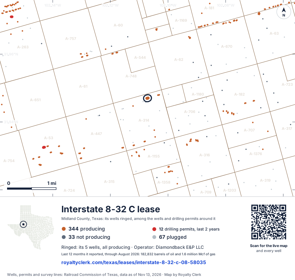
- Their lease5Its wells, ringed on the map: all producing
- Drilling locations12Permits issued in the last two years
- Producing wells344On a lease reporting production now
- Not producing33Shut in, inactive or no lease on record
- Plugged67The state's wellbore record says plugged
The 5 ringed dots are this lease's wells, each where the Railroad Commission's map puts it. The other dots are wells and drilling permits of the last 24 months on the land around it; the counts are for everything in the picture, which is about 6 miles across. The thin brown lines are the original land surveys. Sources: Railroad Commission of Texas well layers, drilling permit files and survey lines.
Where the money comes from
The 5 ringed wells are this lease's. The estate’s royalty is paid on what they produce.
Drilling nearby
12 drilling permits were issued in this picture in the last 2 years, the red dots. Companies are still drilling here, and a new well on this lease would add to what it pays.
The land on paper
The state’s well records put most of its wells in Section 17, Block 39 T2S, T&P RR CO Survey, A-314. The court inventory uses the same words. Open the live map to see the original surveys and their abstract numbers.