
The Texas oil and gas well map
507,552 wells · 15,697 permits in 2 years · permits through November 13, 2026
FreeNo account needed
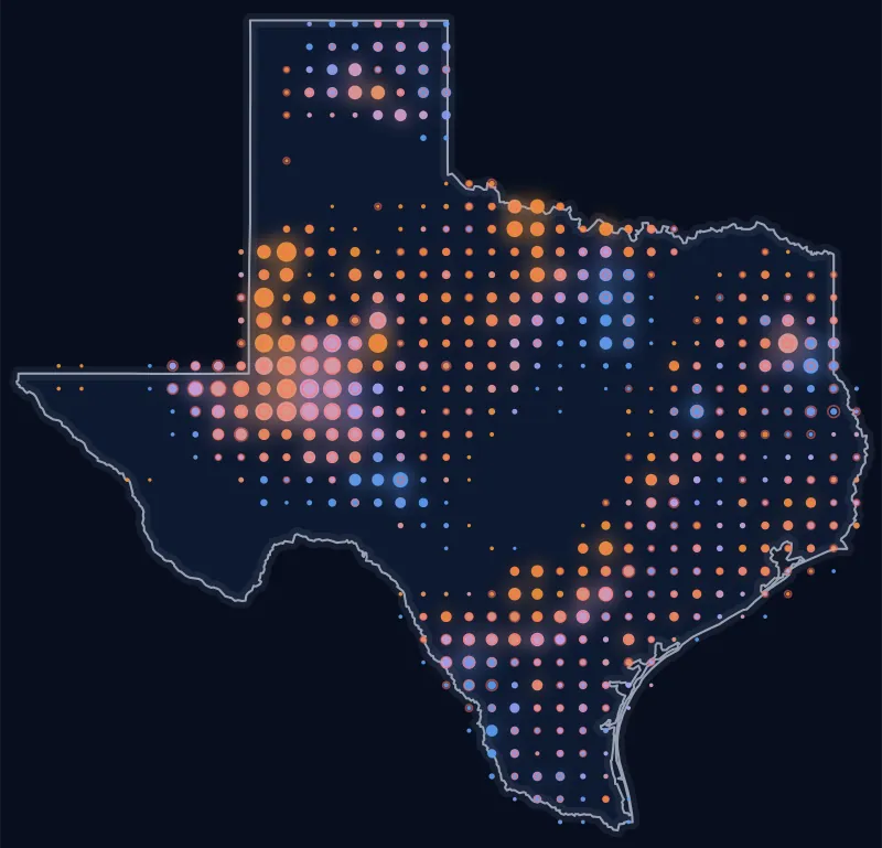
The wells on Texas leases and the drilling permits of the last 2 years, each where the Railroad Commission puts it, from the whole state down to a single pad, with the survey lines your deed is written in. Type a street address, a ZIP code or an abstract, see what is drilling near your home or land, and open any well for its production.
Permits through November 13, 2026. Permits are checked every night, wells every week.
- 507,552wells on the map, each where the state puts it
- 15,697drilling permits in the last 2 years
- 134,140wells and permits drawn out to their bottom hole
- 224county maps, and maps around 852 towns
On the live map
What you can do on it
Real screenshots of the live map around Cotulla, in La Salle County. It works the same in every county, on a computer or a phone.
On the map
- Drilling permits
- Producing
- Not producing
- Plugged
- Survey lines
- Well paths
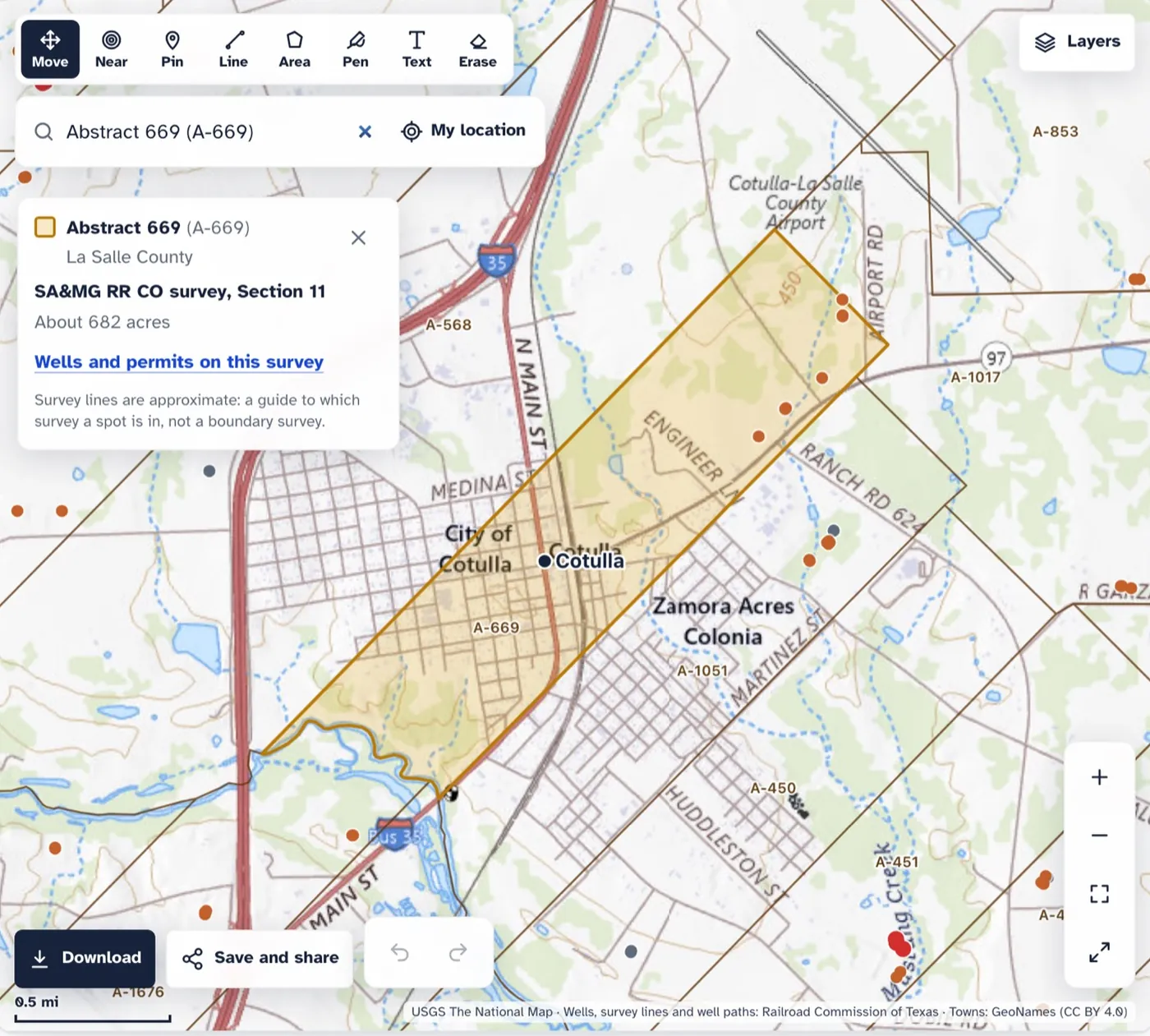
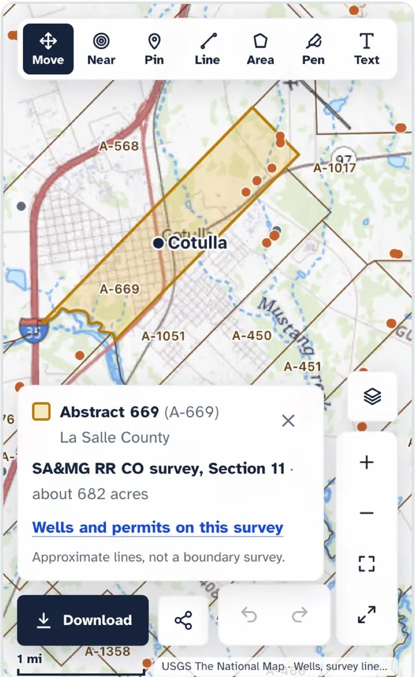
Find your tract by its abstract. Type the abstract number from your deed, like A-669. The map shades the survey, gives its size and links to the wells and permits on it.
On the map
- Drilling permits
- Producing
- Not producing
- Plugged
- Survey lines
- Well paths
224 county maps
Find your county’s map
Your deed, lease and tax bill all name the county. Pick it on the map or type it, and its map opens with its wells and the permits of the last 2 years.
Most wells on the map
Andrews County
- Wells on the map
- 19,604
- Permits, last 2 years
- 411
The live map opens on the county: zoom in, switch to satellite, turn on the survey lines and draw.
Know the town, not the county? Maps around 852 Texas towns
All 224 county maps, A to Z
- Anderson
- Andrews
- Angelina
- Aransas
- Archer
- Atascosa
- Austin
- Bandera
- Bastrop
- Baylor
- Bee
- Bexar
- Borden
- Bosque
- Bowie
- Brazoria
- Brazos
- Brooks
- Brown
- Burleson
- Caldwell
- Calhoun
- Callahan
- Cameron
- Camp
- Carson
- Cass
- Chambers
- Cherokee
- Childress
- Clay
- Cochran
- Coke
- Coleman
- Collin
- Collingsworth
- Colorado
- Comanche
- Concho
- Cooke
- Cottle
- Crane
- Crockett
- Crosby
- Culberson
- Dallam
- Dallas
- Dawson
- Deaf Smith
- Denton
- De Witt
- Dickens
- Dimmit
- Donley
- Duval
- Eastland
- Ector
- Edwards
- Ellis
- Erath
- Falls
- Fayette
- Fisher
- Floyd
- Foard
- Fort Bend
- Franklin
- Freestone
- Frio
- Gaines
- Galveston
- Garza
- Glasscock
- Goliad
- Gonzales
- Gray
- Grayson
- Gregg
- Grimes
- Guadalupe
- Hale
- Hamilton
- Hansford
- Hardeman
- Hardin
- Harris
- Harrison
- Hartley
- Haskell
- Hemphill
- Henderson
- Hidalgo
- Hill
- Hockley
- Hood
- Hopkins
- Houston
- Howard
- Hudspeth
- Hunt
- Hutchinson
- Irion
- Jack
- Jackson
- Jasper
- Jefferson
- Jim Hogg
- Jim Wells
- Johnson
- Jones
- Karnes
- Kaufman
- Kenedy
- Kent
- Kimble
- King
- Kleberg
- Knox
- Lamb
- La Salle
- Lavaca
- Lee
- Leon
- Liberty
- Limestone
- Lipscomb
- Live Oak
- Loving
- Lubbock
- Lynn
- Madison
- Marion
- Martin
- Matagorda
- Maverick
- McCulloch
- McLennan
- McMullen
- Medina
- Menard
- Midland
- Milam
- Mills
- Mitchell
- Montague
- Montgomery
- Moore
- Morris
- Motley
- Nacogdoches
- Navarro
- Newton
- Nolan
- Nueces
- Ochiltree
- Oldham
- Orange
- Palo Pinto
- Panola
- Parker
- Pecos
- Polk
- Potter
- Presidio
- Rains
- Reagan
- Real
- Red River
- Reeves
- Refugio
- Roberts
- Robertson
- Runnels
- Rusk
- Sabine
- San Augustine
- San Jacinto
- San Patricio
- Schleicher
- Scurry
- Shackelford
- Shelby
- Sherman
- Smith
- Somervell
- Starr
- Stephens
- Sterling
- Stonewall
- Sutton
- Tarrant
- Taylor
- Terrell
- Terry
- Throckmorton
- Titus
- Tom Green
- Travis
- Trinity
- Tyler
- Upshur
- Upton
- Val Verde
- Van Zandt
- Victoria
- Walker
- Waller
- Ward
- Washington
- Webb
- Wharton
- Wheeler
- Wichita
- Wilbarger
- Willacy
- Williamson
- Wilson
- Winkler
- Wise
- Wood
- Yoakum
- Young
- Zapata
- Zavala
Your own land
Find it on the map in three steps
Step 1: Type an address, a ZIP code or the abstract
A street address or ZIP code goes straight there. For land with no address, your deed, lease, division order or tax bill names the county and the survey, and usually the abstract number, like A-669.
Step 2: Search it on the map above
An address gets rings at half a mile, 1 mile and 3 miles; an abstract is shaded with its size. You can also type a town, a lease, an operator or a well’s API number.
Step 3: Tap Near, or draw your tract
List the wells and permits within 1, 2 or 5 miles, nearest first, with the operator. Or outline the tract and read its acres.
Read it right
Four things to keep in mind
- A dot is where a well startsIts surface location. A horizontal well can run a mile or more from it, under other tracts.
- A line is straight; the bore can curveEach line runs from a well to its bottom hole on file with the Railroad Commission.
- Survey lines are a guideApproximate: a guide to which survey a spot is in, not a boundary survey.
- Near is not paidWho is paid for a well depends on the lease, the unit and the division order, not on distance.
FAQ
Questions people ask
Is the Texas well map free?
Yes. Looking at the map, searching a street address, ZIP code or abstract number, listing what is near a spot, showing one operator's wells and drawing on the map are free, with no account. A free account adds saving your maps, sharing them with your drawings, and downloads: a picture, a page to print, and your drawings for Google Earth.
Where do the wells and permits come from?
From the Railroad Commission of Texas: its well layers for where each well is and where its bottom hole is, its drilling permit files, its wellbore records for which wells are plugged, and the monthly production reports for which leases are producing. The survey lines are the Commission's, drawn from General Land Office maps. Under them are streets and places from OpenStreetMap (through OpenFreeMap) on the statewide map, and the US Geological Survey's National Map, as a topo map or satellite photos.
How do I find my land on the map?
Type a street address or a ZIP code into the search box on the map above, and it goes there. For land without a street address, look on your deed, lease, division order or county tax bill for the county, the survey and the abstract number, like A-669, and type the abstract number instead: the map shades that survey and gives its size. Then tap Near on it to list the wells and permits around it, nearest first.
Can I see the oil and gas wells near my home?
Yes. Type your street address, or tap "Use my location" on a phone, and the map goes there and draws rings at half a mile, 1 mile and 3 miles, with how many wells and recent permits are inside each, nearest first. The address is sent to the US Census Bureau to find it on the map and is never saved, put in the page's address or shared.
What else does the map do besides showing wells?
A year slider plays the wells and permits year by year, with the year over the map. A heat view shows where drilling is busiest across the state. On any well's card, "See it underground" draws the well's depth and reach to scale, to print on one page. And every Texas ZIP code has its own page of the wells inside it and near it.
Are the survey lines exact?
No. They are approximate: a guide to which survey a spot is in, not a boundary survey. Where a line matters, the deed's own description and a licensed surveyor decide.
Is the line from a well the path of the well?
Not exactly. The map draws a straight line from where the well starts at the surface to its bottom hole on file with the Railroad Commission. A horizontal well turns and can curve underground, so the line shows which way the well reaches and how far, not every turn of it. Dashed lines are recent drilling permits.
How current is the map?
Drilling permits are checked every night, the well layers and wellbore records every week, and production, which decides whether a well shows as producing, every month. The Railroad Commission publishes on its own schedule, so a new well can take days or weeks to appear.
Does a well near my land mean I am owed royalties?
No. A well near your land, or a line under it, does not say who owns the minerals or who is paid. That depends on your lease, the unit the well is pooled in and the division order. If a well reaches your tract and no check comes, look up the lease and ask the operator in writing.
Can I get an email when a well is permitted near my land?
Yes. Pick a spot on the map (right-click it, or hold a finger on it on a phone) and tap Alert me: you get an email when a drilling permit is filed within 1, 3, 5 or 10 miles of it. Texas Well Watch also sends one email a week when the Railroad Commission records something new on an abstract, a lease or an operator you follow: a permit, a completion or first production. Both are free.
Related
More Texas maps and alerts
- Texas dataNew Texas drilling permitsEvery drilling permit of the last seven days, on a map, with a page for each week since 2024.
- Texas dataOil and gas wells by ZIP codeThe wells inside any Texas ZIP code and near it, the newest permits and the operators.
- Texas dataTexas oil and gas playsThe Permian, the Eagle Ford and the other big plays: their counties, wells and permits.
- ToolTown fact sheets for reportersA one-page fact sheet, the map and three facts to quote for each Texas town near drilling.
- ToolPut a well map on your siteA town's, county's or ZIP code's live well map in a news story or a local page, with the credit built in.
- ToolTexas well watchPermit, completion, first production and when the first check is due.
- Texas dataOil wells near Texas townsWells and new drilling locations within 10 miles of a town, on a map.
- Texas dataTexas lease lookupFind your lease by name, RRC number or county.
- Texas dataTexas county mapOil and gas by county, every year since 1993.
Found the wells? Make sure they pay you.
Put your royalty statement beside the state’s record for the lease, month by month. Free to start.
Sources
Primary sources, opened on 29 September 2026.
- Railroad Commission of Texas, data sets available for download (drilling permits, production, GIS)
- Railroad Commission of Texas, Public GIS Viewer (survey and abstract boundaries)
- USGS The National Map, basemap services (topo and imagery map under the wells), public domain
- US Census Bureau, cartographic boundary files (county outlines)
- GeoNames geographical database (town points), CC BY 4.0
- US Census Bureau, Geocoder (street address search) and ZIP Code Tabulation Areas
- OpenFreeMap, map tiles from OpenStreetMap data (streets and places on the statewide map), © OpenStreetMap contributors, ODbL