
RRC field 85808550 · District 09
Steele (Steele Sand)
The Steele (Steele Sand) field reported 21 barrels of oil in the last 12 months.
Field dossier
- Producing leases
- 1
- Operators
- 1
- Counties
- 1
- Biggest operator
- Steele, Mark E.
Own minerals in this field?
A family member owned minerals here?
Search their name: a family member who owned minerals hereWhere the field sits
This county
- Data through
- Jul 2026
- Leases on record
- 1
Wells in the Steele (Steele Sand) field
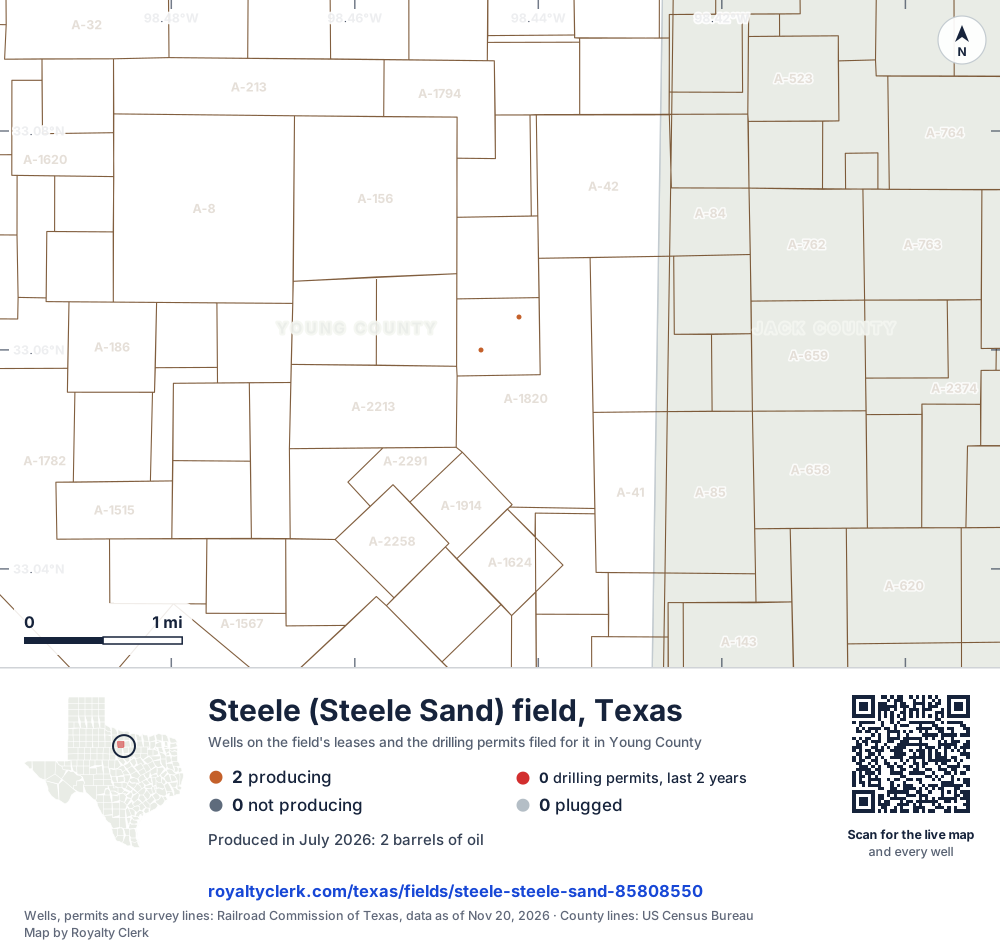
- Drilling locations0Permits issued in the last two years
- Producing wells2On a lease reporting production now
- Not producing0Shut in, inactive or no lease on record
- Plugged0The state's wellbore record says plugged
Each dot is a well on a lease the Railroad Commission lists in the Steele (Steele Sand) field, where its map puts it, or a drilling permit filed for the field in the last 24 months. Wells of other fields are not on this map. The picture is about 6 miles across. The white counties are the ones with a well or drilling permit of the field on the map. The thin brown lines are the original land surveys; where there is room, a survey carries its abstract number, the number deeds and division orders cite. Sources: Railroad Commission of Texas well layers, drilling permit files and survey lines, US Census Bureau county outlines.
Use this map on your site
You may show this map on any site, unchanged. Keep the credit line and its link to Royalty Clerk under the map. The picture updates by itself as the state records new wells and permits.
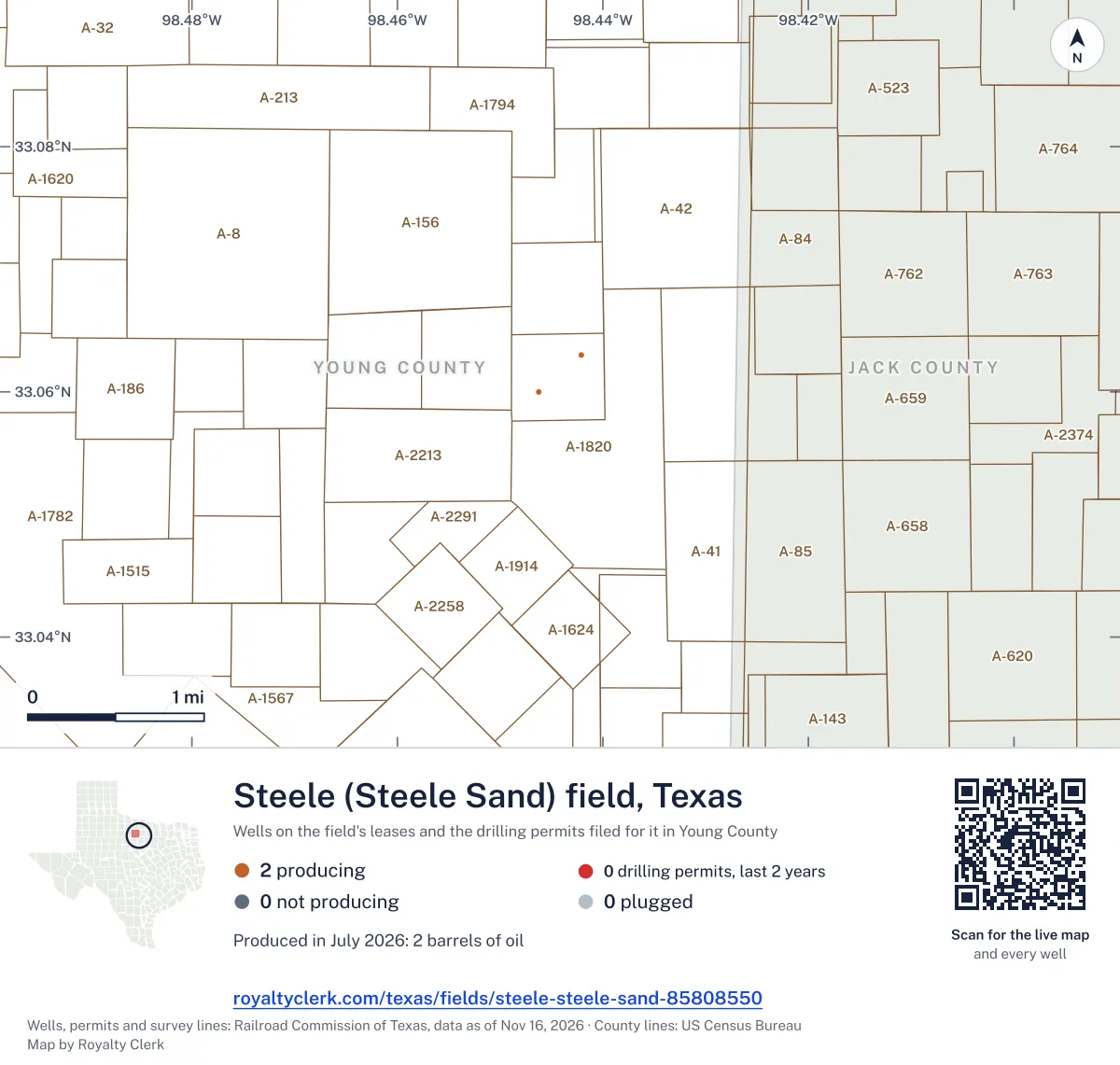
<a href="https://royaltyclerk.com/texas/fields/steele-steele-sand-85808550"><img src="https://royaltyclerk.com/maps/field-wells/steele-steele-sand-85808550.svg" alt="Map of the wells of the Steele (Steele Sand) field, Texas: 2 wells and 0 recent drilling locations, in a picture about 6 miles across." width="1000" height="951" loading="lazy" style="max-width:100%;height:auto;border:0"></a>
<p style="margin:4px 0 0;font-size:14px">Map: <a href="https://royaltyclerk.com/texas/fields/steele-steele-sand-85808550">Oil and gas wells of the Steele (Steele Sand) field, Texas</a> by Royalty Clerk, from Railroad Commission of Texas records</p>
Five years of output in Steele (Steele Sand)
Oil output in the Steele (Steele Sand) field rose 62% over the last 12 months
21 bbl through Jul 2026, against 13 bbl a year earlier. Peak Dec 2023: 11 bbl.
SourceTexas Railroad Commission Production Data Query, field 85808550, through Jul 2026, file dated Oct 20, 2026.
Leases in the Steele (Steele Sand) field
Under each volume: change on the year before.
21bbl oil+62%
Showing 1 of 1.
SourceTexas Railroad Commission Production Data Query.
Recent drilling permits in the Steele (Steele Sand) field
No recent permits.