
RRC operator 216418
Denton Exploration, Inc.
Denton Exploration, Inc. reported 10,366 barrels of oil and 37,164 mcf of gas in the last 12 months.
Operator dossier
- Producing leases
- 11of 14 on record
- Counties
- 3
- Biggest county
- Throckmorton County
- Biggest field
- Que (Noodle Creek)
Get checks from Denton Exploration, Inc.?
A family member owned minerals here?
Search their name: a family member who owned minerals hereWhere they work
fewermore
- Gas, last 12 months
- 37,164 mcf
- Fields
- 4
- Data through
- Aug 2026
- Leases on record
- 14
Where Denton Exploration, Inc. has wells
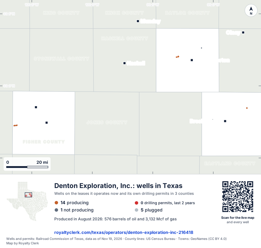
- Drilling locations0Permits issued in the last two years
- Producing wells14On a lease reporting production now
- Not producing1Shut in, inactive or no lease on record
- Plugged5The state's wellbore record says plugged
Each dot is a well on a lease Denton Exploration, Inc. operates now, where the Railroad Commission's map puts it, or one of its drilling permits of the last 24 months. Wells of other operators are not on this map. The picture is about 125 miles across. The white counties are the ones with a well or drilling permit of its own on the map. Sources: Railroad Commission of Texas well layers and drilling permit files, US Census Bureau county outlines, town points from GeoNames (CC BY 4.0).
Use this map on your site
You may show this map on any site, unchanged. Keep the credit line and its link to Royalty Clerk under the map. The picture updates by itself as the state records new wells and permits.
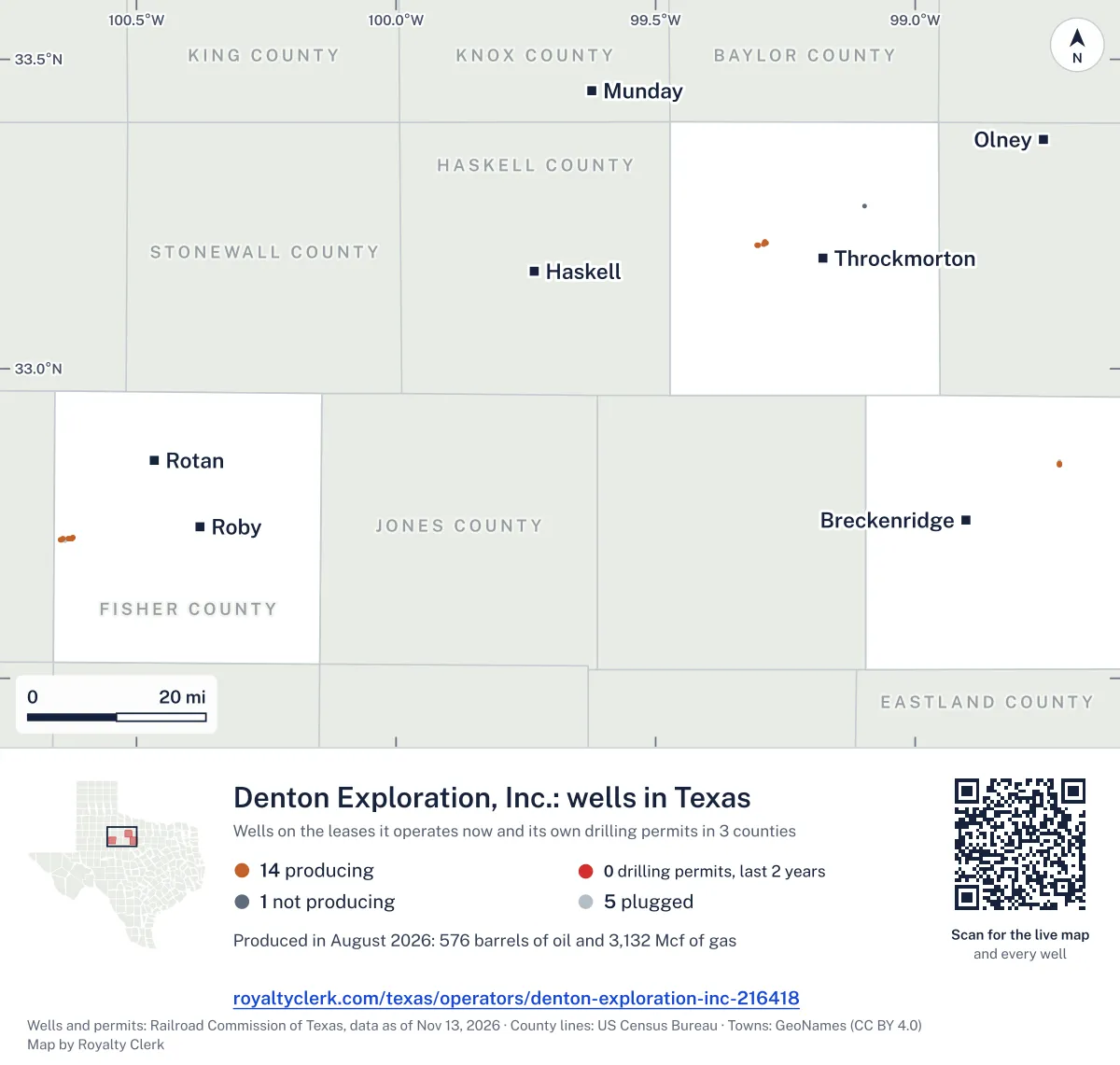
<a href="https://royaltyclerk.com/texas/operators/denton-exploration-inc-216418"><img src="https://royaltyclerk.com/maps/operator-wells/denton-exploration-inc-216418.svg" alt="Map of the wells of Denton Exploration, Inc. in Texas: 20 wells and 0 recent drilling locations, in a picture about 125 miles across." width="1000" height="951" loading="lazy" style="max-width:100%;height:auto;border:0"></a>
<p style="margin:4px 0 0;font-size:14px">Map: <a href="https://royaltyclerk.com/texas/operators/denton-exploration-inc-216418">Oil and gas wells of Denton Exploration, Inc. in Texas</a> by Royalty Clerk, from Railroad Commission of Texas records</p>
Gas fell until 2024, then rose in 2025
Denton Exploration, Inc. runs 14 leases, and 11 of them are producing. They sit in Fisher, Stephens and Throckmorton counties. Oil made more of its output (counted in barrels of oil equivalent) than gas in every full calendar year from 2020 to 2025.
Gas fell from 101,963 mcf in 2020 to 35,689 mcf in 2024. It rose in 2025 to 39,028 mcf. Lease fuel, gas used on the lease itself, took 70.0% of its gas over the last 12 months. The rest, 30.0%, went to a gas line.
Throckmorton County gives 89.7% of its gas. Targa Midstream Services LLC is the buyer listed for two of its leases. Of its 20 wells, 15 are active, and none are horizontal.
Not a forecast, not reserves.
Key moments
- 2020Gas reached 101,963 mcf and oil 20,936 bbl.
- 2021Oil fell to 17,004 bbl and gas to 86,118 mcf.
- 2022Gas fell to 61,515 mcf, and oil to 14,384 bbl.
- 2023Oil rose to 14,935 bbl, while gas fell to 57,630 mcf.
- 2024Gas fell to 35,689 mcf, and oil to 11,968 bbl.
- 2025Gas rose to 39,028 mcf, up from 35,689 mcf in 2024.
If you own here
- Who buys my oil and gas?
Targa Midstream Services LLC is the buyer listed for 2 leases here. The tool shows the buyers listed for a lease, and since when.
- Gas royalty calculator
70.0% of the gas went to lease fuel and 30.0% to a gas line. The tool shows where each cost comes off.
- Why is my royalty check lower?
Oil fell 13.5% over the last 12 months. The tool splits a drop between volume, price, deductions and the owner's share.
Questions owners ask
- How has this operator's gas changed since 2020?
- In 2020 the operator reported 101,963 mcf of gas. In 2024 it reported 35,689 mcf, and in 2025 it reported 39,028 mcf. The 2026 figures cover only the months through July 2026.
- Who buys this operator's oil and gas?
- The Railroad Commission lists Targa Midstream Services LLC for 2 leases, Davis Gas Processing, Inc. for 1 lease, and Targa North Texas LP for 1 lease. These are the main buyers on record. Who buys my oil and gas?
- Where does this operator produce?
- It has 11 producing leases in 3 counties: Fisher, Stephens and Throckmorton. Its fields with producing leases are Que (Noodle Creek), Walker-Davis (Congl. 3960), Denton A. (Caddo) and Swenson (Caddo). Que has 7 producing leases.
- How is its gas used?
- Over the last 12 months, 70.0% of its gas went to lease fuel, and 30.0% went to a gas line. Lease fuel is gas the lease uses itself. Gas royalty calculator
- How much has its oil changed over the last 12 months?
- Oil fell 13.5% over the last 12 months. It was 11,969 bbl in the 12 months before, and 10,352 bbl in the last 12 months. Why is my royalty check lower?
Related pages
- Denton Exploration, Inc.
Identity and role of Denton Exploration, Inc. as a company.
- Throckmorton County
Throckmorton gives 89.7% of this operator's gas.
- Fisher County
Fisher has 7 producing leases and 45.7% of its oil.
- Que (Noodle Creek)
Que (Noodle Creek) has 7 producing leases and no gas reported.
- Perkins
Perkins, its oldest producing lease, has reports back to January 1993.
From the state's records through July 2026.
Gas fell to 35,689 mcf in 2024, then rose
Oil output from Denton Exploration, Inc. fell 10% over the last 12 months
10.4k bbl through Aug 2026, against 11.5k bbl a year earlier. Peak Oct 2022: 1,555 bbl.
Gas output from Denton Exploration, Inc. held steady over the last 12 months
37.2k mcf through Aug 2026, against 37k mcf a year earlier. Peak Nov 2021: 6,995 mcf.
SourceTexas Railroad Commission Production Data Query, operator 216418, through Aug 2026, file dated Oct 20, 2026.
Which 14 leases Denton Exploration runs, biggest first
Under each volume: change on the year before.
3,230bbl oil+22%
2,079bbl oil−10%
1,686bbl oil+10%
907bbl oil−51%
716bbl oil−45%
513bbl oil+31%
492bbl oil−14%
401bbl oil−2%
318bbl oil−14%
1,036mcf gas−1%
24bbl oil−76%
Showing 11 of 11, ranked by output value.
SourceTexas Railroad Commission Production Data Query.
Where it produces: three counties and four fields
Counties, by Denton Exploration, Inc. oil
Throckmorton County leads
Fields, by Denton Exploration, Inc. oil
Que (Noodle Creek) leads
Recent drilling permits Denton Exploration has filed
No recent permits.
Where the gas of Denton Exploration, Inc. went
- Plants
- 0.0%
- Pipelines
- 31%
- Lease fuel
- 69%
- Flared or vented
- 0.0%
SourceTexas Railroad Commission Production Data Query, last 12 months. What the codes mean
Denton Exploration, Inc. address and phone number
This is the mailing address and phone Denton Exploration, Inc. filed with the Texas Railroad Commission. It is the company’s address of record with the state. It can be a regulatory office and not the desk that pays royalties, so a letter about a payment should name the owner relations or division order department, your owner number and the lease name from your stub.
Mailing address
Denton Exploration, Inc.3710 Rawlins Suite 1070 LB70
Dallas, TX 75219-6406
Phone
State filing
RRC operator 216418 · P-5 status: Active · last filing received Feb 11, 2026
Writing about a missing or stopped check? See what to ask first or open the company record for its state registration and who buys its oil and gas.
SourceTexas Railroad Commission, P-5 Organization data, file dated Oct 22, 2026. Royalty Clerk is not affiliated with Denton Exploration, Inc..