
RRC operator 307219
Gilstrap, Joel
Gilstrap, Joel reported 26,694 barrels of oil in the last 12 months.
Operator dossier
- Producing leases
- 13
- Counties
- 2
- Biggest county
- Sterling County
- Biggest field
- Clark (San Andres)
Get checks from Gilstrap, Joel?
A family member owned minerals here?
Search their name: a family member who owned minerals hereWhere they work
fewermore
- Fields
- 5
- Data through
- Aug 2026
Where Gilstrap, Joel has wells
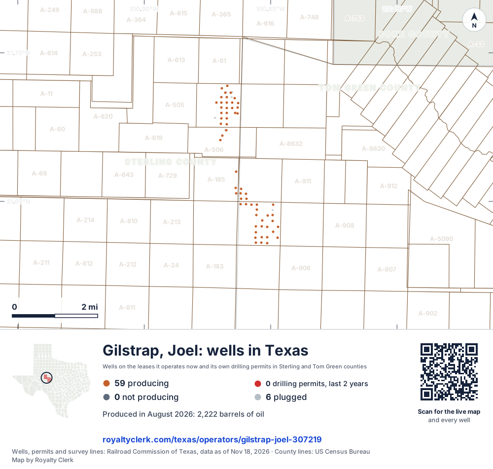
- Drilling locations0Permits issued in the last two years
- Producing wells59On a lease reporting production now
- Not producing0Shut in, inactive or no lease on record
- Plugged6The state's wellbore record says plugged
Each dot is a well on a lease Gilstrap, Joel operates now, where the Railroad Commission's map puts it, or one of its drilling permits of the last 24 months. Wells of other operators are not on this map. The picture is about 11 miles across. The white counties are the ones with a well or drilling permit of its own on the map. The thin brown lines are the original land surveys; where there is room, a survey carries its abstract number, the number deeds and division orders cite. Sources: Railroad Commission of Texas well layers, drilling permit files and survey lines, US Census Bureau county outlines.
Use this map on your site
You may show this map on any site, unchanged. Keep the credit line and its link to Royalty Clerk under the map. The picture updates by itself as the state records new wells and permits.
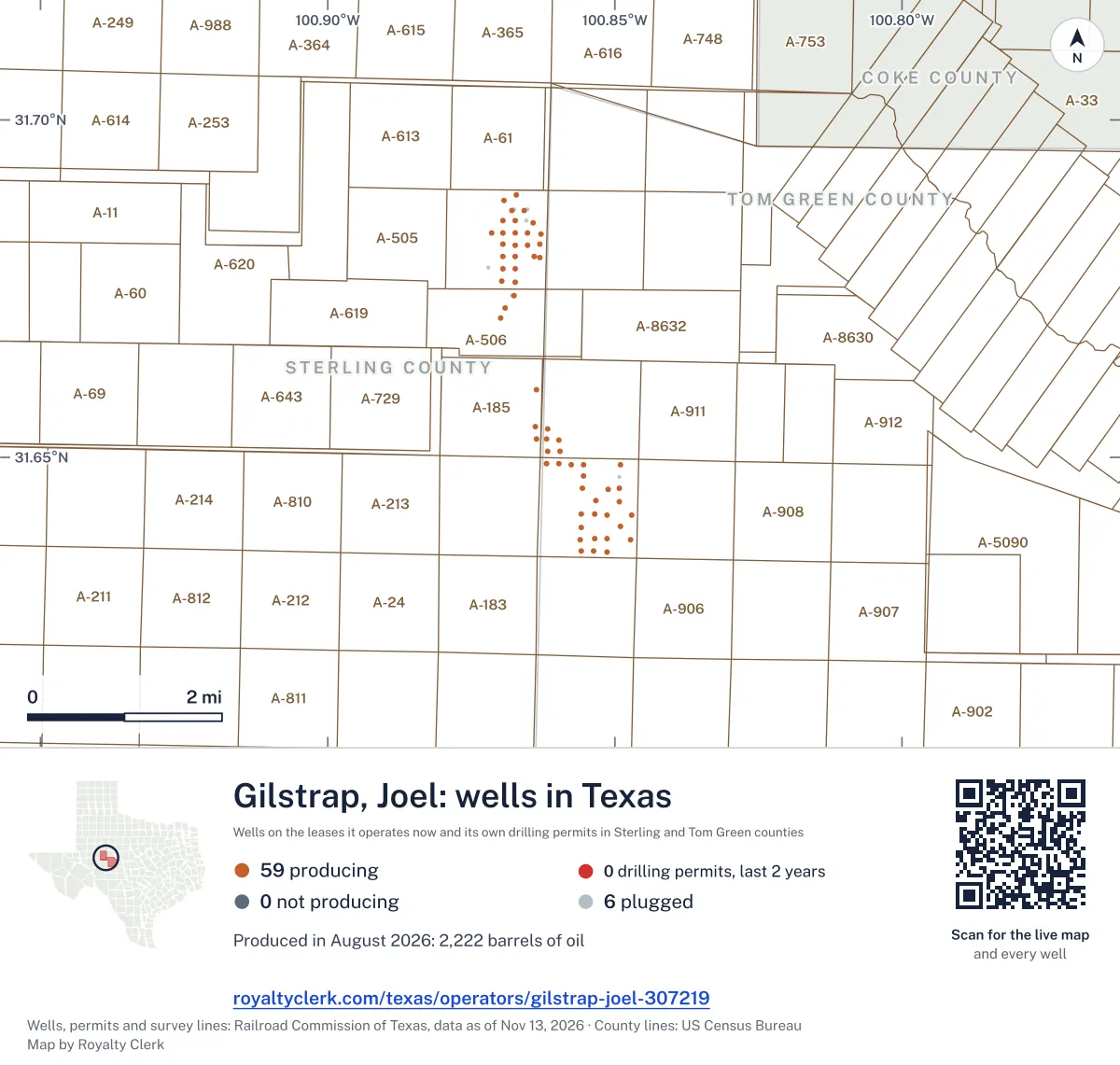
<a href="https://royaltyclerk.com/texas/operators/gilstrap-joel-307219"><img src="https://royaltyclerk.com/maps/operator-wells/gilstrap-joel-307219.svg" alt="Map of the wells of Gilstrap, Joel in Texas: 65 wells and 0 recent drilling locations, in a picture about 11 miles across." width="1000" height="951" loading="lazy" style="max-width:100%;height:auto;border:0"></a>
<p style="margin:4px 0 0;font-size:14px">Map: <a href="https://royaltyclerk.com/texas/operators/gilstrap-joel-307219">Oil and gas wells of Gilstrap, Joel in Texas</a> by Royalty Clerk, from Railroad Commission of Texas records</p>
Oil rose in 2024, when 2 leases changed operators
Joel Gilstrap runs 13 producing leases in Tom Green and Sterling counties, and every one reports oil only. Oil was 11,897 bbl in 2020 and 10,445 bbl in 2023. In 2024 it rose to 18,146 bbl, the same year this operator took over 2 leases. In 2025 it reached 27,427 bbl.
Sterling County holds 3 producing leases and 60.6% of its oil. Tom Green County holds 10 producing leases. Its 86 wells include 67 active ones, and none are horizontal.
The oldest producing lease is Clark, L. C., with reports back to January 1993.
Key moments
- 2021Oil fell to 11,108 bbl, from 11,897 the year before.
- 2022Oil fell again, to 10,839 bbl.
- 2023Oil fell to 10,445 bbl across its leases.
- 2024Took over 2 leases; oil rose to 18,146 bbl.
- 2025Oil rose to 27,427 bbl, from 18,146 in 2024.
If you own here
- Who buys my oil and gas?
All 13 producing leases report oil, so the buyers listed for each lease matter. Shows the buyers and since when.
- Operator price check
Oil is its only product, so the oil price on a check stub is the one to compare. Compares it with Texas buyer prices and WTI.
Questions owners ask
- Which leases and fields does this operator run?
- It runs 13 producing leases in 2 counties and 5 fields. Tom Green County has 10 producing leases and Sterling County has 3. Clark (San Andres) shows 15,209 bbl of oil from 2 producing leases.
- Does this operator drill horizontal wells?
- No. Its 86 wells include 67 active ones, and none are horizontal. Its producing leases report oil only, and no gas is reported on any of them.
- Who buys the oil from these leases?
- The Railroad Commission lists the buyers and gatherers for each lease, with the date each one began. All 13 producing leases report oil, so check the buyer listed for your own lease. Who buys my oil and gas?
Related pages
- Tom Green County
Tom Green County: 10 producing leases and 10,525 bbl of oil.
- Sterling County
Sterling County: 3 producing leases and 16,169 bbl of oil.
- Clark (San Andres)
Clark (San Andres): 2 producing leases and 15,209 bbl of oil.
- Water Valley (San Andres)
Water Valley (San Andres): 5 producing leases and 5,083 bbl of oil.
- Clark, L. C.
Oldest producing lease here, with reports back to January 1993.
From the state's records through July 2026.
Oil output by month over the last five years
Oil output from Gilstrap, Joel fell 6% over the last 12 months
26.7k bbl through Aug 2026, against 28.5k bbl a year earlier. Peak Dec 2024: 2,871 bbl.
SourceTexas Railroad Commission Production Data Query, operator 307219, through Aug 2026, file dated Oct 20, 2026.
Its 13 producing leases, biggest first
Under each volume: change on the year before.
15,163bbl oil−9%
4,185bbl oil+11%
4,184bbl oil+11%
960bbl oil0%
479bbl oil−21%
419bbl oil+13%
419bbl oil+13%
359bbl oil+9%
187bbl oil+12%
172bbl oil+4%
61bbl oil−60%
60bbl oil−94%
46bbl oil−55%
Showing 13 of 13, ranked by output value.
SourceTexas Railroad Commission Production Data Query.
Which counties and fields it produces in
Counties, by Gilstrap, Joel oil
Sterling County leads
Fields, by Gilstrap, Joel oil
Clark (San Andres) leads
- Clark (San Andres)2 leases · District 08 · Field 1859366615.2kbbl
- Water Valley (Clear Fork)4 leases · District 7C · Field 954453335,381bbl
- Water Valley (San Andres)5 leases · District 7C · Field 954456665,083bbl
- Clark (Glorieta)1 lease · District 08 · Field 18593333960bbl
- Water Valley (San Angelo)1 lease · District 7C · Field 9544570061bbl
Recent drilling permits filed by this operator
No recent permits.