
Wharton County, Texas
Oil wells and drilling locations near El Campo
- 297wells
- 12drilling locations in two years
- 71producing leases
Within 10 miles
Wells and drilling locations around El Campo
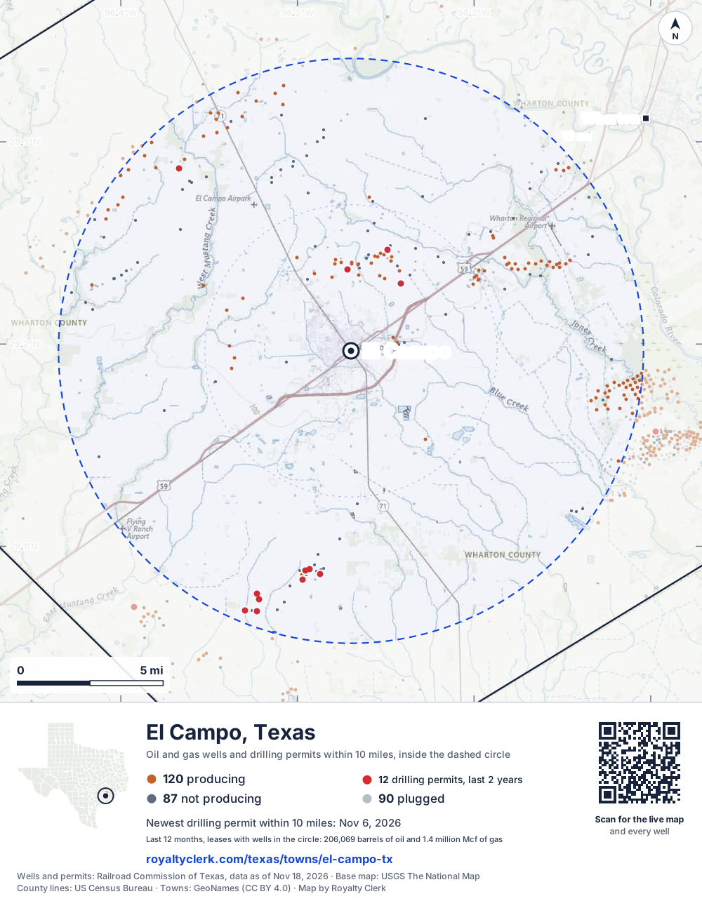
- Drilling locations12Permits issued in the last two years
- Producing wells120On a lease reporting production now
- Not producing87Shut in, inactive or no lease on record
- Plugged90The state's wellbore record says plugged
The dashed circle is 10 miles from the town's point (29.19664, -96.26969); the counts are for wells inside it. Sources: Railroad Commission of Texas well layers and permit files, US Census Bureau county outlines, town points from GeoNames (CC BY 4.0), base map from USGS The National Map.
Use this map on your site
You may show this map on any site, unchanged. Keep the credit line and its link to Royalty Clerk under the map. The picture updates by itself as the state records new wells and permits.
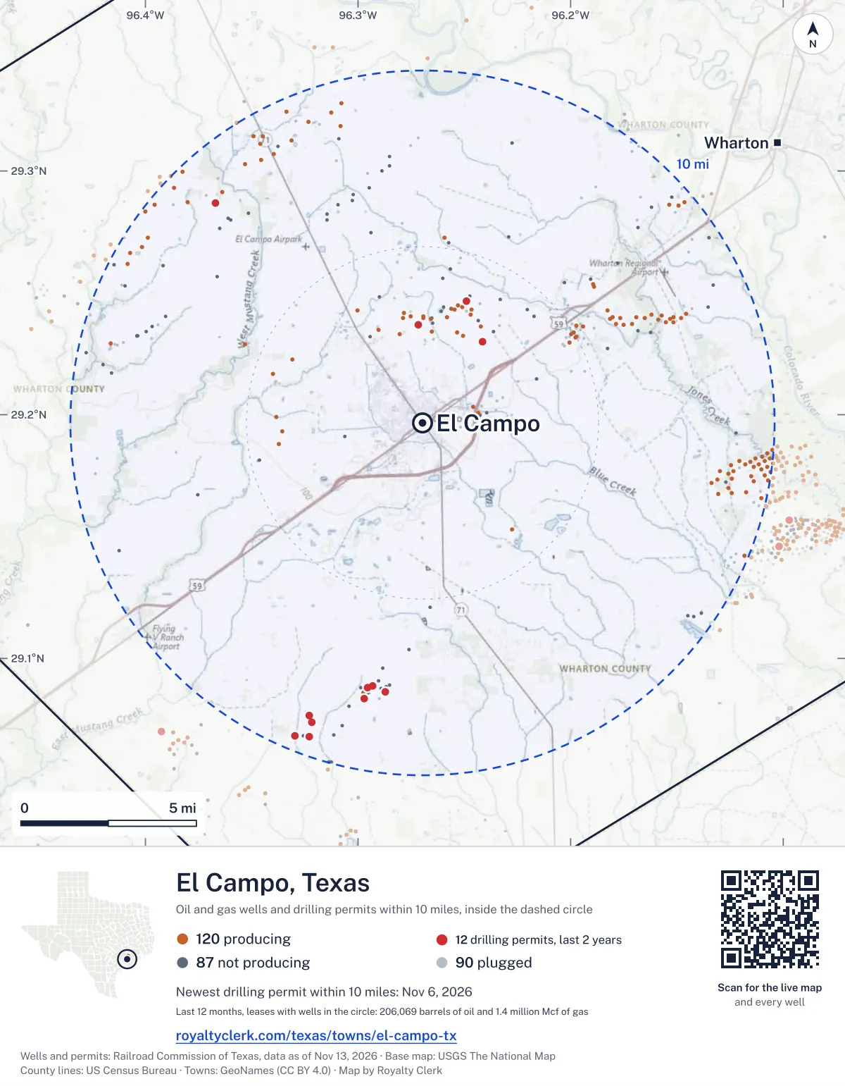
<a href="https://royaltyclerk.com/texas/towns/el-campo-tx"><img src="https://royaltyclerk.com/maps/town-wells/el-campo-tx.svg" alt="Map of El Campo, Texas: 297 wells and 12 recent drilling locations within 10 miles, inside a dashed circle." width="1000" height="1284" loading="lazy" style="max-width:100%;height:auto;border:0"></a>
<p style="margin:4px 0 0;font-size:14px">Map: <a href="https://royaltyclerk.com/texas/towns/el-campo-tx">El Campo, Texas oil and gas wells</a> by Royalty Clerk, from Railroad Commission of Texas records</p>
Which way it is heading
Where the new drilling is around El Campo
What became of the 12 permits
- 3finished, on a lease that reports productionThe well was completed and its lease is reporting oil or gas to the state.
- 1finished, no production reported yetA completion is on file. The first production report follows weeks or months later.
- 5drilling startedThe operator reported a start date. No completion is on file yet.
- 3still only a permitNothing after the permit is on file. Many permits wait a year or more, and some are never drilled.
Wells finished in the last two years: 1 north, 3 south, 1 north-west of town.
A permit is permission to drill, not a well, and a well nearby says nothing about who owns the minerals under it. Direction is taken from the well's surface location. Source: Railroad Commission of Texas drilling permits and wellbore records.
In numbers
Oil and gas within 10 miles of El Campo
- wells with a location on the state's map
- 297
- drilling permits in the last 24 months
- 12
- producing leases with a well in the circle
- 71
- operators running them
- 14
- oil and condensate those leases reported in their latest 12 months
- 206,069 bbl
- gas those leases reported in their latest 12 months
- 1,368,479 mcf
A lease counts when at least one of its wells is inside the circle; its whole production is counted, so a lease reaching beyond the circle counts in full.
In dollars
What the oil and gas near El Campo sold for
- sale value of 12 months, before taxes and costs
- $20 million
- oil and condensate sold
- 203,498 bbl
- gas sold
- 1,194,716 mcf
- the middle lease: half sold more, half less
- $136,648
A 0.01 share (1%) of the middle producing lease near El Campo comes to about $1,366 for the 12 months.
Sold volumes at the public monthly prices, before severance tax and any costs. A guide to the size, not what any owner was paid.
Sold volumes from each lease's monthly report to the Railroad Commission, times the month's West Texas Intermediate oil price and Henry Hub gas price (EIA). Real prices at the lease differ. A lease counts in full when one of its wells is near the town. Check a statement against what the lease sold
Drilling locations
The newest drilling permits near El Campo
| Issued | Lease and well | Where | Operator |
|---|---|---|---|
| 2026-11-06 | CAROLYN LANGE 4vertical · API 42-481-35526 · permit 0919980MB Energy, LLC | 2.8 mi N29.23693, -96.27169 on OpenStreetMap (opens in a new tab) | MB Energy, LLC |
| 2026-08-26 | APPLING 1vertical · API 42-481-35525 · permit 0918104Paloma Operating, LLC | 9.4 mi S29.06798, -96.32283 on OpenStreetMap (opens in a new tab) | Paloma Operating, LLC |
| 2026-04-30 | KAINER HEIRS UNIT 2vertical · API 42-481-35522 · permit 0915244MB Energy, LLC | 2.9 mi NE29.23009, -96.24165 on OpenStreetMap (opens in a new tab) | MB Energy, LLC |
| 2026-03-31 | NAISER-STOVALL GAS UNIT 2vertical · API 42-481-35521 · permit 0914427Ricochet Energy, Inc. | 8.6 mi NW29.28689, -96.36709 on OpenStreetMap (opens in a new tab) | Ricochet Energy, Inc. |
| 2026-03-20 | KUBELA 3vertical · API 42-481-35329 · permit 0914240Amexco, LLC | 3.7 mi N29.24664, -96.24903 on OpenStreetMap (opens in a new tab) | Amexco, LLC |
| 2026-02-20 | RECK-KELLY 1vertical · API 42-481-35520 · permit 0913443Paloma Operating, LLC | 8.9 mi S29.07669, -96.32305 on OpenStreetMap (opens in a new tab) | Paloma Operating, LLC |
| 2025-12-11 | DABOVAL, C.J. A 11vertical · API 42-481-35518 · permit 0912073Paloma Operating, LLC | 7.7 mi S29.08642, -96.28720 on OpenStreetMap (opens in a new tab) | Paloma Operating, LLC |
| 2025-04-11 | HENRY A 1vertical · API 42-481-35514 · permit 0907354Paloma Operating, LLC | 8.0 mi S29.08346, -96.29720 on OpenStreetMap (opens in a new tab) | Paloma Operating, LLC |
| 2025-03-20 | LILIE 2vertical · API 42-481-35491 · permit 0906780Paloma Operating, LLC | 7.6 mi S29.08802, -96.29566 on OpenStreetMap (opens in a new tab) | Paloma Operating, LLC |
| 2025-03-13 | KELLY-MATUS 1vertical · API 42-481-35513 · permit 0906642Paloma Operating, LLC | 9.0 mi S29.07397, -96.32194 on OpenStreetMap (opens in a new tab) | Paloma Operating, LLC |
| 2025-02-19 | WIESNER, ET AL 1vertical · API 42-481-35512 · permit 0905972Paloma Operating, LLC | 9.6 mi S29.06826, -96.32990 on OpenStreetMap (opens in a new tab) | Paloma Operating, LLC |
| 2025-01-08 | LILIE 4vertical · API 42-481-35511 · permit 0904964Paloma Operating, LLC | 7.6 mi S29.08868, -96.29320 on OpenStreetMap (opens in a new tab) | Paloma Operating, LLC |
| 2024-11-12 | WRIGHT 3vertical · API 42-481-35507 · permit 0903905MB Energy, LLC | 2.6 mi N29.23410, -96.26522 on OpenStreetMap (opens in a new tab) | MB Energy, LLC |
| 2024-10-14 | MAYFIELD 1vertical · API 42-481-35504 · permit 0903216MB Energy, LLC | 2.6 mi N29.23297, -96.25911 on OpenStreetMap (opens in a new tab) | MB Energy, LLC |
| 2024-10-14 | MARTIN 1vertical · API 42-481-35503 · permit 0903215MB Energy, LLC | 2.9 mi NW29.23472, -96.29019 on OpenStreetMap (opens in a new tab) | MB Energy, LLC |
| 2024-07-02 | MOLLNAR 1vertical · API 42-481-35501 · permit 0900938MB Energy, LLC | 2.6 mi N29.23305, -96.28039 on OpenStreetMap (opens in a new tab) | MB Energy, LLC |
| 2024-05-24 | WRIGHT 1vertical · API 42-481-35489 · permit 0899901MB Energy, LLC | 2.8 mi N29.23761, -96.26480 on OpenStreetMap (opens in a new tab) | MB Energy, LLC |
| 2024-03-14 | CARY COLE 1vertical · API 42-481-35500 · permit 0898122Paloma Operating, LLC | 7.1 mi S29.09491, -96.28776 on OpenStreetMap (opens in a new tab) | Paloma Operating, LLC |
| 2024-03-11 | LILIE 3vertical · API 42-481-35499 · permit 0897802Paloma Operating, LLC | 7.8 mi S29.08603, -96.29751 on OpenStreetMap (opens in a new tab) | Paloma Operating, LLC |
| 2024-02-23 | CAROLYN LANGE 3vertical · API 42-481-35498 · permit 0897412MB Energy, LLC | 3.0 mi N29.23951, -96.26933 on OpenStreetMap (opens in a new tab) | MB Energy, LLC |
| 2024-02-05 | CAROLYN LANGE 1Rvertical · API 42-481-35497 · permit 0896982MB Energy, LLC | 3.0 mi N29.23947, -96.26552 on OpenStreetMap (opens in a new tab) | MB Energy, LLC |
A permit is permission to drill, not a well. Distances are from the town's point to the well's surface location. Source: Railroad Commission of Texas drilling permits.
Find your land
The surveys under the new drilling near El Campo
- A-132 ET RR CO, section 772 permits, newest February 20, 2026
- A-130 ET RR CO, section 732 permits, newest March 20, 2025
- A-240 I&GN RR CO, section 221 permit, newest November 6, 2026
- A-104 ET RR CO, section 1011 permit, newest August 26, 2026
- A-243 I&GN RR CO, section 251 permit, newest April 30, 2026
- A-608 KING, E C, section 561 permit, newest March 31, 2026
- A-660 GIFFORD, G C, section 41 permit, newest March 20, 2026
- A-495 BAGNAL, J, section 721 permit, newest December 11, 2025
Not in the list? Search every survey in the county by name or abstract number.
Producing leases
Top producing leases near El Campo
- 1Pierce Estates53,665 bbl · 26,884 mcf a yearRemora Management, LLC · Wharton County · 8 wells in the circle
- 2Dorothy Hite Gas Unit0 bbl · 147,585 mcf a yearHilcorp Energy Company · Wharton County · 1 well in the circle
- 3Lilie12,920 bbl · 63,678 mcf a yearPaloma Operating, LLC · Wharton County · 1 well in the circle
- 4Pierce Estates14,666 bbl · 7,146 mcf a yearRemora Management, LLC · Wharton County · 4 wells in the circle
- 5Pierce Estates -A-15,535 bbl · 365 mcf a yearRemora Management, LLC · Wharton County · 22 wells in the circle
- 6Merta, Celestina Et Al423 bbl · 90,079 mcf a yearFaulconer Energy, LLC · Wharton County · 1 well in the circle
- 7Pierce Estates, Inc.14,891 bbl · 2,572 mcf a yearMcGowan Working Partners, Inc. · Wharton County · 19 wells in the circle
- 8Pierce Estates13,365 bbl · 6,437 mcf a yearRemora Management, LLC · Wharton County · 2 wells in the circle
- 9Richter-Niles242 bbl · 82,774 mcf a yearFaulconer Energy, LLC · Wharton County · 1 well in the circle
- 10Pierce Ranch N 4900 Unit11,411 bbl · 13,640 mcf a yearMcGowan Working Partners, Inc. · Wharton County · 13 wells in the circle
- 11Mollnar50 bbl · 73,423 mcf a yearMB Energy, LLC · Wharton County · 1 well in the circle
- 12Duson2,122 bbl · 57,600 mcf a yearTranspacific Energy, LLC · Wharton County · 1 well in the circle
- 13Naiser, J.e. Estate829 bbl · 64,937 mcf a yearFaulconer Energy, LLC · Wharton County · 1 well in the circle
- 14Wright97 bbl · 68,604 mcf a yearMB Energy, LLC · Wharton County · 1 well in the circle
- 15Daboval, C.j.6,899 bbl · 20,179 mcf a yearPaloma Operating, LLC · Wharton County · 1 well in the circle
- 16Carolyn Lange268 bbl · 59,615 mcf a yearMB Energy, LLC · Wharton County · 1 well in the circle
- 17Carriere-Henderson146 bbl · 55,179 mcf a yearFaulconer Energy, LLC · Wharton County · 1 well in the circle
- 18Naiser, J. E. Estate0 bbl · 54,973 mcf a yearFaulconer Energy, LLC · Wharton County · 1 well in the circle
- 19Kelly-Matus8,427 bbl · 0 mcf a yearPaloma Operating, LLC · Wharton County · 1 well in the circle
- 20Naiser, J. E. Estate50 bbl · 45,945 mcf a yearFaulconer Energy, LLC · Wharton County · 1 well in the circle
Whose name is on the check
Who buys the oil and gas near El Campo
Oil and condensate
- GULFMARK ENERGY, INC.60 leases
- ENERGY TRANSFER MARKETING & TERM9 leases
- ENTERPRISE CRUDE OIL LLC7 leases
- GENESIS CRUDE OIL, L.P.3 leases
- TRUTH RESOURCES, L.P.3 leases
Gas
- FAULCONER ENERGY, LLC24 leases
- DCP OPERATING COMPANY, LP18 leases
- HOUSTON PIPE LINE COMPANY LP7 leases
- COKINOS ENERGY, L.L.C.5 leases
- DOW HYDROCARBONS AND RES. LLC4 leases
From each lease's newest Form P-4 filing with the Railroad Commission, which names its gatherers and purchasers. One lease can name several.
If your checks stopped
Leases near El Campo that went quiet or changed hands
22 leases reported nothing for a year or more
Leases that reported within the last four years and then stopped. The newest to stop first; 10 shown.
- Brothers-Knipling Oil Unit · Viper S.w.d., LLClast report August 2025
- O.b. Ranch · Hilcorp Energy Companylast report July 2025
- Lilie · Paloma Operating, LLClast report May 2025
- Matula Family Trust · Hilcorp Energy Companylast report May 2025
- Dybala G.u. · Dallas Petroleum Group, LLClast report April 2025
- Maxwell Unit · Kaler Energy Corp.last report October 2024
- Henry-Rod Unit · Ricochet Energy, Inc.last report September 2024
- Wright · MB Energy, LLClast report September 2024
- Lucian · Ricochet Energy, Inc.last report September 2024
- Gresham Unit · Kaler Energy Corp.last report July 2024
19 leases got a new operator in two years
Checks often pause after a change while the new company sets up its owner records. The newest first; 10 shown.
- StovallViper S.w.d., LLC to Paloma Operating, LLCJune 2026
- Stockton Gas UnitKaler Energy Corp. to Viper S.w.d., LLCMarch 2026
- DrastataFletcher Operating, LLC to Texas Operating Partners LLCJanuary 2026
- FrelsFletcher Operating, LLC to Texas Operating Partners LLCJanuary 2026
- Fucik, George F.Fletcher Operating, LLC to Texas Operating Partners LLCJanuary 2026
- GreerFletcher Operating, LLC to Texas Operating Partners LLCJanuary 2026
- KubalaFletcher Operating, LLC to Texas Operating Partners LLCJanuary 2026
- KubalaFletcher Operating, LLC to Texas Operating Partners LLCJanuary 2026
- RiouxFletcher Operating, LLC to Texas Operating Partners LLCJanuary 2026
- Rioux PropertiesFletcher Operating, LLC to Texas Operating Partners LLCJanuary 2026
From the monthly production reports operators file with the Railroad Commission. The newest months fill in late, so a lease is listed only after 12 months with no report.
Year by year
Production of the leases near El Campo, by year
| Year | Oil, bbl | Gas, mcf |
|---|---|---|
| 2026 so far | 137,135 | 967,310 |
| 2025 | 221,353 | 1,310,851 |
| 2024 | 257,845 | 1,828,293 |
| 2023 | 231,858 | 1,778,892 |
| 2022 | 206,506 | 1,881,916 |
| 2021 | 227,800 | 2,343,313 |
| 2020 | 270,740 | 3,552,510 |
Every lease with a well in the circle, producing now or not, as reported to the Railroad Commission. The newest months fill in as operators report.
The long view: in the state's records from January 1993 on, 186 of these leases reported 16,085,217 bbl of oil and condensate and 243,004,327 mcf of gas. Each lease page carries that lease's history back to January 1993.
Around it
Towns near El Campo
- Wharton13 mi NE257 wells · 4 permits
- Ganado18 mi SW349 wells · 6 permits
- Boling20 mi E324 wells · 2 permits
- Markham20 mi SE319 wells · 6 permits
- Bay City23 mi SE279 wells · 5 permits
- East Bernard26 mi NE184 wells · 4 permits
- Van Vleck26 mi SE273 wells · 5 permits
- Edna27 mi SW242 wells · 8 permits
- Eagle Lake27 mi N125 wells · 0 permits
- Needville30 mi NE280 wells · 4 permits
El Campo is in ZIP code 77437: its wells and permits
All of Wharton County: leases, operators and production · Wharton County well map
Press and community kit
Writing about El Campo? Take what you need
Three facts to quote
- 297 oil and gas wells on the state's map lie within 10 miles of El Campo: 120 on producing leases, 87 not producing and 90 plugged.
- The Railroad Commission of Texas issued 7 drilling permits within 10 miles of El Campo in the last 12 months, the newest dated November 6, 2026.
- The 71 producing leases with a well in that circle, run by 14 operators, reported 206,069 barrels of oil and 1,368,479 thousand cubic feet of gas over their latest 12 months.
The map picture
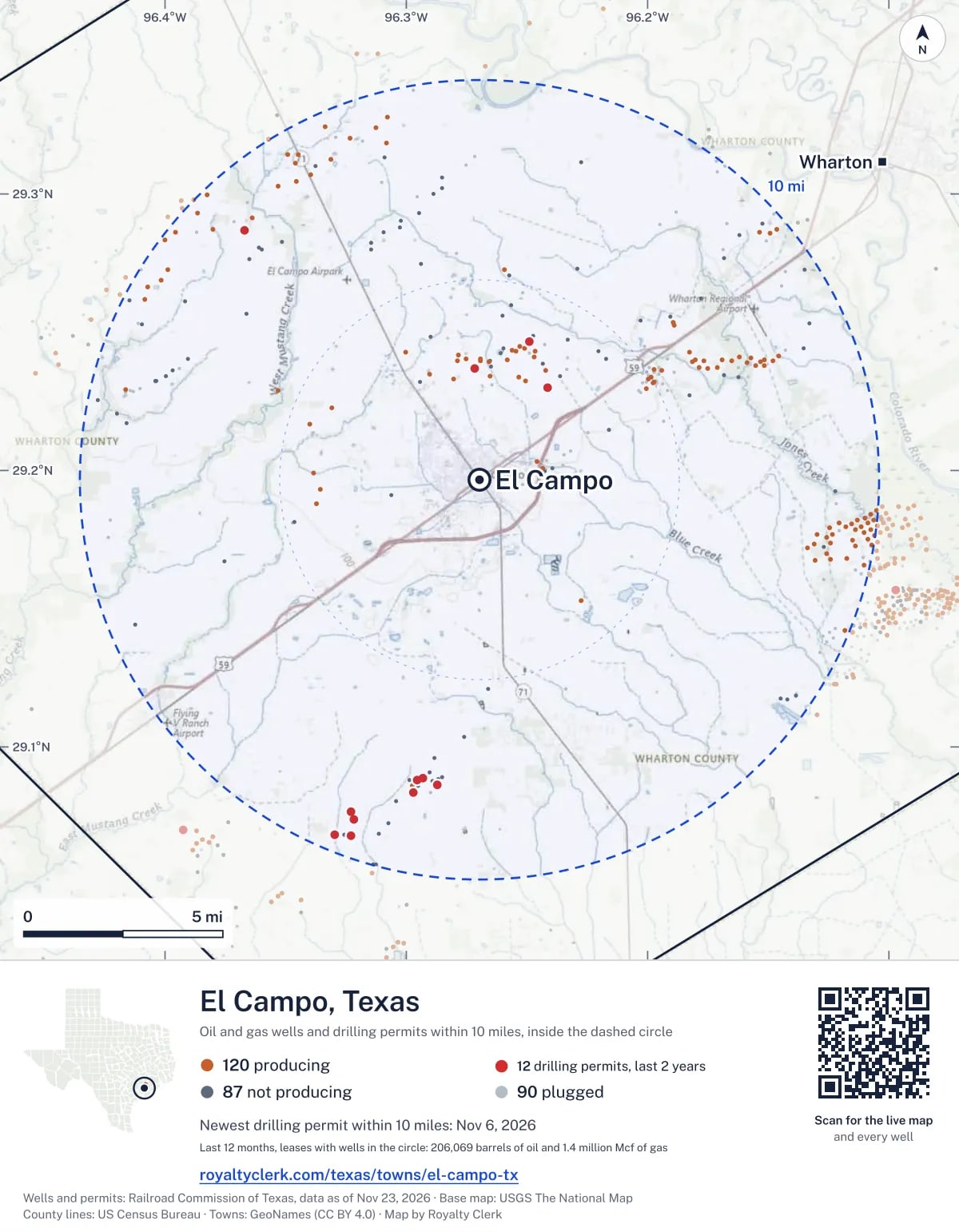
The page's map with its legend and credit, as a JPEG.

The live map on your page
A frame that loads its picture first and the live map on a tap. No cookies.
How to cite
Railroad Commission of Texas records of the wells and drilling permits within 10 miles of El Campo, mapped by Royalty Clerk (https://royaltyclerk.com/texas/towns/el-campo-tx), data as of November 16, 2026.
Under a map or a chart: Source: Railroad Commission of Texas · Map: Royalty Clerk, with a link to this page.
The figures say where the state's records put wells and permits, not who owns the land or the minerals. Kits for other Texas towns
Follow it
Watch the 10 miles around El Campo
Watching a place says nothing about who owns the land or the minerals there. For the whole county, or one survey, use the Wharton County well watch.
FAQ
Questions people ask
How many oil and gas wells are near El Campo?
297 wells with a location on the Railroad Commission's map lie within 10 miles of El Campo: 120 on leases that are producing, 87 not producing and 90 plugged. The state also issued 12 drilling permits with a well location in that circle in the last 24 months.
What are the coordinates on this page?
Latitude and longitude of the well's surface location in NAD83, the coordinates map apps use. They come from the Railroad Commission's well layers as published, and from its drilling permit files, which are published in the older NAD27 and converted here. Paste them into any map app. A horizontal well's bottom hole can be a mile or two away from its surface location.
Do I own minerals under a well near El Campo?
A well nearby says nothing about who owns the minerals under it. The county's mineral roll lists who is paid on each producing lease. Search a name to see whether the Wharton County roll lists it.
Is drilling near El Campo picking up or slowing down?
Drilling permits near El Campo are rising: 7 permits in the last 12 months, 5 in the 12 months before. Most of them are south of town: 8 of 12 lie on that side. The nearest is 2.8 miles north of the town's point. A permit is permission to drill, not a well.
How much are the oil and gas near El Campo worth?
The 71 producing leases with a well within 10 miles sold about $20 million of oil and gas in their newest 12 months on file, at the public monthly prices and before taxes and costs. That is what the leases sold, not what a tract of land or a mineral interest is worth: an owner is paid a share of one lease.
My checks from a lease here stopped. Why?
The usual reasons: the lease stopped producing, a new operator took it over, or the operator put the payments in suspense over a title or address question. Near El Campo, 22 leases went quiet and 19 changed operator; both lists are on this page.
Own land or minerals near El Campo?
See whether a county roll lists your name, and get an email when a permit or a new well is filed near you.
Sources
Primary sources, opened on 29 September 2026. Statute text is the current version on statutes.capitol.texas.gov.