
Mitchell County, Texas
Mitchell County drilling permits: what the state recorded
- 23drilling permits
- 26completions
- 3first-production reports
- in the last twelve months
Wells by coordinates
Oil wells and drilling locations in Mitchell County
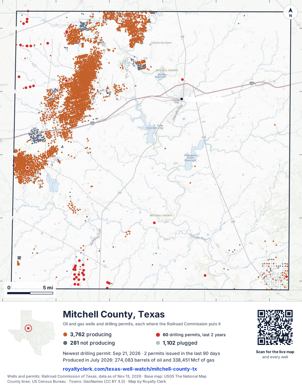
- Drilling locations60Permits issued in the last two years
- Producing wells3,762On a lease reporting production now
- Not producing281Shut in, inactive or no lease on record
- Plugged1,102The state's wellbore record says plugged
Sources: Railroad Commission of Texas well layers and permit files, US Census Bureau county outline, town points from GeoNames (CC BY 4.0), base map from USGS The National Map. A dot is a surface location; a horizontal well runs a mile or more from it.
5,145 wells with a location on the state's map and 60 drilling locations permitted in the last 24 months, each where the Railroad Commission puts it.
A permit is not a well.
Mitchell County is one of the 61 counties of the Permian Basin
Wells near each town in Mitchell County
Wells within 10 miles of each town, on either side of the county line.
Use this map on your site
You may show this map on any site, unchanged. Keep the credit line and its link to Royalty Clerk under the map. The picture updates by itself as the state records new wells and permits.
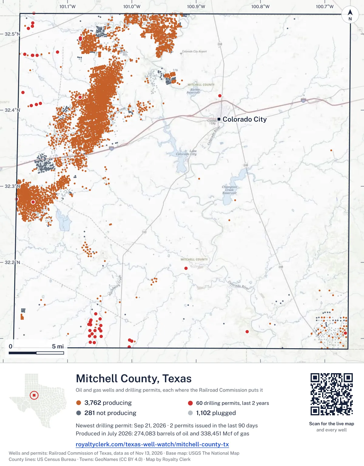
<a href="https://royaltyclerk.com/texas-well-watch/mitchell-county-tx"><img src="https://royaltyclerk.com/maps/county-wells/mitchell-county-tx.svg" alt="Map of Mitchell County, Texas, with 5,145 oil and gas wells and 60 recent drilling locations as dots." width="1000" height="1280" loading="lazy" style="max-width:100%;height:auto;border:0"></a>
<p style="margin:4px 0 0;font-size:14px">Map: <a href="https://royaltyclerk.com/texas-well-watch/mitchell-county-tx">Mitchell County, Texas oil and gas wells</a> by Royalty Clerk, from Railroad Commission of Texas records</p>
The last twelve months
Month by month in Mitchell County
| Month | Permits | Completions | First production |
|---|---|---|---|
| Sep 2026 | 1 | 0 | 0 |
| Aug 2026 | 1 | 0 | 0 |
| Jul 2026 | 2 | 0 | 1 |
| Jun 2026 | 5 | 3 | 0 |
| May 2026 | 1 | 2 | 0 |
| Apr 2026 | 0 | 10 | 1 |
| Mar 2026 | 3 | 2 | 0 |
| Feb 2026 | 3 | 0 | 1 |
| Jan 2026 | 3 | 7 | 0 |
| Dec 2025 | 3 | 2 | 0 |
| Nov 2025 | 1 | 0 | 0 |
Counted from November 15, 2025 to September 21, 2026, so the first and last months are partial. Source: Railroad Commission of Texas data sets.
Free, no sign-in
The newest drilling permits in Mitchell County
| Issued | Lease and well | Operator | Drilling began | Depth, ft | API number | Coordinates | Permit |
|---|---|---|---|---|---|---|---|
| 2026-09-21 | FOSTER, MARY 22reclass · verticalBasa Resources, Inc.API 42-335-00906 · permit 091871232.27934, -101.153388,473 ft | Basa Resources, Inc. | |||||
| 2026-08-26 | CP# 26-146 CATHODIC PROTECTION 41new drill · verticalEnergy Transfer CompanyAPI 42-335-36128 · permit 091811332.28326, -101.17936600 ft | Energy Transfer Company | |||||
| 2026-07-16 | MEMPHIS 9-3-60 H 3Wnew drill · horizontalBayswater Operating Company LLCAPI 42-335-36127 · permit 091712232.47359, -101.16635drilling began 2026-08-09 · 7,100 ft | Bayswater Operating Company LLC | |||||
| 2026-07-16 | LUXOR 9-3-60 H 1Wnew drill · horizontalBayswater Operating Company LLCAPI 42-335-36126 · permit 091712132.47359, -101.16629drilling began 2026-08-09 · 7,100 ft | Bayswater Operating Company LLC | |||||
| 2026-06-29 | OASIS 9-16-33-40 H 1Wnew drill · horizontalBayswater Operating Company LLCAPI 42-335-36122 · permit 091598832.47359, -101.16648drilling began 2026-08-08 · 7,300 ft | Bayswater Operating Company LLC | |||||
| 2026-06-29 | OASIS 9-16-33-40 H 2Wnew drill · horizontalBayswater Operating Company LLCAPI 42-335-36121 · permit 091598732.47359, -101.166427,300 ft | Bayswater Operating Company LLC | |||||
| 2026-06-26 | SPADE 18 3601new drill · verticalKek Exploration LLCAPI 42-335-36125 · permit 091670832.09780, -101.00364drilling began 2026-07-20 · 8,900 ft | Kek Exploration LLC | |||||
| 2026-06-15 | NILE 9-16-33-40 H 3Wnew drill · horizontalBayswater Operating Company LLCAPI 42-335-36124 · permit 091629332.47359, -101.16655drilling began 2026-08-08 · 7,300 ft | Bayswater Operating Company LLC | |||||
| 2026-06-15 | NILE 9-16-33-40 H 2Wnew drill · horizontalBayswater Operating Company LLCAPI 42-335-36123 · permit 091629232.47359, -101.166617,300 ft | Bayswater Operating Company LLC | |||||
| 2026-05-19 | SE-118 1new drill · verticalEnterprise Products OperatingllcAPI 42-335-36120 · permit 091565732.08695, -101.17511400 ft | Enterprise Products Operatingllc | |||||
| 2026-03-24 | MCCABE, V. T. 70recompletion · verticalSD Royale Energy, Inc.API 42-335-36021 · permit 091433932.10710, -100.668177,500 ft | SD Royale Energy, Inc. | |||||
| 2026-03-11 | SPADE 15 1801new drill · verticalKek Exploration LLCAPI 42-335-36119 · permit 091397432.10881, -100.82085drilling began 2026-04-11 · 8,900 ft | Kek Exploration LLC | |||||
| 2026-03-03 | GLASS-O'CONNOR '34' UNIT 1new drill · verticalSaguaro Petroleum, LLCAPI 42-335-36118 · permit 091378432.11869, -101.06712drilling began 2026-03-05 · 8,200 ft | Saguaro Petroleum, LLC | |||||
| 2026-02-20 | GLASS 21-34 17Wnew drill · verticalSaguaro Petroleum, LLCAPI 42-335-36117 · permit 091354932.12197, -101.06444drilling began 2026-02-24 · 8,200 ft | Saguaro Petroleum, LLC | |||||
| 2026-02-11 | PORT LAVACA 39 1new drill · verticalSaguaro Petroleum, LLCAPI 42-335-36116 · permit 091337732.10231, -101.057108,200 ft | Saguaro Petroleum, LLC | |||||
| 2026-02-06 | PORT ARANSAS 35-34 11Wnew drill · verticalSaguaro Petroleum, LLCAPI 42-335-36115 · permit 091326432.11273, -101.05071drilling began 2026-02-13 · 8,200 ft | Saguaro Petroleum, LLC | |||||
| 2026-01-26 | GLASS 21 3new drill · verticalSaguaro Petroleum, LLCAPI 42-335-36114 · permit 091305732.13216, -101.056128,200 ft | Saguaro Petroleum, LLC | |||||
| 2026-01-22 | PORT O'CONNOR 34 4new drill · verticalSaguaro Petroleum, LLCAPI 42-335-36113 · permit 091297232.11780, -101.064078,200 ft | Saguaro Petroleum, LLC | |||||
| 2026-01-13 | ELLWOOD 20 3new drill · verticalSaguaro Petroleum, LLCAPI 42-335-36112 · permit 091249432.12591, -101.04913drilling began 2026-02-03 · 8,200 ft | Saguaro Petroleum, LLC | |||||
| 2025-12-30 | GLASS 21 2new drill · verticalSaguaro Petroleum, LLCAPI 42-335-36111 · permit 091246632.12430, -101.06348drilling began 2026-01-25 · 8,200 ft | Saguaro Petroleum, LLC | |||||
| 2025-12-18 | PORT ARANSAS 35 3new drill · verticalSaguaro Petroleum, LLCAPI 42-335-36110 · permit 091226332.11003, -101.04837drilling began 2026-01-11 · 8,200 ft | Saguaro Petroleum, LLC | |||||
| 2025-12-17 | PORT ARANSAS 35 4new drill · verticalSaguaro Petroleum, LLCAPI 42-335-36109 · permit 091226232.11687, -101.04816drilling began 2025-12-31 · 8,200 ft | Saguaro Petroleum, LLC | |||||
| 2025-11-17 | PORT ARTHUR '38' 4new drill · verticalSaguaro Petroleum, LLCAPI 42-335-36108 · permit 091172832.10278, -101.04781drilling began 2025-12-21 · 8,200 ft | Saguaro Petroleum, LLC | |||||
| 2025-11-13 | TREASURE TOMB 11-2 H 3Wnew drill · horizontalBayswater Operating Company LLCAPI 42-335-36107 · permit 091166432.40876, -101.14206drilling began 2025-11-29 · 7,100 ft | Bayswater Operating Company LLC | |||||
| 2025-11-13 | TREASURE TOMB 11-2 H 1Wnew drill · horizontalBayswater Operating Company LLCAPI 42-335-36106 · permit 091166332.40875, -101.14212drilling began 2025-11-29 · 7,100 ft | Bayswater Operating Company LLC | |||||
| 2025-11-12 | PORT LAVACA 39 2new drill · verticalSaguaro Petroleum, LLCAPI 42-335-36105 · permit 091167132.09450, -101.05813drilling began 2025-12-08 · 8,200 ft | Saguaro Petroleum, LLC | |||||
| 2025-11-07 | COBRA 15-22 H 3Wnew drill · horizontalBayswater Operating Company LLCAPI 42-335-36104 · permit 091163632.40753, -101.148097,100 ft | Bayswater Operating Company LLC | |||||
| 2025-11-06 | ENDLESS DUNE 10-3 H 3Wnew drill · horizontalBayswater Operating Company LLCAPI 42-335-36103 · permit 091156932.40752, -101.14815drilling began 2025-11-11 · 7,100 ft | Bayswater Operating Company LLC | |||||
| 2025-10-31 | PORT LAVACA '39' 3new drill · verticalSaguaro Petroleum, LLCAPI 42-335-36102 · permit 091147232.09486, -101.06484drilling began 2025-11-30 · 8,200 ft | Saguaro Petroleum, LLC | |||||
| 2025-09-30 | SOLOMON FARMS 3new drill · verticalRHB Exploration & Production,llcAPI 42-335-36101 · permit 091076232.49492, -101.079763,000 ft | RHB Exploration & Production,llc | |||||
| 2025-09-30 | SOLOMON FARMS 2new drill · verticalRHB Exploration & Production,llcAPI 42-335-36100 · permit 091076032.49311, -101.07982drilling began 2026-03-24 · 3,000 ft | RHB Exploration & Production,llc | |||||
| 2025-09-08 | CATHODIC PROTECTION 29new drill · verticalEnergy Transfer CompanyAPI 42-335-36099 · permit 091002132.19240, -100.91562400 ft | Energy Transfer Company | |||||
| 2025-09-02 | SPADE 18 3701new drill · verticalKek Exploration LLCAPI 42-335-36098 · permit 091017332.08889, -101.00431drilling began 2025-10-04 · 8,900 ft | Kek Exploration LLC | |||||
| 2025-09-02 | SPADE 18 3501new drill · verticalKek Exploration LLCAPI 42-335-36097 · permit 091017232.09642, -101.00024drilling began 2025-09-22 · 8,900 ft | Kek Exploration LLC | |||||
| 2025-08-26 | SPHINX 8-17-32 H 1Wnew drill · horizontalBayswater Operating Company LLCAPI 42-335-36096 · permit 090992932.47199, -101.14731drilling began 2025-10-13 · 6,800 ft | Bayswater Operating Company LLC | |||||
| 2025-08-18 | STATE SCARAB 8-17-32 H 3Wnew drill · horizontalBayswater Operating Company LLCAPI 42-335-36095 · permit 090990532.47204, -101.15437drilling began 2025-08-25 · 6,800 ft | Bayswater Operating Company LLC | |||||
| 2025-08-18 | STATE SCARAB 8-17-32 H 2Wnew drill · horizontalBayswater Operating Company LLCAPI 42-335-36094 · permit 090990032.47204, -101.15443drilling began 2025-08-25 · 6,800 ft | Bayswater Operating Company LLC | |||||
| 2025-08-18 | STATE SCARAB 8-17-32 H 1Wnew drill · horizontalBayswater Operating Company LLCAPI 42-335-36093 · permit 090989832.47205, -101.15450drilling began 2025-08-25 · 6,800 ft | Bayswater Operating Company LLC | |||||
| 2025-07-15 | CLEOPATRA 8-2-61 H 1Wnew drill · horizontalBayswater Operating Company LLCAPI 42-335-36092 · permit 090924232.47189, -101.14737drilling began 2025-10-12 · 6,800 ft | Bayswater Operating Company LLC | |||||
| 2025-07-15 | CLEOPATRA 8-2-61 H 2Wnew drill · horizontalBayswater Operating Company LLCAPI 42-335-36091 · permit 090924132.47194, -101.147346,800 ft | Bayswater Operating Company LLC | |||||
| 2025-07-15 | KING TUT 8-2-61 H 2Wnew drill · horizontalBayswater Operating Company LLCAPI 42-335-36089 · permit 090920532.47204, -101.154246,800 ft | Bayswater Operating Company LLC | |||||
| 2025-07-15 | KING TUT 8-2-61 H 1Wnew drill · horizontalBayswater Operating Company LLCAPI 42-335-36088 · permit 090920332.47204, -101.154306,800 ft | Bayswater Operating Company LLC | |||||
| 2025-07-14 | KING TUT 8-2-61 H 3Wnew drill · horizontalBayswater Operating Company LLCAPI 42-335-36090 · permit 090920732.47204, -101.154176,800 ft | Bayswater Operating Company LLC | |||||
| 2025-06-02 | STERLING FAMILY TRUST 'D' 6002re-entry · verticalBayswater Operating Company LLCAPI 42-335-33680 · permit 090826932.50750, -101.160958,393 ft | Bayswater Operating Company LLC | |||||
| 2025-04-22 | ENDLESS DUNE 10-3 H 1Wnew drill · horizontalBayswater Operating Company LLCAPI 42-335-36087 · permit 090751632.40580, -101.15624drilling began 2025-07-03 · 7,100 ft | Bayswater Operating Company LLC | |||||
| 2025-04-15 | MONGOOSE AGI 2new drill · verticalBayswater Operating Company LLCAPI 42-335-36086 · permit 090743232.42301, -101.1695710,000 ft | Bayswater Operating Company LLC | |||||
| 2025-04-08 | PORT LAVACA '39-34' 13Wnew drill · verticalSaguaro Petroleum, LLCAPI 42-335-36085 · permit 090703232.10606, -101.06175drilling began 2025-05-23 · 8,200 ft | Saguaro Petroleum, LLC | |||||
| 2025-04-01 | PORT LAVACA '39' 4new drill · verticalSaguaro Petroleum, LLCAPI 42-335-36084 · permit 090698932.10333, -101.06555drilling began 2025-05-08 · 8,200 ft | Saguaro Petroleum, LLC | |||||
| 2025-03-27 | RAMESSES 6-73 H 1Wnew drill · horizontalBayswater Operating Company LLCAPI 42-335-36083 · permit 090691732.47610, -101.11575drilling began 2025-04-12 · 6,800 ft | Bayswater Operating Company LLC | |||||
| 2025-03-27 | GOLDEN SAND 10-3 H 4Wnew drill · horizontalBayswater Operating Company LLCAPI 42-335-36081 · permit 090689932.40578, -101.15630drilling began 2025-07-02 · 6,800 ft | Bayswater Operating Company LLC |
These are the newest 50 of 97 permits on file for Mitchell County. The rest follow, 50 to a page.
A permit is permission to drill, not a well. Source: Railroad Commission of Texas drilling permit files.
Year by year
Drilling permits issued in Mitchell County, by year
| Year | Permits issued |
|---|---|
| 2026 so far | 19 |
| 2025 | 40 |
| 2024 | 25 |
| 2023 | 12 |
| 2022 | 1 |
Counted from the permit files we hold, which start in 2022; that first year may be partial. Source: Railroad Commission of Texas drilling permit files.
The latest
The most recent records
| Date | What, who and where |
|---|---|
| 2026-09-21 | Permit issued: Basa Resources, Inc.FOSTER, MARY · A-599 · permit 0918712 |
| 2026-08-26 | Permit issued: Energy Transfer CompanyCP# 26-146 CATHODIC PROTECTION · A-1608 · permit 0918113 |
| 2026-07-16 | Permit issued: Bayswater Operating Company LLCMEMPHIS 9-3-60 · A-5 · permit 0917122 |
| 2026-07-16 | Permit issued: Bayswater Operating Company LLCLUXOR 9-3-60 · A-5 · permit 0917121 |
| 2026-07-01 | First production: Saguaro Petroleum, LLCGlass-O'Connor '34' Unit · A-673 · permit 0913784 |
| 2026-06-29 | Permit issued: Bayswater Operating Company LLCOASIS 9-16-33-40 · A-5 · permit 0915988 |
| 2026-06-29 | Permit issued: Bayswater Operating Company LLCOASIS 9-16-33-40 · A-5 · permit 0915987 |
| 2026-06-27 | Completed: Bce-Mach III LLCWESTBROOK SOUTHEAST UNIT · A-570 |
| 2026-06-26 | Permit issued: Kek Exploration LLCSPADE 18 · A-880 · permit 0916708 |
| 2026-06-17 | Completed: Bce-Mach III LLCWESTBROOK SOUTHEAST UNIT · A-1521 |
| 2026-06-15 | Permit issued: Bayswater Operating Company LLCNILE 9-16-33-40 · A-5 · permit 0916293 |
| 2026-06-15 | Permit issued: Bayswater Operating Company LLCNILE 9-16-33-40 · A-5 · permit 0916292 |
| 2026-06-05 | Completed: Bce-Mach III LLCNORTH WESTBROOK UNIT · A-537 |
| 2026-05-22 | Completed: Bce-Mach III LLCWESTBROOK SOUTHEAST UNIT · A-1488 |
| 2026-05-19 | Permit issued: Enterprise Products OperatingllcSE-118 · A-1738 · permit 0915657 |
Coming up
First checks coming due in Mitchell County
- Glass-O'Connor '34' Unit, Saguaro Petroleum, LLCby November 28, 2026
Follow it
Watch Mitchell County, or one abstract
What do you want to follow?
Where the land is. Your deed or lease names it.
For example A-1119, or Bush, or T&P 38. Your deed or the tax bill has it.
Other counties
Drilling activity in other counties
Related
Related
- ToolTexas well watchPermit, completion, first production and when the first check is due.
- ToolIs this buyout offer fair?The offer as months of your income, what the acres mean, and the questions to ask.
- ToolIs this lease offer good?Bonus and royalty against the county, and a scan of the lease's clauses.
- Texas dataTexas operator changesWho took over whose leases in the last 24 months.
- ToolLate payment interestDeadlines and the interest a late payment earns.
- Texas dataTexas oil and gas atlas254 counties, every lease, operator and field.
FAQ
Questions people ask
How many wells were permitted in Mitchell County in the last year?
The Railroad Commission issued 23 drilling permits in Mitchell County in the twelve months to September 21, 2026, and recorded 26 completions and 3 first-production reports. A permit is permission to drill, not a well.
How do I get an alert when a permit is issued near my land in Mitchell County?
Choose your abstract on this page, or the whole county, and sign in. You get one email a week, only when something new is recorded after you sign up. The alert says whether an event is on an interest in your Mineral File, on a place you follow, or only nearby.
When is my first royalty check due after a new well?
Natural Resources Code section 91.402(a) says on or before 120 days after the end of the month of first sale of production from the well. The state's first-production month is the closest public marker, so the date on this page is the earliest, not a certainty.
Got a new well on your land?
The first check is due within 120 days after the end of the month of first sale.
Sources
Primary sources, opened on 29 September 2026. Statute text is the current version on statutes.capitol.texas.gov.