
RRC field 00016001 · District 7C
No producing leasesWildcat
The Railroad Commission lists 14 leases in this field, none of them reporting recent production.
Field dossier
- Producing leases
- 0of 14 on record
- Operators
- 0
- Counties
- 0
Own minerals in this field?
A family member owned minerals here?
Search their name: a family member who owned minerals here- Data through
- Aug 2026
- Leases on record
- 14
Wells in the Wildcat field

- Drilling locations21Permits issued in the last two years
- Producing wells0On a lease reporting production now
- Not producing19Shut in, inactive or no lease on record
- Plugged3The state's wellbore record says plugged
Each dot is a well on a lease the Railroad Commission lists in the Wildcat field, where its map puts it, or a drilling permit filed for the field in the last 24 months. Wells of other fields are not on this map. The picture is about 189 miles across. The white counties are the ones with a well or drilling permit of the field on the map. Sources: Railroad Commission of Texas well layers and drilling permit files, US Census Bureau county outlines, town points from GeoNames (CC BY 4.0).
Use this map on your site
You may show this map on any site, unchanged. Keep the credit line and its link to Royalty Clerk under the map. The picture updates by itself as the state records new wells and permits.
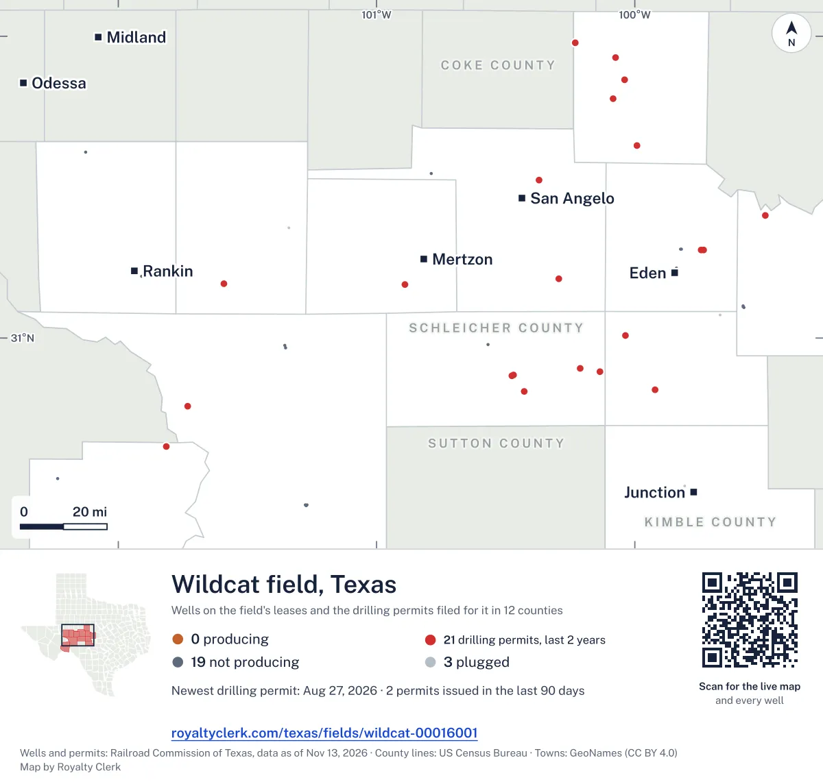
<a href="https://royaltyclerk.com/texas/fields/wildcat-00016001"><img src="https://royaltyclerk.com/maps/field-wells/wildcat-00016001.svg" alt="Map of the wells of the Wildcat field, Texas: 22 wells and 21 recent drilling locations, in a picture about 189 miles across." width="1000" height="951" loading="lazy" style="max-width:100%;height:auto;border:0"></a>
<p style="margin:4px 0 0;font-size:14px">Map: <a href="https://royaltyclerk.com/texas/fields/wildcat-00016001">Oil and gas wells of the Wildcat field, Texas</a> by Royalty Clerk, from Railroad Commission of Texas records</p>
Five years of output in Wildcat
Oil output in the Wildcat field fell 100% over the last 12 months
0 bbl through Aug 2026, against 3 bbl a year earlier. Peak May 2022: 25 bbl.
Gas output in the Wildcat field fell 100% over the last 12 months
0 mcf through Aug 2026, against 3,290 mcf a year earlier. Peak May 2025: 899 mcf.
SourceTexas Railroad Commission Production Data Query, field 00016001, through Aug 2026, file dated Oct 20, 2026.
Leases in the Wildcat field
Under each volume: change on the year before.
- No lease in this list matches. Clear the filter, or search the whole record.
Showing 0 of 0.
SourceTexas Railroad Commission Production Data Query.
Recent drilling permits in the Wildcat field
WHEELER #1DF
new drill · DRY Fork Production Co., LLC · Schleicher County
Permit 0918125 · Aug 27, 2026
CHOAT #1
new drill · Out West Operating, LLC · Concho County
Permit 0917923 · Aug 24, 2026
ALDA DAVIS #2
recompletion · Geosurveys, Inc. · Menard County
Permit 0916842 · Jul 10, 2026
SE-196 #1
new drill · Enterprise Products Operatingllc · Runnels County
Permit 0915655 · May 19, 2026
SE-230 #1
new drill · Enterprise Products Operatingllc · McCulloch County
Permit 0915653 · May 19, 2026
WHITEHEAD #V 1
new drill · Tischer Energy, LLC · Tom Green County
Permit 0915286 · May 4, 2026