
Texas oil lease
ProducingWRIGHT
Wright is an oil lease in Gaines County, Texas, operated by Comstock Energy, LLC in the Nickell (Wolfcamp) field.
1 well
- Operator
- Comstock Energy, LLC
- County
- Gaines County
- Field
- Nickell (Wolfcamp)
- RRC lease
- 8A-70435
Is your family on this lease?
Where it sits
This county
- Oil in Jul 2026
- 2 bbl
- Reporting since
- Jan 2020
Did a relative own a share of this lease?
Pick the year they passed and see what the lease has sold since.
Checks stopped on this lease?
- Sales
No sales reported for the last 12 months of state data (through Aug 2026).
SourceRailroad Commission production, P-5 and P-4 records, data through Aug 2026.
See why checks stop on this leaseWells on this lease and around it
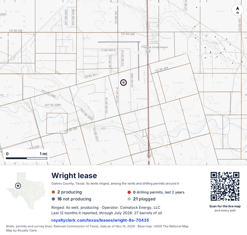
- This lease1Its well, ringed on the map: producing
- Drilling locations0Permits issued in the last two years
- Producing wells2On a lease reporting production now
- Not producing16Shut in, inactive or no lease on record
- Plugged21The state's wellbore record says plugged
The ringed dot is this lease's well, where the Railroad Commission's map puts it. The other dots are wells and drilling permits of the last 24 months on the land around it; the counts are for everything in the picture, which is about 6 miles across. The thin brown lines are the original land surveys; where there is room, a survey carries its abstract number, the number deeds and division orders cite. Sources: Railroad Commission of Texas well layers, drilling permit files and survey lines, base map from USGS The National Map.
A one-page map of this lease to print, for a lawyer, a buyer or a probate file.
Use this map on your site
You may show this map on any site, unchanged. Keep the credit line and its link to Royalty Clerk under the map. The picture updates by itself as the state records new wells and permits.
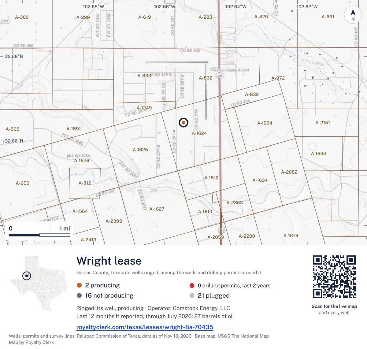
<a href="https://royaltyclerk.com/texas/leases/wright-8a-70435"><img src="https://royaltyclerk.com/maps/lease-wells/wright-8a-70435.svg" alt="Map of the Wright lease in Gaines County, Texas: its well ringed, among 39 wells and 0 recent drilling locations in a picture about 6 miles across." width="1000" height="951" loading="lazy" style="max-width:100%;height:auto;border:0"></a>
<p style="margin:4px 0 0;font-size:14px">Map: <a href="https://royaltyclerk.com/texas/leases/wright-8a-70435">Wells on the Wright lease, Gaines County, Texas</a> by Royalty Clerk, from Railroad Commission of Texas records</p>
Other leases named Wright
- 8A-65281, oil leaseProducing2,416 bbllast 12 reported monthsRun by Brown, H.l. Operating, L.L.C.
- 8A-70582, oil leaseProducing120 bbllast 12 reported monthsRun by Atlas Operating LLC
- 8A-70435, oil leaseThis leaseProducing27 bbllast 12 reported months
- 8A-073322, gas wellShut in0 mcflast 12 reported monthsRun by Atlas Operating LLC
Production by month
Oil output fell 56% over the last 12 months
Aug 2026 was not reported.
- Oil (bars)
- Last 12 months
SourceTexas Railroad Commission Production Data Query, through Aug 2026.
From the state record
What owners ask about Wright
- When is the check for May 2024 due?
- May 2024 is the newest month the state has posted for this lease. Texas law gives the payor until 60 days after the end of the sale month for oil and 90 for gas: the oil by Jul 30, 2024, unless the lease sets another time.
- Source: Railroad Commission production reports; Texas Natural Resources Code §91.402.
- See your next three checks
- Which Texas production tax rate applies?
- The Texas Comptroller lists no approved exemption or reduced rate for this lease for May 2024, so the full 4.6% on oil applies.
- Source: Texas Comptroller, approved severance tax exemptions.
- Check the tax on your stub
- Who buys the oil and gas?
- Oil: Oasis Transp & Marketing Corp. gathers it. The buyer's price is what a royalty check is figured on.
- Source: Railroad Commission Form P-4, gatherers and purchasers.
- See every buyer and past buyers
- How many 1099s should an owner expect for 2025?
- One company, Comstock Energy, LLC, filed this lease's reports behind every 2025 check, so most owners get one form. The operator is not always the company that pays, so go by the name on the stubs.
- Source: Railroad Commission production reports, operator of record by month.
- Check your 1099 against it
Free tools, already on this lease
Ask a question about Wright
33 years of state records, 1993–2026
WRIGHT since 2015
We read every monthly report the Railroad Commission holds, back to January 1993. This lease first reported in November 2015. It filed 129 monthly reports through August 2026.
Sold since 2015
$75,000
What the whole lease’s oil and gas sold for at each month’s public prices, before tax and the operator’s deductions. A royalty owner’s share is their decimal of it.
- Oil sold
- 1,354 bbl
- Gas sold
- 0 mcf
- Best year
- 2016$14,000 sold
- Last report
- Jul 2026First: Nov 2015
Its best year was 2016: $14,000 of oil and gas sold
Each bar is what the lease’s oil and gas sold for that year, at that month’s prices. 2026 is only part of a year in the records, drawn lighter.
SourceTexas Railroad Commission Production Data Query, every monthly report since January 1993; EIA monthly WTI and Henry Hub prices (before 1997, EIA's yearly Texas natural gas wellhead price), through August 2026.
Every year as a table
| Year | Months | Oil sold, bbl | Gas sold, mcf | Sold for |
|---|---|---|---|---|
| 2026 * | 7 | 0 | 0 | $0 |
| 2025 | 12 | 0 | 0 | $0 |
| 2024 | 12 | 173 | 0 | $13,843 |
| 2023 | 12 | 0 | 0 | $0 |
| 2022 | 12 | 161 | 0 | $14,096 |
| 2021 | 12 | 0 | 0 | $0 |
| 2020 | 12 | 158 | 0 | $6,225 |
| 2019 | 12 | 0 | 0 | $0 |
| 2018 | 12 | 171 | 0 | $12,098 |
| 2017 | 12 | 175 | 0 | $7,907 |
| 2016 | 12 | 359 | 0 | $14,755 |
| 2015 | 2 | 157 | 0 | $6,663 |
* Part of the year: the records run through August 2026.
Where the gas went
No gas disposition reported for this lease
1 well on this lease
| API number | Well | Status | Completed |
|---|---|---|---|
| 42-165-35892 | Wright 1 | Active | Feb 11, 2015 |
SourceTexas Railroad Commission production records and full wellbore file.
Buyers and gatherers
| Company | Product | Role | Share% | From | Until |
|---|---|---|---|---|---|
| Oasis Transp & Marketing Corp. | Oil | Gathers | 100 | Sep 1, 2020 | – |
| Sunoco Ptnrs. Mktg.&terminals LP | Oil | Gathers | 100 | Jun 1, 2020 | Sep 1, 2020 |
| Maxim Crude Oil, L.l.c. | Oil | Gathers | 100 | May 1, 2020 | Jun 1, 2020 |
| Sunoco Ptnrs. Mktg.&terminals LP | Oil | Gathers | 100 | Feb 11, 2015 | May 1, 2020 |
SourceRailroad Commission Form P-4 file, Oct 24, 2026 (source).
Estimate your royalty
36 months, newest first
| Month | Oil producedbbl | Oil soldbbl | WTI$/bbl | Henry Hub$/MMBtu |
|---|---|---|---|---|
| Aug 2026No report filed | – | – | $83.90 | $2.78 |
| Jul 2026 | 2 | 0 | $80.46 | $2.89 |
| Jun 2026 | 3 | 0 | $84.81 | $3.15 |
| May 2026 | 2 | 0 | $102.13 | $2.94 |
| Apr 2026 | 1 | 0 | $100.32 | $2.77 |
| Mar 2026 | 2 | 0 | $91.38 | $3.04 |
| Feb 2026 | 3 | 0 | $64.51 | $3.62 |
| Jan 2026 | 2 | 0 | $60.04 | $7.72 |
| Dec 2025 | 2 | 0 | $57.97 | $4.26 |
| Nov 2025 | 2 | 0 | $60.06 | $3.79 |
| Oct 2025 | 3 | 0 | $60.89 | $3.19 |
| Sep 2025 | 3 | 0 | $63.96 | $2.97 |
| Aug 2025 | 2 | 0 | $64.86 | $2.91 |
| Jul 2025 | 3 | 0 | $68.39 | $3.20 |
| Jun 2025 | 4 | 0 | $68.17 | $3.02 |
| May 2025 | 3 | 0 | $62.17 | $3.12 |
| Apr 2025 | 3 | 0 | $63.54 | $3.42 |
| Mar 2025 | 2 | 0 | $68.24 | $4.12 |
| Feb 2025 | 4 | 0 | $71.53 | $4.19 |
| Jan 2025 | 3 | 0 | $75.74 | $4.13 |
| Dec 2024 | 1 | 0 | $70.12 | $3.01 |
| Nov 2024 | 2 | 0 | $69.95 | $2.12 |
| Oct 2024 | 2 | 0 | $71.99 | $2.20 |
| Sep 2024 | 28 | 0 | $70.24 | $2.28 |
| Aug 2024 | 13 | 0 | $76.68 | $1.99 |
| Jul 2024 | 3 | 0 | $81.80 | $2.07 |
| Jun 2024 | 3 | 0 | $79.77 | $2.54 |
| May 2024 | 118 | 173 | $80.02 | $2.12 |
| Apr 2024 | 4 | 0 | $85.35 | $1.60 |
| Mar 2024 | 2 | 0 | $81.28 | $1.49 |
| Feb 2024 | 3 | 0 | $77.25 | $1.72 |
| Jan 2024 | 1 | 0 | $74.15 | $3.18 |
| Dec 2023 | 1 | 0 | $71.90 | $2.52 |
| Nov 2023 | 10 | 0 | $77.69 | $2.71 |
| Oct 2023 | 2 | 0 | $85.64 | $2.98 |
| Sep 2023 | 2 | 0 | $89.43 | $2.64 |
No report filed
SourceTexas Railroad Commission Production Data Query, through Aug 2026. Prices: EIA, through Oct 2026. Updated Oct 30, 2026.
How to check your stub against this lease Checks stopped on this lease? See the likely reasonsNearby
This lease belongs to
Comstock Energy, LLC in Gaines County
No other producing leases from this operator in this county are in our data yet.
Nickell (Wolfcamp) field
No other producing leases in this field are in our data yet.
Leases within 10 km
- SEMINOLE, SE. (STRAWN) UNIT
0 bbl · 2.9 km
- SESSAU
0 bbl · 3.2 km
- SEMINOLE SAN ANDRES UNIT
7,567,169 bbl · 3.5 km
- MORIAH
11,019 bbl · 3.7 km
- TUCK
0 bbl · 4.4 km
- NIP
8,877 bbl · 4.7 km
- O'DANIEL 16
806 bbl · 5.3 km
- PAOLO, GIOVANNI
0 bbl · 5.3 km
- SEMINOLE TOWNSITE "A"
121 bbl · 5.5 km
- NORTHCUTT
0 bbl · 5.6 km
Drilling permits within 10 km
SEMINOLE SAN ANDRES UNIT #4126
recompletion · OXY USA Inc. · Gaines County · 9.4 km
Permit 0920008 · Nov 12, 2026
WESCOTT STRAWN UNIT #24
new drill · Active Iron Energy, LLC · Gaines County · 7.9 km
Permit 0919742 · Nov 6, 2026
SEMINOLE SAN ANDRES UNIT #5102
recompletion · OXY USA Inc. · Gaines County · 8.3 km
Permit 0919761 · Oct 29, 2026
MONARCH #11W
new drill · McClure Oil Company, Inc. · Gaines County · 9.1 km
Permit 0919673 · Oct 27, 2026
MONARCH #9W
new drill · McClure Oil Company, Inc. · Gaines County · 9.2 km
Permit 0919671 · Oct 27, 2026