
Webb County, Texas
Oil wells and drilling locations near Cactus
- 780wells
- 140drilling locations in two years
- 720producing leases
Within 10 miles
Wells and drilling locations around Cactus
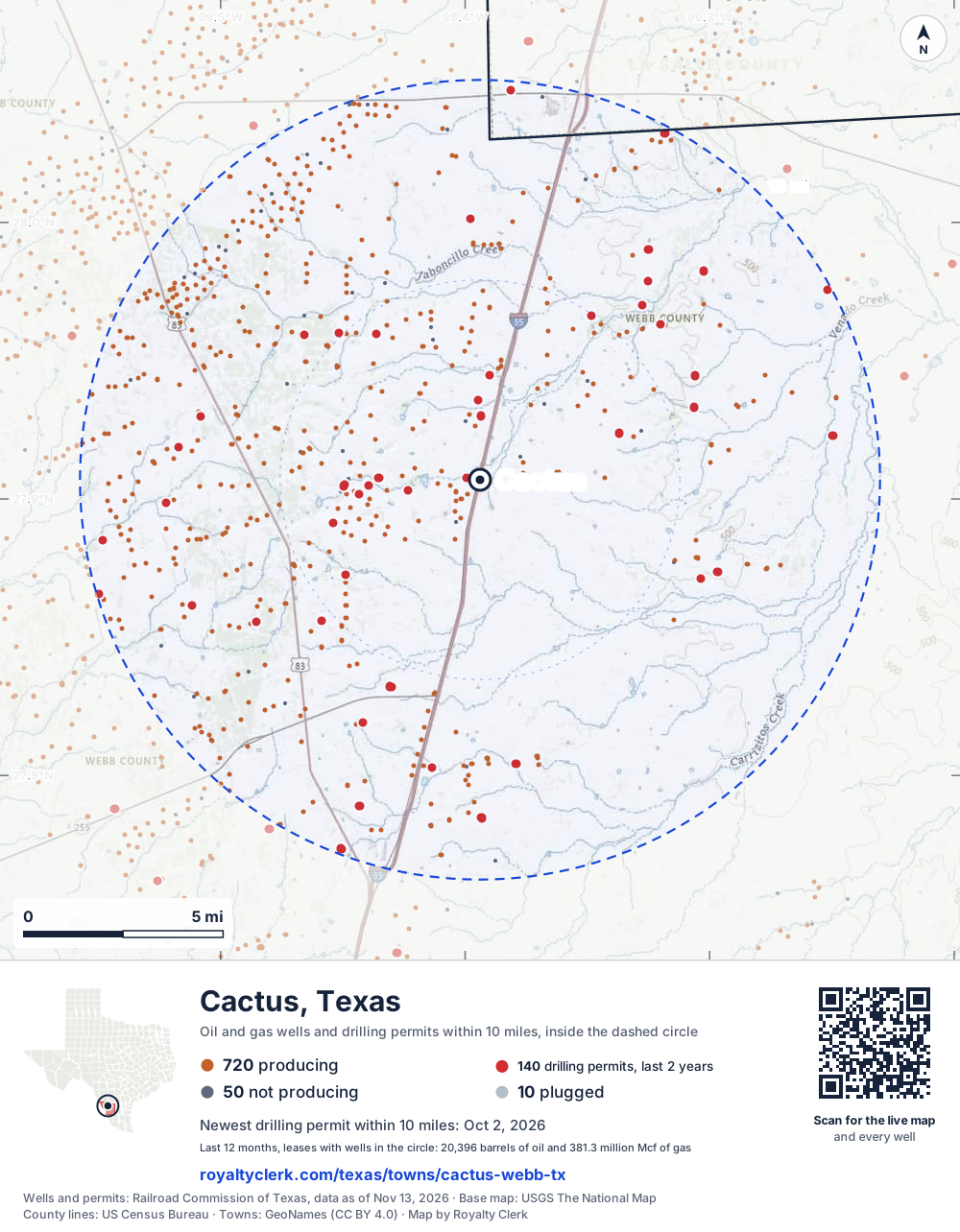
- Drilling locations140Permits issued in the last two years
- Producing wells720On a lease reporting production now
- Not producing50Shut in, inactive or no lease on record
- Plugged10The state's wellbore record says plugged
The dashed circle is 10 miles from the town's point (27.90695, -99.39392); the counts are for wells inside it. Sources: Railroad Commission of Texas well layers and permit files, US Census Bureau county outlines, town points from GeoNames (CC BY 4.0), base map from USGS The National Map.
Use this map on your site
You may show this map on any site, unchanged. Keep the credit line and its link to Royalty Clerk under the map. The picture updates by itself as the state records new wells and permits.
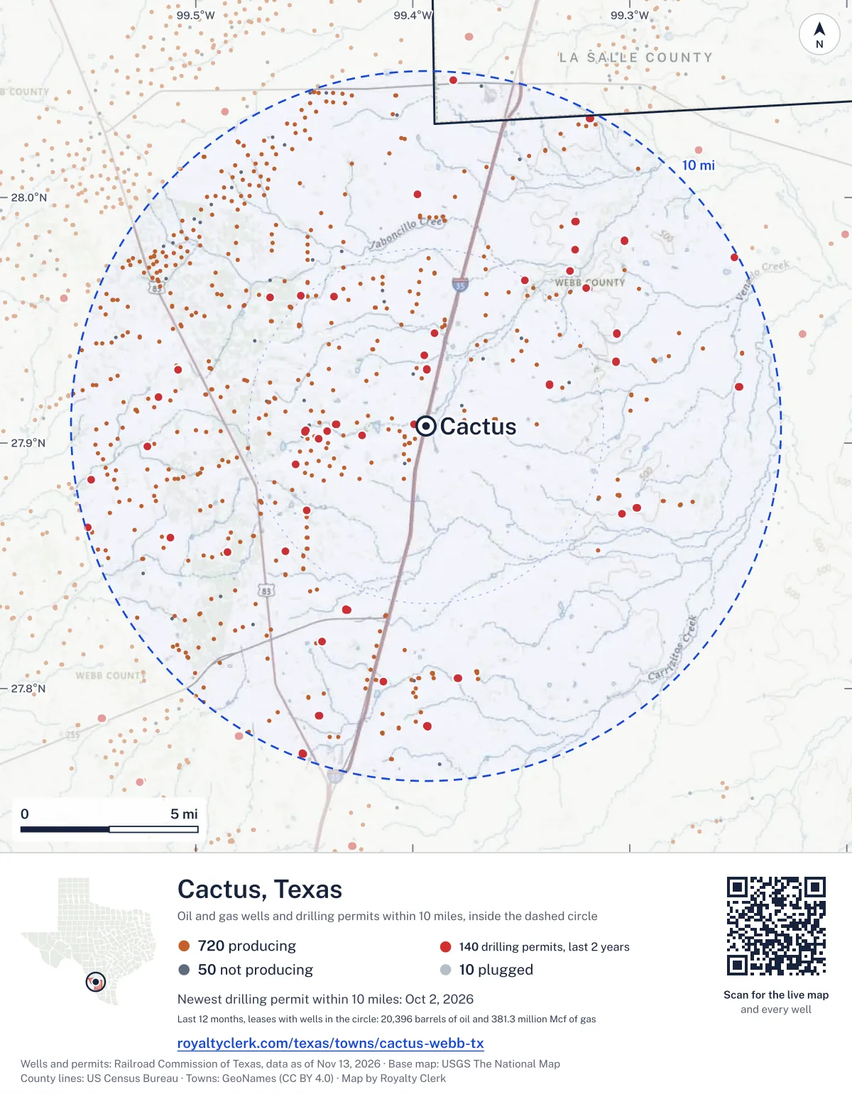
<a href="https://royaltyclerk.com/texas/towns/cactus-webb-tx"><img src="https://royaltyclerk.com/maps/town-wells/cactus-webb-tx.svg" alt="Map of Cactus, Texas: 780 wells and 140 recent drilling locations within 10 miles, inside a dashed circle." width="1000" height="1284" loading="lazy" style="max-width:100%;height:auto;border:0"></a>
<p style="margin:4px 0 0;font-size:14px">Map: <a href="https://royaltyclerk.com/texas/towns/cactus-webb-tx">Cactus, Texas oil and gas wells</a> by Royalty Clerk, from Railroad Commission of Texas records</p>
Which way it is heading
Where the new drilling is around Cactus
What became of the 140 permits
- 52finished, on a lease that reports productionThe well was completed and its lease is reporting oil or gas to the state.
- 3finished, no production reported yetA completion is on file. The first production report follows weeks or months later.
- 56drilling startedThe operator reported a start date. No completion is on file yet.
- 29still only a permitNothing after the permit is on file. Many permits wait a year or more, and some are never drilled.
Wells finished in the last two years: 12 north, 12 north-east, 10 east, 13 south, 13 south-west, 12 west, 3 north-west of town.
A horizontal well runs sideways underground. 32 wells start outside the 10-mile circle and end inside it. 59 start inside and end outside. So a well can drain land a mile or two from the spot where it shows on a map.
A permit is permission to drill, not a well, and a well nearby says nothing about who owns the minerals under it. Direction is taken from the well's surface location. Source: Railroad Commission of Texas drilling permits and wellbore records.
When a new well starts paying
First checks coming due near Cactus
- LA Moca Gas Unit G well 33Hdue by November 28, 2026
The date is the earliest the law allows a first payment to be late (Texas Natural Resources Code 91.402), worked out from the first month of production on file. It is not a promise of a check: title questions and unsigned division orders can hold one back. Work out a first-check date · What to do before the first check
In numbers
Oil and gas within 10 miles of Cactus
- wells with a location on the state's map
- 780
- drilling permits in the last 24 months
- 140
- producing leases with a well in the circle
- 720
- operators running them
- 13
- oil and condensate those leases reported in their latest 12 months
- 20,396 bbl
- gas those leases reported in their latest 12 months
- 381,325,972 mcf
A lease counts when at least one of its wells is inside the circle; its whole production is counted, so a lease reaching beyond the circle counts in full.
In dollars
What the oil and gas near Cactus sold for
- sale value of 12 months, before taxes and costs
- $1.4 billion
- oil and condensate sold
- 19,958 bbl
- gas sold
- 376,112,377 mcf
- the middle lease: half sold more, half less
- $166,385
A 0.01 share (1%) of the middle producing lease near Cactus comes to about $1,664 for the 12 months.
Sold volumes at the public monthly prices, before severance tax and any costs. A guide to the size, not what any owner was paid.
Sold volumes from each lease's monthly report to the Railroad Commission, times the month's West Texas Intermediate oil price and Henry Hub gas price (EIA). Real prices at the lease differ. A lease counts in full when one of its wells is near the town. Check a statement against what the lease sold
Drilling locations
The newest drilling permits near Cactus
| Issued | Lease and well | Where | Operator |
|---|---|---|---|
| 2026-10-02 | BFM-AIG V 305Hhorizontal · API 42-479-45752 · permit 0918716Caturus Energy, LLC | 5.6 mi SW27.83214, -99.43065 on OpenStreetMap (opens in a new tab) | Caturus Energy, LLC |
| 2026-10-02 | BFM-AIG U 404Hhorizontal · API 42-479-45751 · permit 0918710Caturus Energy, LLC | 5.6 mi SW27.83219, -99.43065 on OpenStreetMap (opens in a new tab) | Caturus Energy, LLC |
| 2026-10-02 | BFM-AIG T 304Hhorizontal · API 42-479-45750 · permit 0918703Caturus Energy, LLC | 5.6 mi SW27.83225, -99.43066 on OpenStreetMap (opens in a new tab) | Caturus Energy, LLC |
| 2026-09-24 | SCHLETZE Y UNIT B 2Hhorizontal · API 42-479-45757 · permit 0918720Pursuit Oil & Gas STX, LLC | 9.8 mi NE28.03235, -99.31833 on OpenStreetMap (opens in a new tab) | Pursuit Oil & Gas STX, LLC |
| 2026-09-23 | HUISACHE-STATE OF TEXAS B 321Hhorizontal · API 42-479-45747 · permit 0918646Caturus Energy, LLC | 7.3 mi S27.80297, -99.41371 on OpenStreetMap (opens in a new tab) | Caturus Energy, LLC |
| 2026-09-22 | HUISACHE E 311Hhorizontal · API 42-479-45746 · permit 0918633Caturus Energy, LLC | 7.3 mi S27.80297, -99.41365 on OpenStreetMap (opens in a new tab) | Caturus Energy, LLC |
| 2026-09-22 | ATLANTIC INLAND GROUP-HUISACHE N 411Hhorizontal · API 42-479-45749 · permit 0918628Caturus Energy, LLC | 7.3 mi S27.80297, -99.41359 on OpenStreetMap (opens in a new tab) | Caturus Energy, LLC |
| 2026-09-22 | ATLANTIC INLAND GROUP-HUISACHE M 310Hhorizontal · API 42-479-45748 · permit 0918626Caturus Energy, LLC | 7.3 mi S27.80297, -99.41353 on OpenStreetMap (opens in a new tab) | Caturus Energy, LLC |
| 2026-09-21 | SCHLETZE Y UNIT A 1Hhorizontal · API 42-479-45756 · permit 0918719Pursuit Oil & Gas STX, LLC | 9.8 mi NE28.03235, -99.31839 on OpenStreetMap (opens in a new tab) | Pursuit Oil & Gas STX, LLC |
| 2026-08-17 | G-B STATE F 102Hhorizontal · API 42-479-45715 · permit 0917717EOG Resources, Inc. | 9.8 mi S27.77335, -99.45056 on OpenStreetMap (opens in a new tab) | EOG Resources, Inc. |
| 2026-08-13 | G-B STATE E 302Hhorizontal · API 42-479-45716 · permit 0917724EOG Resources, Inc. | 9.8 mi S27.77330, -99.45054 on OpenStreetMap (opens in a new tab) | EOG Resources, Inc. |
| 2026-08-07 | STATE OF TEXAS RAFTER O UNIT B 12Hhorizontal · API 42-479-45693 · permit 0917356Killam Oil Co., Ltd. | 7.9 mi SW27.86136, -99.51157 on OpenStreetMap (opens in a new tab) | Killam Oil Co., Ltd. |
| 2026-07-30 | LEWIS-GILPIN A 100HRhorizontal · API 42-479-45696 · permit 0917539Lewis Petro Properties, Inc. | 6.5 mi N28.00117, -99.39769 on OpenStreetMap (opens in a new tab) | Lewis Petro Properties, Inc. |
| 2026-07-23 | STATE OF TEXAS RAFTER O UNIT B 8Hhorizontal · API 42-479-45692 · permit 0917353Killam Oil Co., Ltd. | 7.8 mi SW27.86138, -99.51152 on OpenStreetMap (opens in a new tab) | Killam Oil Co., Ltd. |
| 2026-07-22 | STATE OF TEXAS RAFTER O UNIT C 7Hhorizontal · API 42-479-45691 · permit 0917290Killam Oil Co., Ltd. | 7.9 mi SW27.86134, -99.51163 on OpenStreetMap (opens in a new tab) | Killam Oil Co., Ltd. |
| 2026-07-20 | AI SAN ROMAN 314Hhorizontal · API 42-479-45679 · permit 0917080Warwick Poseidon, GP | 6.0 mi NE27.94464, -99.30611 on OpenStreetMap (opens in a new tab) | Warwick Poseidon, GP |
| 2026-07-14 | AI SAN ROMAN 208Hhorizontal · API 42-479-45681 · permit 0917083Warwick Poseidon, GP | 6.0 mi NE27.94471, -99.30611 on OpenStreetMap (opens in a new tab) | Warwick Poseidon, GP |
| 2026-07-14 | AI SAN ROMAN 206Hhorizontal · API 42-479-45680 · permit 0917082Warwick Poseidon, GP | 5.7 mi E27.93325, -99.30637 on OpenStreetMap (opens in a new tab) | Warwick Poseidon, GP |
| 2026-07-13 | AI SAN ROMAN 313Hhorizontal · API 42-479-45678 · permit 0917073Warwick Poseidon, GP | 5.7 mi E27.93318, -99.30637 on OpenStreetMap (opens in a new tab) | Warwick Poseidon, GP |
| 2026-07-13 | AI SAN ROMAN 116Hhorizontal · API 42-479-45677 · permit 0917071Warwick Poseidon, GP | 6.0 mi NE27.94478, -99.30611 on OpenStreetMap (opens in a new tab) | Warwick Poseidon, GP |
| 2026-06-03 | LAUREL SA C 1004Hhorizontal · API 42-479-45654 · permit 0916002Lewis Petro Properties, Inc. | 3.0 mi W27.90181, -99.44333 on OpenStreetMap (opens in a new tab) | Lewis Petro Properties, Inc. |
| 2026-06-03 | LAUREL SA B 500Hhorizontal · API 42-479-45653 · permit 0916001Lewis Petro Properties, Inc. | 3.0 mi W27.90185, -99.44333 on OpenStreetMap (opens in a new tab) | Lewis Petro Properties, Inc. |
| 2026-05-20 | LEWIS-GILPIN B 101Hhorizontal · API 42-479-45643 · permit 0915638Lewis Petro Properties, Inc. | 6.5 mi N28.00117, -99.39776 on OpenStreetMap (opens in a new tab) | Lewis Petro Properties, Inc. |
| 2026-05-20 | LEWIS-GILPIN A 100Hhorizontal · API 42-479-45642 · permit 0915637Lewis Petro Properties, Inc. | 6.5 mi N28.00117, -99.39780 on OpenStreetMap (opens in a new tab) | Lewis Petro Properties, Inc. |
| 2026-05-07 | TREVINO B 100Hhorizontal · API 42-479-45625 · permit 0915388EOG Resources, Inc. | 9.9 mi W27.86571, -99.54970 on OpenStreetMap (opens in a new tab) | EOG Resources, Inc. |
A permit is permission to drill, not a well. Distances are from the town's point to the well's surface location. Source: Railroad Commission of Texas drilling permits.
Find your land
The surveys under the new drilling near Cactus
- A-2348 MARTINEZ, E, section 13226 permits, newest October 2, 2026
- A-539 LINDSEY, F B, section 18966 permits, newest August 17, 2026
- A-2327 LINDSAY, S A, section 14046 permits, newest March 25, 2026
- A-408 BS&F, section 13896 permits, newest November 7, 2025
- A-757 BENAVIDES, C G, section 3666 permits, newest October 7, 2025
- A-3226 GALAN, J, section 22926 permits, newest August 5, 2025
- A-291 SM&S, section 3296 permits, newest May 28, 2025
- A-876 BS&F, section 14675 permits, newest July 20, 2026
Not in the list? Search every survey in the county by name or abstract number.
Who is on the county roll
42 mineral accounts near Cactus are still in the name of an estate
- mineral accounts on the roll
- 6,014
- owner names
- 1,160
- appraised value of those accounts
- $1.1 billion
- the middle account's appraised value
- $5,000
- the middle account in all of Webb County
- $1,200
- accounts titled to an estate
- 42
An account in the name of an estate usually means the owner died and the title was never moved to the heirs. The account stays on the roll, and these are appraised at $424,000 together. If a parent or grandparent owned minerals near Cactus, their name may be one of them.
Totals from the county appraisal district's mineral roll, matched to leases by the state lease number. No owner is named here, and a count under 10 accounts or 5 owner names is left out. How Webb County values minerals, and how to protest · Inherited minerals: where to start
Producing leases
Top producing leases near Cactus
- 1TRP B0 bbl · 6,342,993 mcf a yearEOG Resources, Inc. · Webb County · 1 well in the circle
- 2Benavides Family Minerals G0 bbl · 5,196,586 mcf a yearCaturus Energy, LLC · Webb County · 1 well in the circle
- 3Botanza St A0 bbl · 4,927,723 mcf a yearEOG Resources, Inc. · Webb County · 1 well in the circle
- 4Botanza St C0 bbl · 4,915,721 mcf a yearEOG Resources, Inc. · Webb County · 1 well in the circle
- 5TRP A0 bbl · 4,858,925 mcf a yearEOG Resources, Inc. · Webb County · 1 well in the circle
- 6Huisache E0 bbl · 4,749,196 mcf a yearCaturus Energy, LLC · Webb County · 1 well in the circle
- 7Atlantic Inland Group-Huisache F0 bbl · 4,711,280 mcf a yearCaturus Energy, LLC · Webb County · 1 well in the circle
- 8Ai San Roman0 bbl · 4,697,317 mcf a yearWarwick Poseidon, GP · Webb County · 1 well in the circle
- 9Huisache E0 bbl · 4,583,776 mcf a yearCaturus Energy, LLC · Webb County · 1 well in the circle
- 10Huisache W0 bbl · 4,503,473 mcf a yearCaturus Energy, LLC · Webb County · 1 well in the circle
- 11Atlantic Inland Group-Huisache G0 bbl · 4,493,326 mcf a yearCaturus Energy, LLC · Webb County · 1 well in the circle
- 12Huisache-State of Texas A0 bbl · 4,462,985 mcf a yearCaturus Energy, LLC · Webb County · 1 well in the circle
- 13Ai San Roman0 bbl · 4,289,416 mcf a yearWarwick Poseidon, GP · Webb County · 1 well in the circle
- 14Lindsay Ranch Unit0 bbl · 4,250,760 mcf a yearMitsui E&P USA LLC · Webb County · 1 well in the circle
- 15Huisache E0 bbl · 4,214,638 mcf a yearCaturus Energy, LLC · Webb County · 1 well in the circle
- 16Ai San Roman0 bbl · 3,944,810 mcf a yearWarwick Poseidon, GP · Webb County · 1 well in the circle
- 17Lindsay Ranch Unit0 bbl · 3,913,782 mcf a yearMitsui E&P USA LLC · Webb County · 1 well in the circle
- 18Zamora0 bbl · 3,895,717 mcf a yearCrescent Energy Operating, LLC · Webb County · 1 well in the circle
- 19State MC Unit317 bbl · 3,886,615 mcf a yearWarwick Poseidon, GP · Webb County · 1 well in the circle
- 20Zamora0 bbl · 3,869,074 mcf a yearCrescent Energy Operating, LLC · Webb County · 1 well in the circle
Whose name is on the check
Who buys the oil and gas near Cactus
Oil and condensate
- SHELL TRADING (US) COMPANY488 leases
- DKS TRANSPORT LLC55 leases
- TRAFIGURA TRADING LLC21 leases
- GULFMARK ENERGY, INC.5 leases
- HARVEST MIDSTREAM COMPANY3 leases
Gas
- ENTERPRISE PRODUCTS OPERATING LLC237 leases
- KINDER MORGAN TEXAS PIPELINE LLC163 leases
- HOUSTON PIPE LINE COMPANY LP116 leases
- ET GATHERING & PROCESSING LLC84 leases
- TEXAS GAS MARKETING LLC80 leases
From each lease's newest Form P-4 filing with the Railroad Commission, which names its gatherers and purchasers. One lease can name several.
If your checks stopped
Leases near Cactus that went quiet or changed hands
5 leases reported nothing for a year or more
Leases that reported within the last four years and then stopped. The newest to stop first.
- Matrix Land Co. · Escondido Resources Oper Co, LLClast report July 2025
- Benavides Family Minerals A · Kimmeridge Texas Gas, LLClast report May 2025
- Zamora A · San Isidro Development Co, L. C.last report January 2025
- Zamora A · San Isidro Development Co, L. C.last report January 2025
- Benavides, G. G. · Lewis Petro Properties, Inc.last report December 2023
99 leases got a new operator in two years
Checks often pause after a change while the new company sets up its owner records. The newest first; 10 shown.
- Ai San RomanAgeron Energy, LLC to Warwick Poseidon, GPMay 2026
- Ai San RomanAgeron Energy, LLC to Warwick Poseidon, GPMay 2026
- Ai San RomanAgeron Energy, LLC to Warwick Poseidon, GPMay 2026
- Ai San RomanAgeron Energy, LLC to Warwick Poseidon, GPMay 2026
- Ai San RomanAgeron Energy, LLC to Warwick Poseidon, GPMay 2026
- Ai San RomanAgeron Energy, LLC to Warwick Poseidon, GPMay 2026
- Ai San RomanAgeron Energy, LLC to Warwick Poseidon, GPMay 2026
- Ai San RomanAgeron Energy, LLC to Warwick Poseidon, GPMay 2026
- Ai San RomanAgeron Energy, LLC to Warwick Poseidon, GPMay 2026
- Ai San RomanAgeron Energy, LLC to Warwick Poseidon, GPMay 2026
From the monthly production reports operators file with the Railroad Commission. The newest months fill in late, so a lease is listed only after 12 months with no report.
Year by year
Production of the leases near Cactus, by year
| Year | Oil, bbl | Gas, mcf |
|---|---|---|
| 2026 so far | 14,267 | 259,856,839 |
| 2025 | 17,744 | 332,612,901 |
| 2024 | 12,992 | 270,421,481 |
| 2023 | 17,568 | 239,438,122 |
| 2022 | 21,280 | 194,601,449 |
| 2021 | 27,094 | 102,390,826 |
| 2020 | 30,676 | 125,062,355 |
Every lease with a well in the circle, producing now or not, as reported to the Railroad Commission. The newest months fill in as operators report.
The long view: in the state's records from January 1993 on, 538 of these leases reported 1,611,027 bbl of oil and condensate and 747,994,190 mcf of gas. Each lease page carries that lease's history back to January 1993.
Good to know
The wells near Cactus, and what a lease has gone for
For a lease offer: the State of Texas leased 219 of its own tracts in Webb County in the last ten years. The middle bonus was $375 an acre, the usual royalty 12.5%, the usual term 3 years; the newest is dated September 1, 2026. Private leases are not public, so these are the nearest figures on record. Is my lease offer fair in Webb County?
Depth and well type from the Railroad Commission's well records, where the record has them. State lease figures from the Texas General Land Office.
Press and community kit
Writing about Cactus? Take what you need
Three facts to quote
- 780 oil and gas wells on the state's map lie within 10 miles of Cactus: 720 on producing leases, 50 not producing and 10 plugged.
- The Railroad Commission of Texas issued 65 drilling permits within 10 miles of Cactus in the last 12 months, the newest dated October 2, 2026.
- The 720 producing leases with a well in that circle, run by 13 operators, reported 20,396 barrels of oil and 381,325,972 thousand cubic feet of gas over their latest 12 months.
The map picture
The page's map with its legend and credit, as a JPEG.
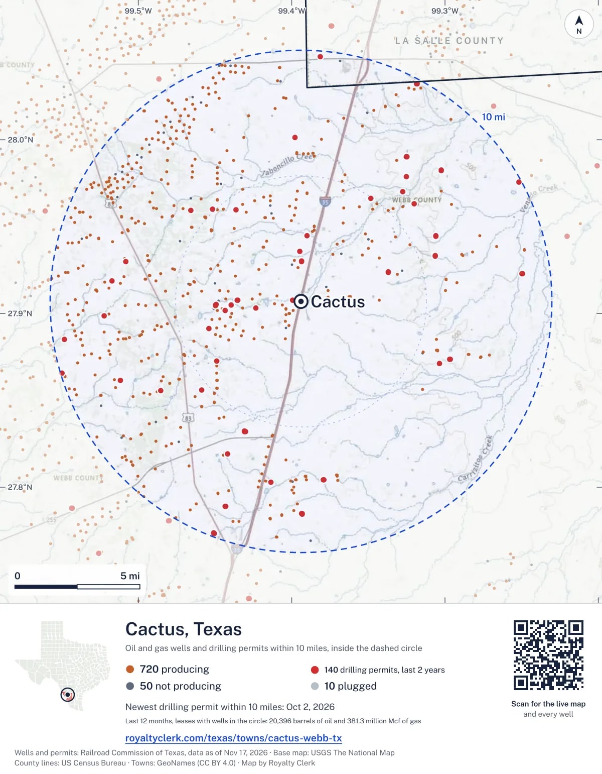
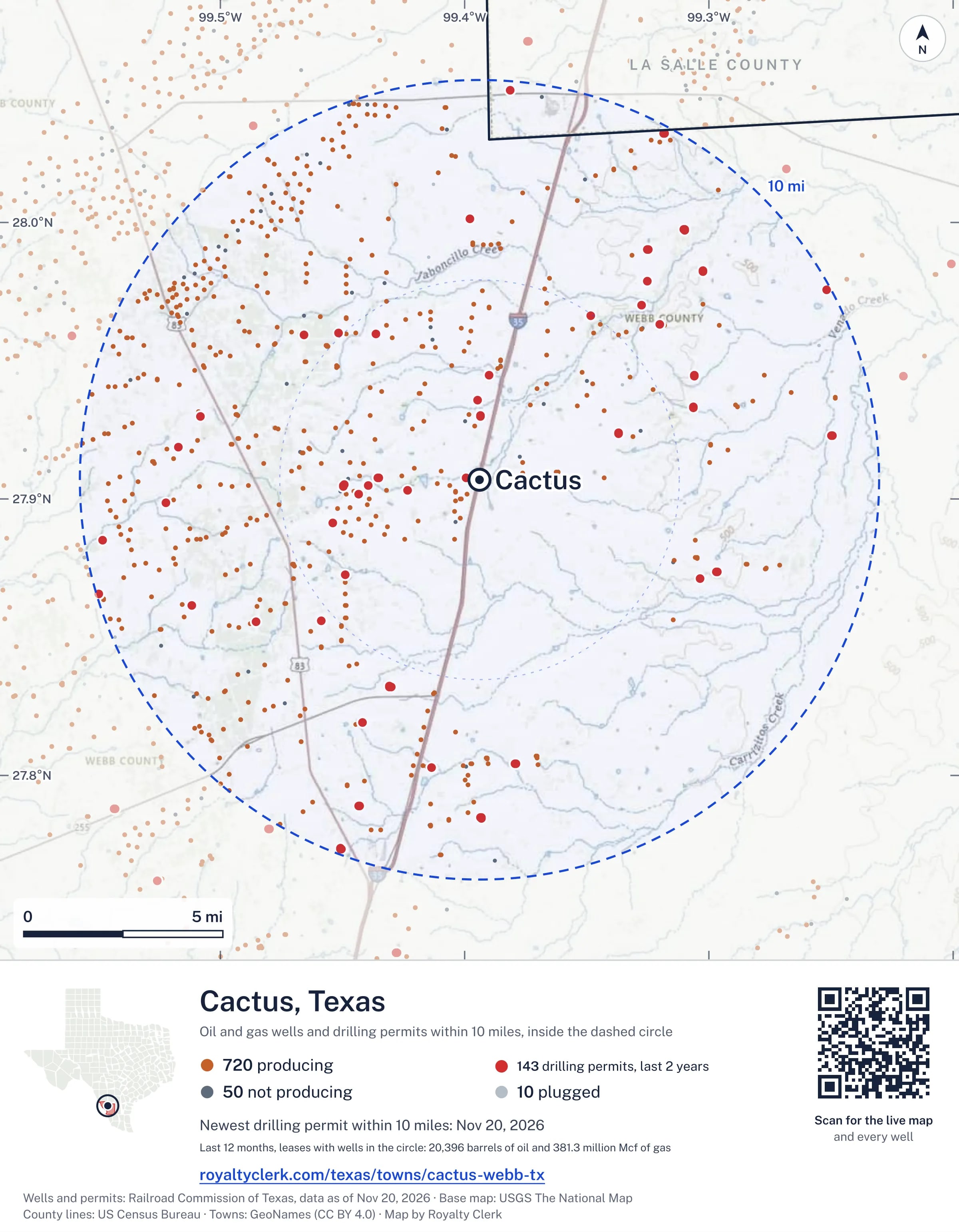
The live map on your page
A frame that loads its picture first and the live map on a tap. No cookies.
How to cite
Railroad Commission of Texas records of the wells and drilling permits within 10 miles of Cactus, mapped by Royalty Clerk (https://royaltyclerk.com/texas/towns/cactus-webb-tx), data as of November 15, 2026.
Under a map or a chart: Source: Railroad Commission of Texas · Map: Royalty Clerk, with a link to this page.
The figures say where the state's records put wells and permits, not who owns the land or the minerals. Kits for other Texas towns
Follow it
Watch the 10 miles around Cactus
Watching a place says nothing about who owns the land or the minerals there. For the whole county, or one survey, use the Webb County well watch.
FAQ
Questions people ask
How many oil and gas wells are near Cactus?
780 wells with a location on the Railroad Commission's map lie within 10 miles of Cactus: 720 on leases that are producing, 50 not producing and 10 plugged. The state also issued 140 drilling permits with a well location in that circle in the last 24 months.
What are the coordinates on this page?
Latitude and longitude of the well's surface location in NAD83, the coordinates map apps use. They come from the Railroad Commission's well layers as published, and from its drilling permit files, which are published in the older NAD27 and converted here. Paste them into any map app. A horizontal well's bottom hole can be a mile or two away from its surface location.
Do I own minerals under a well near Cactus?
A well nearby says nothing about who owns the minerals under it. The county's mineral roll lists who is paid on each producing lease. Search a name to see whether the Webb County roll lists it.
Is drilling near Cactus picking up or slowing down?
Drilling permits near Cactus are holding steady: 65 permits in the last 12 months, 75 in the 12 months before. Most of them are south-west of town: 73 of 140 lie on that side. The nearest is under a mile west of the town's point. A permit is permission to drill, not a well.
When does a new well near Cactus start paying royalties?
Texas law gives the payor 120 days after the end of the month of first sale to send the first payment (Natural Resources Code 91.402). The next date on file for a lease near Cactus is November 28, 2026. The date is the earliest a first payment becomes late, not a promise: a title question or an unsigned division order can hold a check back.
How much are the oil and gas near Cactus worth?
The 720 producing leases with a well within 10 miles sold about $1.4 billion of oil and gas in their newest 12 months on file, at the public monthly prices and before taxes and costs. That is what the leases sold, not what a tract of land or a mineral interest is worth: an owner is paid a share of one lease.
A relative owned minerals near Cactus and has died. What now?
The county mineral roll still lists 42 accounts in the name of an estate on leases near Cactus. Search the family name first. If an account turns up, the title usually has to be moved to the heirs before the operator will pay them.
My checks from a lease here stopped. Why?
The usual reasons: the lease stopped producing, a new operator took it over, or the operator put the payments in suspense over a title or address question. Near Cactus, 5 leases went quiet and 99 changed operator; both lists are on this page.
Own land or minerals near Cactus?
The next first check near Cactus falls due by November 28, 2026. See whether a county roll lists your name, and get an email when a permit or a new well is filed near you.
Sources
Primary sources, opened on 29 September 2026. Statute text is the current version on statutes.capitol.texas.gov.