
Johnson County, Texas
Oil wells and drilling locations near Cleburne
- 1,485wells
- 0drilling locations in two years
- 574producing leases
Within 10 miles
Wells and drilling locations around Cleburne
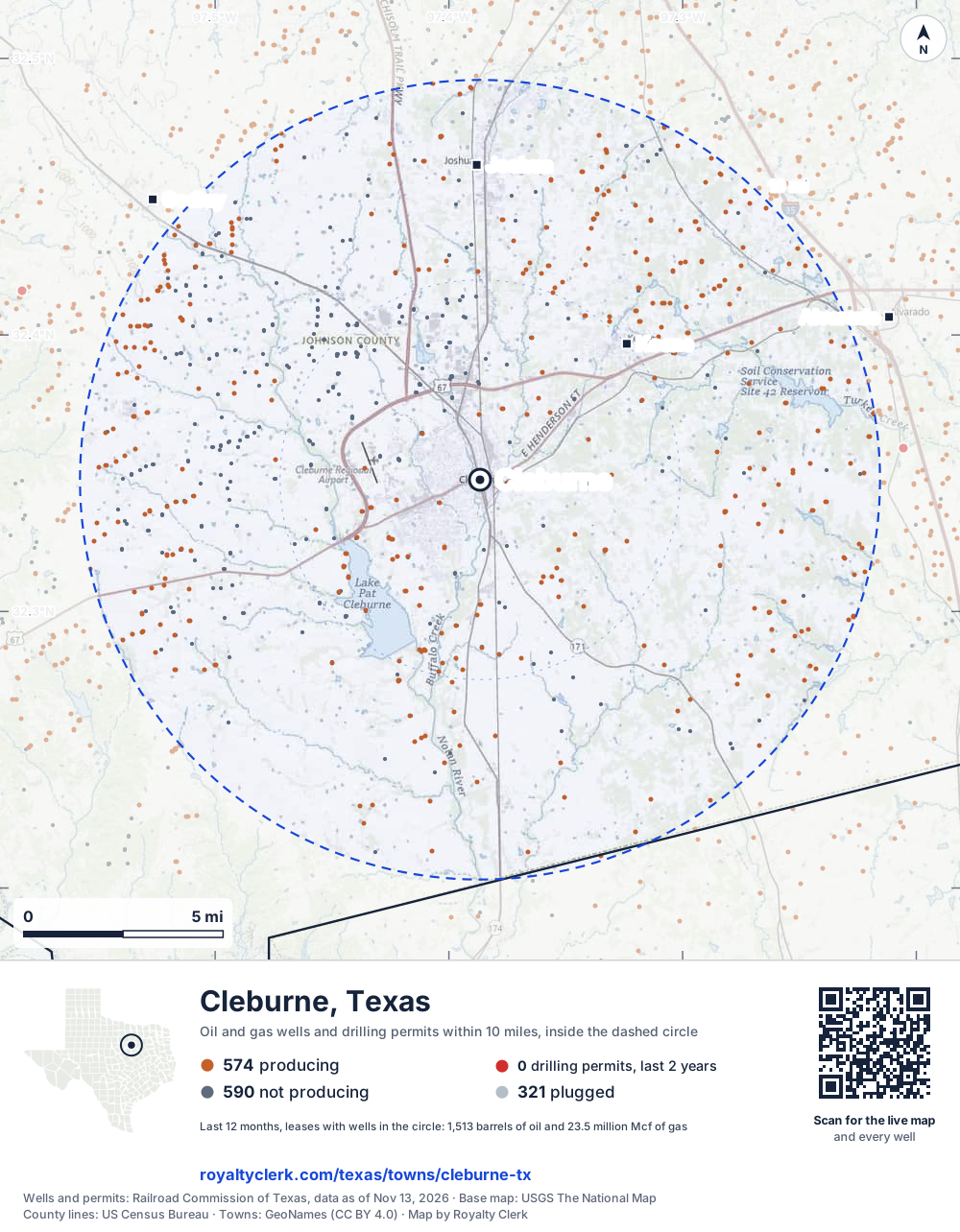
- Drilling locations0Permits issued in the last two years
- Producing wells574On a lease reporting production now
- Not producing590Shut in, inactive or no lease on record
- Plugged321The state's wellbore record says plugged
The dashed circle is 10 miles from the town's point (32.34764, -97.38668); the counts are for wells inside it. Sources: Railroad Commission of Texas well layers and permit files, US Census Bureau county outlines, town points from GeoNames (CC BY 4.0), base map from USGS The National Map.
Use this map on your site
You may show this map on any site, unchanged. Keep the credit line and its link to Royalty Clerk under the map. The picture updates by itself as the state records new wells and permits.
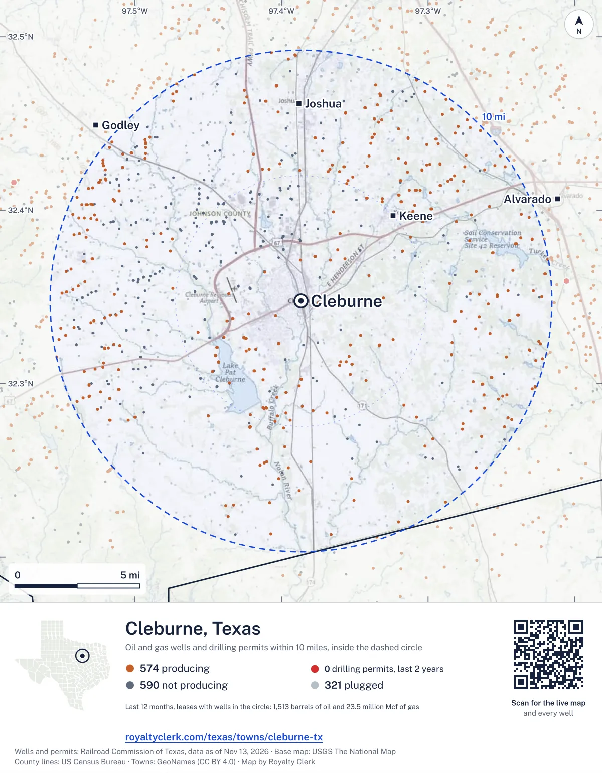
<a href="https://royaltyclerk.com/texas/towns/cleburne-tx"><img src="https://royaltyclerk.com/maps/town-wells/cleburne-tx.svg" alt="Map of Cleburne, Texas: 1,485 wells and 0 recent drilling locations within 10 miles, inside a dashed circle." width="1000" height="1284" loading="lazy" style="max-width:100%;height:auto;border:0"></a>
<p style="margin:4px 0 0;font-size:14px">Map: <a href="https://royaltyclerk.com/texas/towns/cleburne-tx">Cleburne, Texas oil and gas wells</a> by Royalty Clerk, from Railroad Commission of Texas records</p>
In numbers
Oil and gas within 10 miles of Cleburne
- wells with a location on the state's map
- 1,485
- drilling permits in the last 24 months
- 0
- producing leases with a well in the circle
- 574
- operators running them
- 9
- oil and condensate those leases reported in their latest 12 months
- 1,513 bbl
- gas those leases reported in their latest 12 months
- 23,452,291 mcf
A lease counts when at least one of its wells is inside the circle; its whole production is counted, so a lease reaching beyond the circle counts in full.
In dollars
What the oil and gas near Cleburne sold for
- sale value of 12 months, before taxes and costs
- $82 million
- oil and condensate sold
- 1,672 bbl
- gas sold
- 22,802,879 mcf
- the middle lease: half sold more, half less
- $135,244
A 0.01 share (1%) of the middle producing lease near Cleburne comes to about $1,352 for the 12 months.
Sold volumes at the public monthly prices, before severance tax and any costs. A guide to the size, not what any owner was paid.
Sold volumes from each lease's monthly report to the Railroad Commission, times the month's West Texas Intermediate oil price and Henry Hub gas price (EIA). Real prices at the lease differ. A lease counts in full when one of its wells is near the town. Check a statement against what the lease sold
Who is on the county roll
What the county mineral roll lists near Cleburne
- mineral accounts on the roll
- 17
- owner names
- 17
- appraised value of those accounts
- $10,000
- the middle account's appraised value
- $0
Totals from the county appraisal district's mineral roll, matched to leases by the state lease number. No owner is named here, and a count under 10 accounts or 5 owner names is left out. How Johnson County values minerals, and how to protest · Inherited minerals: where to start
Producing leases
Top producing leases near Cleburne
- 1Kennedy0 bbl · 127,330 mcf a yearTep Barnett USA, LLC · Johnson County · 1 well in the circle
- 2Tindall-Uysaler (Sa)0 bbl · 119,726 mcf a yearFormentera Operations LLC · Johnson County · 1 well in the circle
- 3Bransom, Cynthia0 bbl · 109,514 mcf a yearFormentera Operations LLC · Johnson County · 1 well in the circle
- 4Preston, Elizabeth0 bbl · 109,439 mcf a yearFormentera Operations LLC · Johnson County · 1 well in the circle
- 5Rive Enterprises0 bbl · 109,346 mcf a yearFormentera Operations LLC · Johnson County · 1 well in the circle
- 6Preston-Scarberry (Sa)0 bbl · 106,467 mcf a yearFormentera Operations LLC · Johnson County · 1 well in the circle
- 7Baylor-West0 bbl · 104,513 mcf a yearFormentera Operations LLC · Johnson County · 1 well in the circle
- 8Nowlin-Davis (Sa)0 bbl · 103,234 mcf a yearFormentera Operations LLC · Johnson County · 1 well in the circle
- 9Hodges Trust0 bbl · 101,698 mcf a yearTep Barnett USA, LLC · Johnson County · 1 well in the circle
- 10Davis-Bussey (Sa)0 bbl · 100,816 mcf a yearFormentera Operations LLC · Johnson County · 1 well in the circle
- 11Davis-Bussey (Sa)0 bbl · 100,563 mcf a yearFormentera Operations LLC · Johnson County · 1 well in the circle
- 12Uysaler, Ahmet0 bbl · 98,894 mcf a yearFormentera Operations LLC · Johnson County · 1 well in the circle
- 13Marti0 bbl · 98,767 mcf a yearBKV North Texas, LLC · Johnson County · 1 well in the circle
- 14Hollingsworth, Gary0 bbl · 97,164 mcf a yearFormentera Operations LLC · Johnson County · 1 well in the circle
- 15Gatlin, Winston0 bbl · 95,978 mcf a yearFormentera Operations LLC · Johnson County · 1 well in the circle
- 16Skaggs0 bbl · 95,492 mcf a yearTep Barnett USA, LLC · Johnson County · 1 well in the circle
- 17Preston, Elizabeth0 bbl · 94,719 mcf a yearFormentera Operations LLC · Johnson County · 1 well in the circle
- 18Barron Unit3 bbl · 94,053 mcf a yearUpp Operating, LLC · Johnson County · 1 well in the circle
- 19Bussey, Thomas0 bbl · 93,089 mcf a yearFormentera Operations LLC · Johnson County · 1 well in the circle
- 20Tindall-Uysaler (Sa)0 bbl · 88,439 mcf a yearFormentera Operations LLC · Johnson County · 1 well in the circle
Whose name is on the check
Who buys the oil and gas near Cleburne
Oil and condensate
- ENERGY TRANS CRUDE MARKETING LLC333 leases
- SHELL TRADING (US) COMPANY88 leases
- GULFMARK ENERGY, INC.73 leases
- ENERGY TRANSFER MARKETING & TERM64 leases
- PTT PREMIER TRADING AND TRAN LLC3 leases
Gas
- JAVELIN MARKETING, LLC307 leases
- TOTAL GAS & POWER NA, INC.133 leases
- ENERGY TRANSFER COMPANY87 leases
- BKV MARKETING, LLC21 leases
- EAGLERIDGE OPERATING, LLC7 leases
From each lease's newest Form P-4 filing with the Railroad Commission, which names its gatherers and purchasers. One lease can name several.
If your checks stopped
Leases near Cleburne that went quiet or changed hands
187 leases reported nothing for a year or more
Leases that reported within the last four years and then stopped. The newest to stop first; 10 shown.
- Featherston · Tep Barnett USA, LLClast report August 2025
- Featherston · Tep Barnett USA, LLClast report August 2025
- Allen · Tep Barnett USA, LLClast report August 2025
- Featherston · Tep Barnett USA, LLClast report August 2025
- Kinnear · Tep Barnett USA, LLClast report August 2025
- East Allen · Tep Barnett USA, LLClast report August 2025
- Joshua · Tep Barnett USA, LLClast report August 2025
- Joshua · Tep Barnett USA, LLClast report August 2025
- Joshua · Tep Barnett USA, LLClast report August 2025
- Kinnear · Tep Barnett USA, LLClast report August 2025
468 leases got a new operator in two years
Checks often pause after a change while the new company sets up its owner records. The newest first; 10 shown.
- Peugh UnitDiversified Production LLC to Eagleridge Operating, LLCJuly 2026
- StoutDiversified Production LLC to Eagleridge Operating, LLCJuly 2026
- H&DBRG Lone Star Ltd. to Riverbirch Resources, LLCMay 2026
- PratherBRG Lone Star Ltd. to Riverbirch Resources, LLCMay 2026
- WoodsBRG Lone Star Ltd. to Riverbirch Resources, LLCMay 2026
- Abshire, WilliamJavelin Energy Partners Mgmt LLC to Formentera Operations LLCDecember 2025
- Abshire, WilliamJavelin Energy Partners Mgmt LLC to Formentera Operations LLCDecember 2025
- Atkins, E. L.Javelin Energy Partners Mgmt LLC to Formentera Operations LLCDecember 2025
- Balentine, DonJavelin Energy Partners Mgmt LLC to Formentera Operations LLCDecember 2025
- Barr, DannyJavelin Energy Partners Mgmt LLC to Formentera Operations LLCDecember 2025
From the monthly production reports operators file with the Railroad Commission. The newest months fill in late, so a lease is listed only after 12 months with no report.
Year by year
Production of the leases near Cleburne, by year
| Year | Oil, bbl | Gas, mcf |
|---|---|---|
| 2026 so far | 1,143 | 14,917,301 |
| 2025 | 1,033 | 24,776,646 |
| 2024 | 1,053 | 27,646,034 |
| 2023 | 772 | 31,871,625 |
| 2022 | 589 | 35,814,087 |
| 2021 | 369 | 36,867,582 |
| 2020 | 115 | 40,090,239 |
Every lease with a well in the circle, producing now or not, as reported to the Railroad Commission. The newest months fill in as operators report.
The long view: in the state's records from July 1998 on, 1,484 of these leases reported 5,423 bbl of oil and condensate and 1,764,753,629 mcf of gas. Each lease page carries that lease's history back to January 1993.
Around it
Towns near Cleburne
- Keene5.0 mi NE1,903 wells · 1 permits
- Joshua7.8 mi N2,183 wells · 1 permits
- Godley11 mi NW1,911 wells · 2 permits
- Alvarado11 mi E1,422 wells · 2 permits
- Grandview13 mi SE403 wells · 1 permits
- Burleson14 mi N2,278 wells · 1 permits
- Crowley16 mi N2,118 wells · 1 permits
- Pecan Plantation17 mi W1,182 wells · 1 permits
- Venus18 mi E1,004 wells · 6 permits
- Rendon18 mi NE2,315 wells · 12 permits
Cleburne is in ZIP code 76031: its wells and permits
All of Johnson County: leases, operators and production · Johnson County well map
Follow it
Watch the 10 miles around Cleburne
Watching a place says nothing about who owns the land or the minerals there. For the whole county, or one survey, use the Johnson County well watch.
FAQ
Questions people ask
How many oil and gas wells are near Cleburne?
1,485 wells with a location on the Railroad Commission's map lie within 10 miles of Cleburne: 574 on leases that are producing, 590 not producing and 321 plugged. The state issued no drilling permit with a well location in that circle in the last 24 months.
What are the coordinates on this page?
Latitude and longitude of the well's surface location in NAD83, the coordinates map apps use. They come from the Railroad Commission's well layers as published, and from its drilling permit files, which are published in the older NAD27 and converted here. Paste them into any map app. A horizontal well's bottom hole can be a mile or two away from its surface location.
Do I own minerals under a well near Cleburne?
A well nearby says nothing about who owns the minerals under it. The county's mineral roll lists who is paid on each producing lease. Search a name to see whether the Johnson County roll lists it.
Is drilling near Cleburne picking up or slowing down?
The state issued no drilling permit with a well location within 10 miles of Cleburne in the last two years. The nearest one is 11 miles east of town, issued June 3, 2026. A permit is permission to drill, not a well.
How much are the oil and gas near Cleburne worth?
The 574 producing leases with a well within 10 miles sold about $82 million of oil and gas in their newest 12 months on file, at the public monthly prices and before taxes and costs. That is what the leases sold, not what a tract of land or a mineral interest is worth: an owner is paid a share of one lease.
My checks from a lease here stopped. Why?
The usual reasons: the lease stopped producing, a new operator took it over, or the operator put the payments in suspense over a title or address question. Near Cleburne, 187 leases went quiet and 468 changed operator; both lists are on this page.
Own land or minerals near Cleburne?
See whether a county roll lists your name, and get an email when a permit or a new well is filed near you.
Sources
Primary sources, opened on 29 September 2026. Statute text is the current version on statutes.capitol.texas.gov.