
Cass County, Texas
Oil wells and drilling locations near Linden
- 147wells
- 22drilling locations in two years
- 114producing leases
Within 10 miles
Wells and drilling locations around Linden
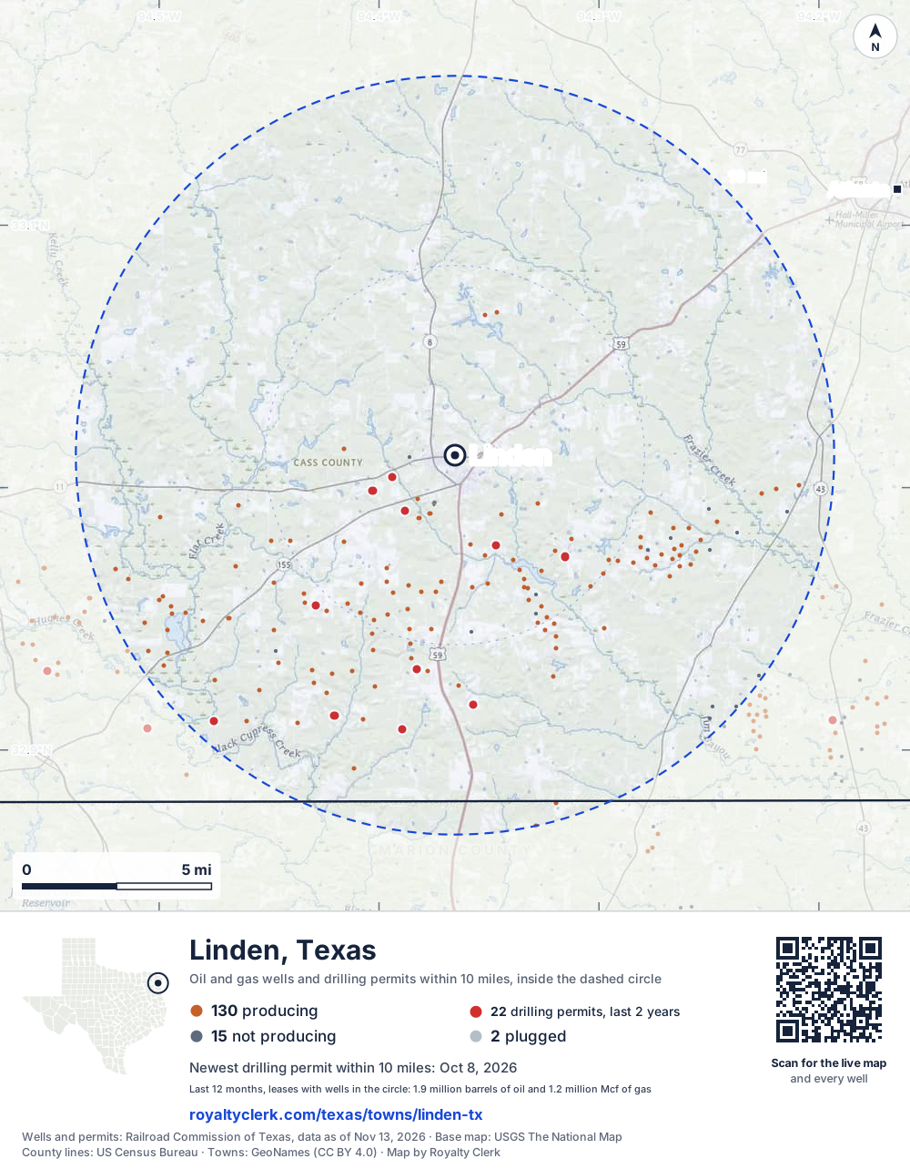
- Drilling locations22Permits issued in the last two years
- Producing wells130On a lease reporting production now
- Not producing15Shut in, inactive or no lease on record
- Plugged2The state's wellbore record says plugged
The dashed circle is 10 miles from the town's point (33.01235, -94.36547); the counts are for wells inside it. Sources: Railroad Commission of Texas well layers and permit files, US Census Bureau county outlines, town points from GeoNames (CC BY 4.0), base map from USGS The National Map.
Use this map on your site
You may show this map on any site, unchanged. Keep the credit line and its link to Royalty Clerk under the map. The picture updates by itself as the state records new wells and permits.
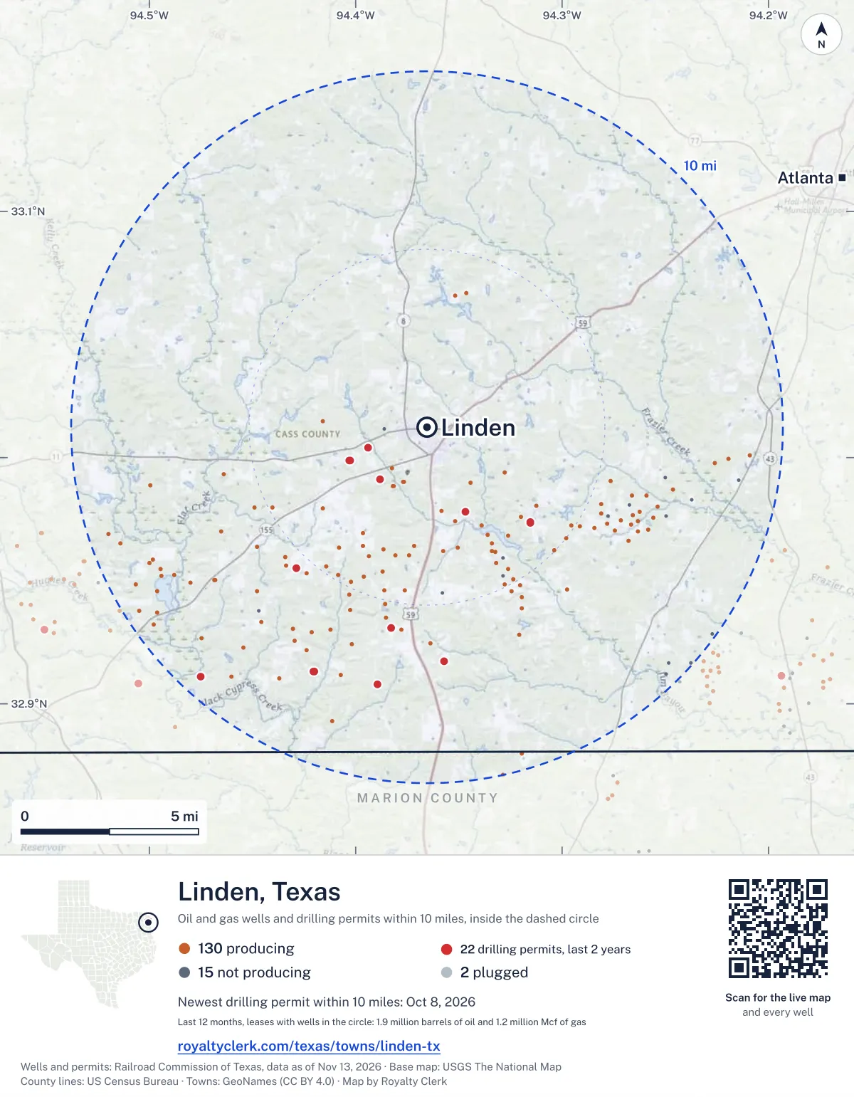
<a href="https://royaltyclerk.com/texas/towns/linden-tx"><img src="https://royaltyclerk.com/maps/town-wells/linden-tx.svg" alt="Map of Linden, Texas: 147 wells and 22 recent drilling locations within 10 miles, inside a dashed circle." width="1000" height="1284" loading="lazy" style="max-width:100%;height:auto;border:0"></a>
<p style="margin:4px 0 0;font-size:14px">Map: <a href="https://royaltyclerk.com/texas/towns/linden-tx">Linden, Texas oil and gas wells</a> by Royalty Clerk, from Railroad Commission of Texas records</p>
Which way it is heading
Where the new drilling is around Linden
What became of the 22 permits
- 6finished, on a lease that reports productionThe well was completed and its lease is reporting oil or gas to the state.
- 8drilling startedThe operator reported a start date. No completion is on file yet.
- 8still only a permitNothing after the permit is on file. Many permits wait a year or more, and some are never drilled.
Wells finished in the last two years: 2 south-east, 4 south, 6 south-west, 1 west of town.
A horizontal well runs sideways underground. 2 start inside and end outside. So a well can drain land a mile or two from the spot where it shows on a map.
A permit is permission to drill, not a well, and a well nearby says nothing about who owns the minerals under it. Direction is taken from the well's surface location. Source: Railroad Commission of Texas drilling permits and wellbore records.
In numbers
Oil and gas within 10 miles of Linden
- wells with a location on the state's map
- 147
- drilling permits in the last 24 months
- 22
- producing leases with a well in the circle
- 114
- operators running them
- 8
- oil and condensate those leases reported in their latest 12 months
- 1,893,168 bbl
- gas those leases reported in their latest 12 months
- 1,175,913 mcf
A lease counts when at least one of its wells is inside the circle; its whole production is counted, so a lease reaching beyond the circle counts in full.
In dollars
What the oil and gas near Linden sold for
- sale value of 12 months, before taxes and costs
- $142 million
- oil and condensate sold
- 1,890,427 bbl
- gas sold
- 29,790 mcf
- the middle lease: half sold more, half less
- $430,701
A 0.01 share (1%) of the middle producing lease near Linden comes to about $4,307 for the 12 months.
Sold volumes at the public monthly prices, before severance tax and any costs. A guide to the size, not what any owner was paid.
Sold volumes from each lease's monthly report to the Railroad Commission, times the month's West Texas Intermediate oil price and Henry Hub gas price (EIA). Real prices at the lease differ. A lease counts in full when one of its wells is near the town. Check a statement against what the lease sold
Drilling locations
The newest drilling permits near Linden
| Issued | Lease and well | Where | Operator |
|---|---|---|---|
| 2026-10-08 | TORRANS 1Hhorizontal · API 42-067-30986 · permit 0918430Rose City Resources, LLC | 7.5 mi SW32.91306, -94.42029 on OpenStreetMap (opens in a new tab) | Rose City Resources, LLC |
| 2026-08-28 | WARE 1Hhorizontal · API 42-067-30985 · permit 0918105Rose City Resources, LLC | 7.5 mi SW32.91306, -94.42036 on OpenStreetMap (opens in a new tab) | Rose City Resources, LLC |
| 2026-07-28 | PERRY 1Hhorizontal · API 42-067-30982 · permit 0916401Rose City Resources, LLC | 2.4 mi SW32.99894, -94.40305 on OpenStreetMap (opens in a new tab) | Rose City Resources, LLC |
| 2026-07-01 | FULLER 1Hhorizontal · API 42-067-30981 · permit 0915860Rose City Resources, LLC | 2.4 mi SW32.99883, -94.40279 on OpenStreetMap (opens in a new tab) | Rose City Resources, LLC |
| 2026-06-22 | LYNN 1Hhorizontal · API 42-067-30979 · permit 0915467Rose City Resources, LLC | 7.3 mi S32.90788, -94.38936 on OpenStreetMap (opens in a new tab) | Rose City Resources, LLC |
| 2026-05-28 | CLARK 1Hhorizontal · API 42-067-30977 · permit 0913191Rose City Resources, LLC | 7.3 mi S32.90788, -94.38930 on OpenStreetMap (opens in a new tab) | Rose City Resources, LLC |
| 2026-05-19 | WEBSTER 2Hhorizontal · API 42-067-30978 · permit 0914545Rose City Resources, LLC | 2.4 mi SW32.99884, -94.40273 on OpenStreetMap (opens in a new tab) | Rose City Resources, LLC |
| 2026-03-06 | ALMA 1Hhorizontal · API 42-067-30975 · permit 0913001Rose City Resources, LLC | 9.5 mi SW32.91102, -94.47518 on OpenStreetMap (opens in a new tab) | Rose City Resources, LLC |
| 2026-02-26 | HORACE 1Hhorizontal · API 42-067-30976 · permit 0912979Rose City Resources, LLC | 9.5 mi SW32.91101, -94.47525 on OpenStreetMap (opens in a new tab) | Rose City Resources, LLC |
| 2025-12-09 | MCDOWELL 1Hhorizontal · API 42-067-30974 · permit 0911597Rose City Resources, LLC | 3.9 mi SE32.97374, -94.31548 on OpenStreetMap (opens in a new tab) | Rose City Resources, LLC |
| 2025-09-29 | KAY 1Hhorizontal · API 42-067-30971 · permit 0910031Rose City Resources, LLC | 3.9 mi SE32.97369, -94.31548 on OpenStreetMap (opens in a new tab) | Rose City Resources, LLC |
| 2025-09-05 | BLEDSOE 1Hhorizontal · API 42-067-30968 · permit 0909025Rose City Resources, LLC | 3.9 mi SE32.97363, -94.31548 on OpenStreetMap (opens in a new tab) | Rose City Resources, LLC |
| 2025-09-04 | WARD 1Hhorizontal · API 42-067-30970 · permit 0909540Rose City Resources, LLC | 1.8 mi W33.00409, -94.39414 on OpenStreetMap (opens in a new tab) | Rose City Resources, LLC |
| 2025-07-15 | WEBSTER 1Hhorizontal · API 42-067-30969 · permit 0909117Rose City Resources, LLC | 1.8 mi W33.00404, -94.39413 on OpenStreetMap (opens in a new tab) | Rose City Resources, LLC |
| 2025-04-22 | TANNER 1Hhorizontal · API 42-067-30967 · permit 0906733Rose City Resources, LLC | 2.0 mi SW32.99109, -94.38807 on OpenStreetMap (opens in a new tab) | Rose City Resources, LLC |
| 2025-04-09 | WILSON 1Hhorizontal · API 42-067-30965 · permit 0906400Rose City Resources, LLC | 2.6 mi SE32.97797, -94.34688 on OpenStreetMap (opens in a new tab) | Rose City Resources, LLC |
| 2025-03-14 | MAHKO 1vertical · API 42-067-30966 · permit 0906553Fossil Petroleum LLC | 6.6 mi S32.91730, -94.35737 on OpenStreetMap (opens in a new tab) | Fossil Petroleum LLC |
| 2025-03-05 | YOCHUM 1Hhorizontal · API 42-067-30964 · permit 0906165Rose City Resources, LLC | 2.0 mi SW32.99106, -94.38805 on OpenStreetMap (opens in a new tab) | Rose City Resources, LLC |
| 2025-01-28 | GRACE 1Hhorizontal · API 42-067-30963 · permit 0905378Rose City Resources, LLC | 5.7 mi S32.93081, -94.38305 on OpenStreetMap (opens in a new tab) | Rose City Resources, LLC |
| 2025-01-16 | HARPER 1Hhorizontal · API 42-067-30957 · permit 0902489Rose City Resources, LLC | 2.6 mi SE32.97802, -94.34686 on OpenStreetMap (opens in a new tab) | Rose City Resources, LLC |
| 2025-01-14 | JENA 1Hhorizontal · API 42-067-30962 · permit 0905116Rose City Resources, LLC | 5.7 mi S32.93076, -94.38305 on OpenStreetMap (opens in a new tab) | Rose City Resources, LLC |
| 2024-12-17 | DURISOE 1vertical · API 42-067-30925 · permit 0895421Brammer Engineering, Inc. | 5.4 mi SW32.95521, -94.42873 on OpenStreetMap (opens in a new tab) | Brammer Engineering, Inc. |
| 2024-10-16 | NELSON 1Hhorizontal · API 42-067-30961 · permit 0903185Rose City Resources, LLC | 1.9 mi SW32.98837, -94.38182 on OpenStreetMap (opens in a new tab) | Rose City Resources, LLC |
| 2024-10-08 | MARSH 1Hhorizontal · API 42-067-30960 · permit 0903116Rose City Resources, LLC | 1.9 mi SW32.98847, -94.38173 on OpenStreetMap (opens in a new tab) | Rose City Resources, LLC |
| 2024-10-04 | GMFB 1Hhorizontal · API 42-067-30959 · permit 0902929Rose City Resources, LLC | 5.7 mi S32.93018, -94.37771 on OpenStreetMap (opens in a new tab) | Rose City Resources, LLC |
A permit is permission to drill, not a well. Distances are from the town's point to the well's surface location. Source: Railroad Commission of Texas drilling permits.
Find your land
The surveys under the new drilling near Linden
- A-258 DAVIS, J5 permits, newest July 28, 2026
- A-251 DUNCAN, A C4 permits, newest June 22, 2026
- A-545 HOGAN, W H3 permits, newest December 9, 2025
- A-51 BARKMAN, J2 permits, newest October 8, 2026
- A-1183 JONES, J2 permits, newest March 6, 2026
- A-354 FRAZIER, D2 permits, newest September 4, 2025
- A-711 MELTON, G2 permits, newest April 9, 2025
- A-448 HANSON, T1 permit, newest March 14, 2025
Not in the list? Search every survey in the county by name or abstract number.
Producing leases
Top producing leases near Linden
- 1Wilson138,466 bbl · 38,720 mcf a yearRose City Resources, LLC · Cass County · 1 well in the circle
- 2Grace127,375 bbl · 62,949 mcf a yearRose City Resources, LLC · Cass County · 1 well in the circle
- 3Jena107,927 bbl · 95,057 mcf a yearRose City Resources, LLC · Cass County · 1 well in the circle
- 4Walnut95,227 bbl · 94,847 mcf a yearRose City Resources, LLC · Cass County · 1 well in the circle
- 5Davis95,502 bbl · 23,949 mcf a yearRose City Resources, LLC · Cass County · 1 well in the circle
- 6Maloney77,461 bbl · 123,054 mcf a yearRose City Resources, LLC · Cass County · 1 well in the circle
- 7Gmfb75,527 bbl · 50,680 mcf a yearRose City Resources, LLC · Cass County · 1 well in the circle
- 8Milton76,809 bbl · 15,275 mcf a yearRose City Resources, LLC · Cass County · 1 well in the circle
- 9Goode-McMahan (Aw)51,712 bbl · 104,298 mcf a yearBarrow-Shaver Resources Co. · Cass County · 1 well in the circle
- 10Hays-Campbell (Aw)59,133 bbl · 49,695 mcf a yearBarrow-Shaver Resources Co. · Cass County · 1 well in the circle
- 11Stanley60,347 bbl · 34,507 mcf a yearRose City Resources, LLC · Cass County · 1 well in the circle
- 12Hays-Glover (Aw)53,810 bbl · 41,784 mcf a yearBarrow-Shaver Resources Co. · Cass County · 1 well in the circle
- 13Cypress44,754 bbl · 1,270 mcf a yearRose City Resources, LLC · Cass County · 1 well in the circle
- 14McFarlane-Alford (Aw)30,013 bbl · 77,645 mcf a yearBarrow-Shaver Resources Co. · Cass County · 1 well in the circle
- 15Marsh37,831 bbl · 19,410 mcf a yearRose City Resources, LLC · Cass County · 1 well in the circle
- 16Nelson37,085 bbl · 10,872 mcf a yearRose City Resources, LLC · Cass County · 1 well in the circle
- 17Ward33,567 bbl · 31,071 mcf a yearRose City Resources, LLC · Cass County · 1 well in the circle
- 18Yochum36,408 bbl · 4,685 mcf a yearRose City Resources, LLC · Cass County · 1 well in the circle
- 19Charlotte30,074 bbl · 17,095 mcf a yearRose City Resources, LLC · Cass County · 1 well in the circle
- 20Tanner30,821 bbl · 10,887 mcf a yearRose City Resources, LLC · Cass County · 1 well in the circle
Whose name is on the check
Who buys the oil and gas near Linden
Oil and condensate
- DK TRADING & SUPPLY, LLC78 leases
- EASTEX CRUDE COMPANY, LLC20 leases
- LION OIL TRADING & TRANS, LLC13 leases
- PLAINS MARKETING, L.P.3 leases
- ENERGY TRANSFER MARKETING & TERM2 leases
Gas
- HIDDEN ROCK MIDSTREAM, LLC23 leases
- SULPHUR RIVER GATHERING LLC2 leases
- INLAND CONTRACTORS, INC.1 lease
- UNIMARK ENERGY LTD.1 lease
From each lease's newest Form P-4 filing with the Railroad Commission, which names its gatherers and purchasers. One lease can name several.
If your checks stopped
Leases near Linden that went quiet or changed hands
6 leases reported nothing for a year or more
Leases that reported within the last four years and then stopped. The newest to stop first.
- Price · Rose City Resources, LLClast report August 2025
- Moore · Machin & Associates, Inc.last report February 2024
- King, Wyatt · Pegasi Operating Inc.last report November 2022
- Oakland Corporation · Pegasi Operating Inc.last report November 2022
- Davis · Pegasi Operating Inc.last report November 2022
- Davis · Pegasi Operating Inc.last report November 2022
From the monthly production reports operators file with the Railroad Commission. The newest months fill in late, so a lease is listed only after 12 months with no report.
Year by year
Production of the leases near Linden, by year
| Year | Oil, bbl | Gas, mcf |
|---|---|---|
| 2026 so far | 1,153,867 | 781,877 |
| 2025 | 2,447,986 | 1,192,698 |
| 2024 | 1,912,395 | 906,736 |
| 2023 | 1,246,200 | 450,373 |
| 2022 | 712,784 | 142,391 |
| 2021 | 289,310 | 130,199 |
| 2020 | 192,034 | 177,737 |
Every lease with a well in the circle, producing now or not, as reported to the Railroad Commission. The newest months fill in as operators report.
The long view: in the state's records from January 1993 on, 45 of these leases reported 2,872,536 bbl of oil and condensate and 3,989,196 mcf of gas. Each lease page carries that lease's history back to January 1993.
Around it
Towns near Linden
- Atlanta14 mi NE47 wells · 2 permits
- Hughes Springs15 mi W107 wells · 17 permits
- Queen City16 mi NE11 wells · 2 permits
- Jefferson18 mi S447 wells · 12 permits
- Lone Star20 mi W126 wells · 16 permits
- Daingerfield21 mi W37 wells · 15 permits
- Maud22 mi N23 wells · 4 permits
- Naples22 mi NW0 wells · 1 permits
- Redwater25 mi N10 wells · 0 permits
- Ore City25 mi SW297 wells · 23 permits
Linden is in ZIP code 75563: its wells and permits
All of Cass County: leases, operators and production · Cass County well map
Press and community kit
Writing about Linden? Take what you need
Three facts to quote
- 147 oil and gas wells on the state's map lie within 10 miles of Linden: 130 on producing leases, 15 not producing and 2 plugged.
- The Railroad Commission of Texas issued 10 drilling permits within 10 miles of Linden in the last 12 months, the newest dated October 8, 2026.
- The 114 producing leases with a well in that circle, run by 8 operators, reported 1,893,168 barrels of oil and 1,175,913 thousand cubic feet of gas over their latest 12 months.
The map picture
The page's map with its legend and credit, as a JPEG.

The live map on your page
A frame that loads its picture first and the live map on a tap. No cookies.
How to cite
Railroad Commission of Texas records of the wells and drilling permits within 10 miles of Linden, mapped by Royalty Clerk (https://royaltyclerk.com/texas/towns/linden-tx), data as of November 15, 2026.
Under a map or a chart: Source: Railroad Commission of Texas · Map: Royalty Clerk, with a link to this page.
The figures say where the state's records put wells and permits, not who owns the land or the minerals. Kits for other Texas towns
Follow it
Watch the 10 miles around Linden
Watching a place says nothing about who owns the land or the minerals there. For the whole county, or one survey, use the Cass County well watch.
FAQ
Questions people ask
How many oil and gas wells are near Linden?
147 wells with a location on the Railroad Commission's map lie within 10 miles of Linden: 130 on leases that are producing, 15 not producing and 2 plugged. The state also issued 22 drilling permits with a well location in that circle in the last 24 months.
What are the coordinates on this page?
Latitude and longitude of the well's surface location in NAD83, the coordinates map apps use. They come from the Railroad Commission's well layers as published, and from its drilling permit files, which are published in the older NAD27 and converted here. Paste them into any map app. A horizontal well's bottom hole can be a mile or two away from its surface location.
Do I own minerals under a well near Linden?
A well nearby says nothing about who owns the minerals under it. The county's mineral roll lists who is paid on each producing lease. Search a name to see whether the Cass County roll lists it.
Is drilling near Linden picking up or slowing down?
Drilling permits near Linden are holding steady: 10 permits in the last 12 months, 12 in the 12 months before. Most of them are south of town: 20 of 22 lie on that side. The nearest is 1.8 miles west of the town's point. A permit is permission to drill, not a well.
How much are the oil and gas near Linden worth?
The 114 producing leases with a well within 10 miles sold about $142 million of oil and gas in their newest 12 months on file, at the public monthly prices and before taxes and costs. That is what the leases sold, not what a tract of land or a mineral interest is worth: an owner is paid a share of one lease.
My checks from a lease here stopped. Why?
The usual reasons: the lease stopped producing, a new operator took it over, or the operator put the payments in suspense over a title or address question. Near Linden, 6 leases went quiet and 0 changed operator; both lists are on this page.
Own land or minerals near Linden?
See whether a county roll lists your name, and get an email when a permit or a new well is filed near you.
Sources
Primary sources, opened on 29 September 2026. Statute text is the current version on statutes.capitol.texas.gov.