
Taylor County, Texas
Oil wells and drilling locations near Merkel
- 534wells
- 11drilling locations in two years
- 128producing leases
Within 10 miles
Wells and drilling locations around Merkel
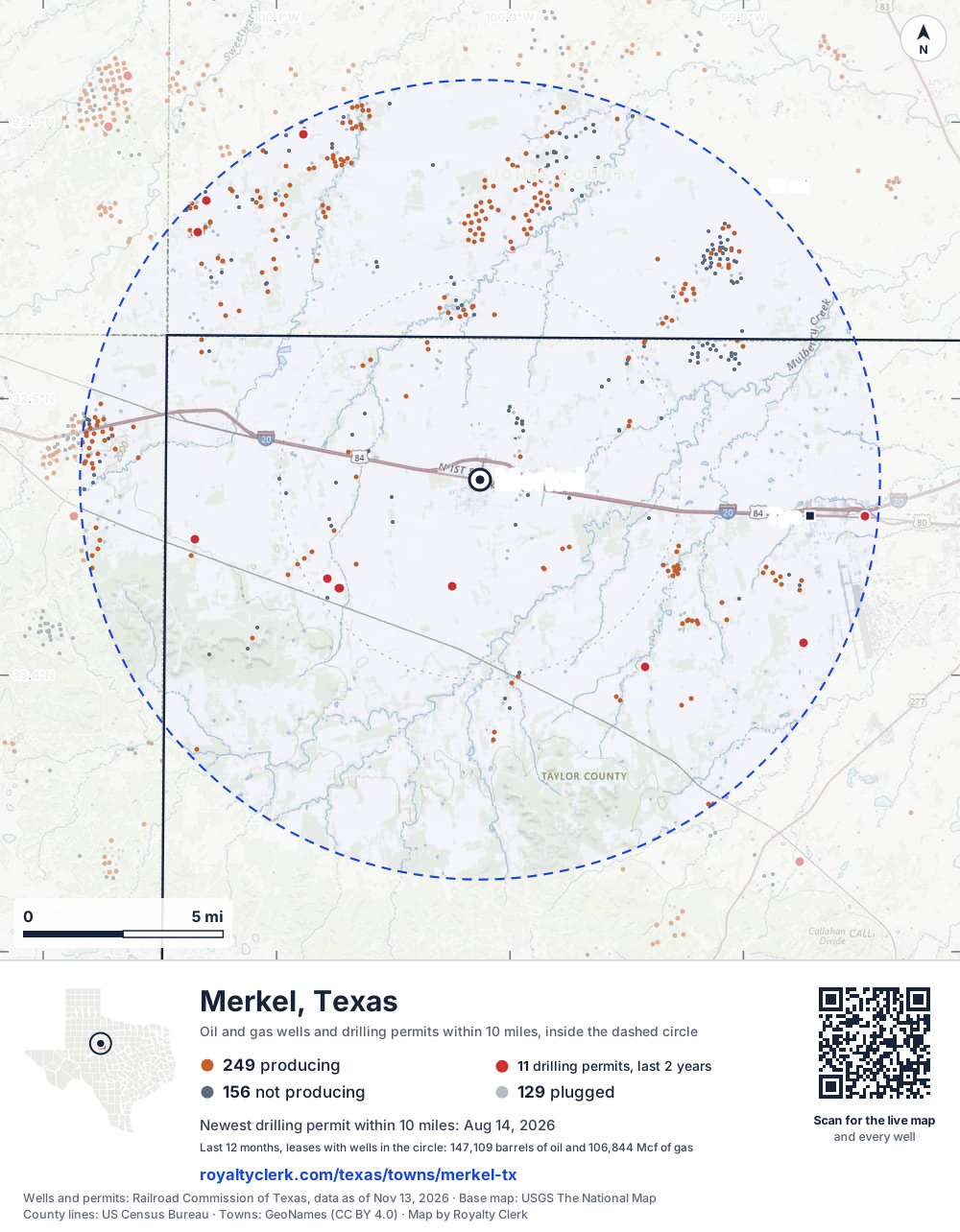
- Drilling locations11Permits issued in the last two years
- Producing wells249On a lease reporting production now
- Not producing156Shut in, inactive or no lease on record
- Plugged129The state's wellbore record says plugged
The dashed circle is 10 miles from the town's point (32.47068, -100.01287); the counts are for wells inside it. Sources: Railroad Commission of Texas well layers and permit files, US Census Bureau county outlines, town points from GeoNames (CC BY 4.0), base map from USGS The National Map.
Use this map on your site
You may show this map on any site, unchanged. Keep the credit line and its link to Royalty Clerk under the map. The picture updates by itself as the state records new wells and permits.
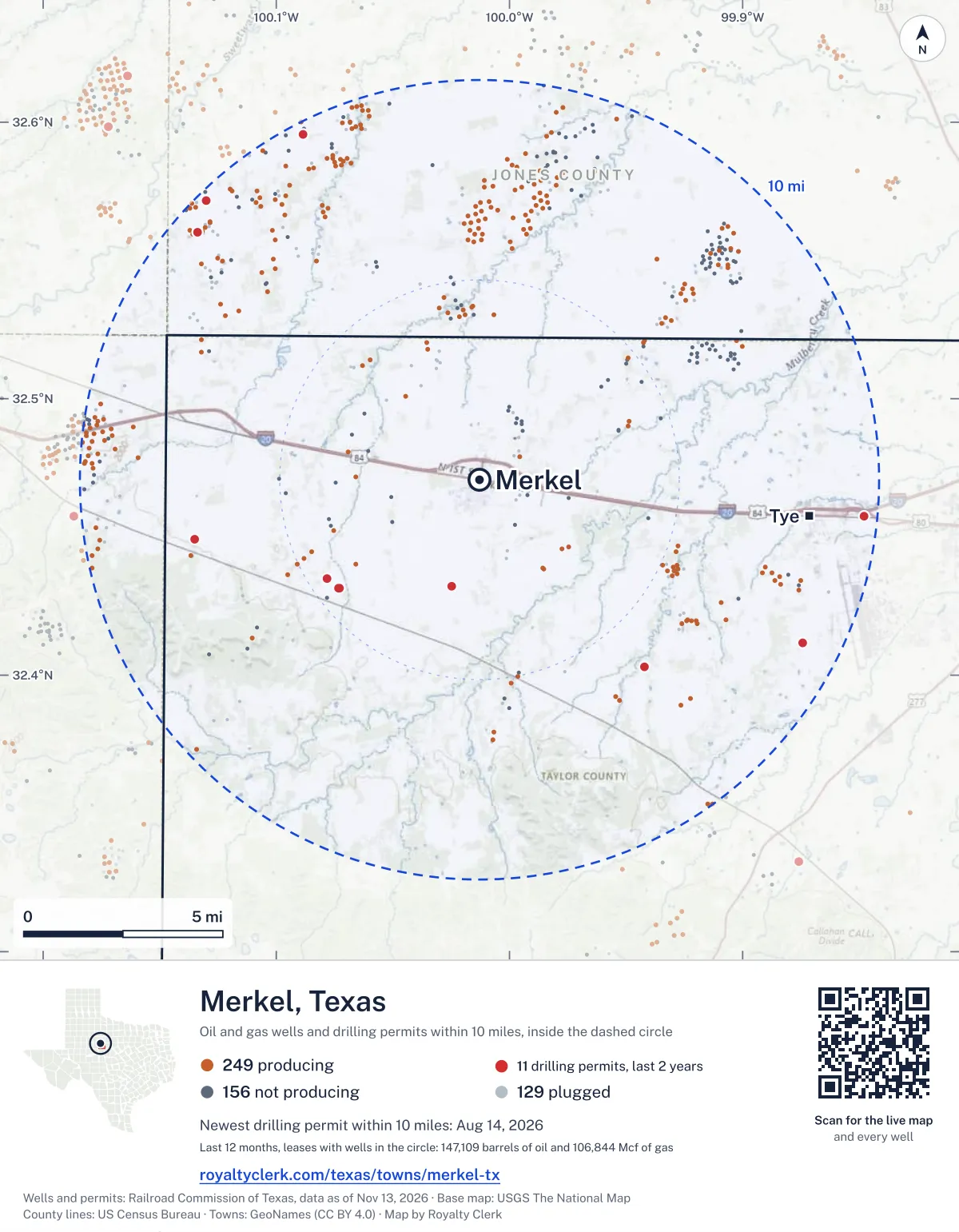
<a href="https://royaltyclerk.com/texas/towns/merkel-tx"><img src="https://royaltyclerk.com/maps/town-wells/merkel-tx.svg" alt="Map of Merkel, Texas: 534 wells and 11 recent drilling locations within 10 miles, inside a dashed circle." width="1000" height="1284" loading="lazy" style="max-width:100%;height:auto;border:0"></a>
<p style="margin:4px 0 0;font-size:14px">Map: <a href="https://royaltyclerk.com/texas/towns/merkel-tx">Merkel, Texas oil and gas wells</a> by Royalty Clerk, from Railroad Commission of Texas records</p>
Which way it is heading
Where the new drilling is around Merkel
What became of the 11 permits
- 2finished, on a lease that reports productionThe well was completed and its lease is reporting oil or gas to the state.
- 1finished, no production reported yetA completion is on file. The first production report follows weeks or months later.
- 2drilling startedThe operator reported a start date. No completion is on file yet.
- 6still only a permitNothing after the permit is on file. Many permits wait a year or more, and some are never drilled.
Wells finished in the last two years: 3 north-west of town.
A horizontal well runs sideways underground. 1 starts inside and ends outside. So a well can drain land a mile or two from the spot where it shows on a map.
A permit is permission to drill, not a well, and a well nearby says nothing about who owns the minerals under it. Direction is taken from the well's surface location. Source: Railroad Commission of Texas drilling permits and wellbore records.
In numbers
Oil and gas within 10 miles of Merkel
- wells with a location on the state's map
- 534
- drilling permits in the last 24 months
- 11
- producing leases with a well in the circle
- 128
- operators running them
- 35
- oil and condensate those leases reported in their latest 12 months
- 147,109 bbl
- gas those leases reported in their latest 12 months
- 106,844 mcf
A lease counts when at least one of its wells is inside the circle; its whole production is counted, so a lease reaching beyond the circle counts in full.
In dollars
What the oil and gas near Merkel sold for
- sale value of 12 months, before taxes and costs
- $11 million
- oil and condensate sold
- 142,984 bbl
- gas sold
- 92,777 mcf
- the middle lease: half sold more, half less
- $55,718
A 0.01 share (1%) of the middle producing lease near Merkel comes to about $557 for the 12 months.
Sold volumes at the public monthly prices, before severance tax and any costs. A guide to the size, not what any owner was paid.
Sold volumes from each lease's monthly report to the Railroad Commission, times the month's West Texas Intermediate oil price and Henry Hub gas price (EIA). Real prices at the lease differ. A lease counts in full when one of its wells is near the town. Check a statement against what the lease sold
Drilling locations
The newest drilling permits near Merkel
| Issued | Lease and well | Where | Operator |
|---|---|---|---|
| 2026-08-14 | TYE-SOUTH STREET 1vertical · API 42-441-34742 · permit 0917750Delek Crude Logistics, LLC | 9.7 mi E32.45737, -99.84777 on OpenStreetMap (opens in a new tab) | Delek Crude Logistics, LLC |
| 2026-05-19 | CH-160 1vertical · API 42-441-34735 · permit 0915648Enterprise Products Operatingllc | 6.2 mi SE32.40313, -99.94219 on OpenStreetMap (opens in a new tab) | Enterprise Products Operatingllc |
| 2025-12-11 | SWANN, W.D. 10vertical · API 42-253-35745 · permit 0912099Sojourner Drilling Corporation | 9.8 mi NW32.57176, -100.13023 on OpenStreetMap (opens in a new tab) | Sojourner Drilling Corporation |
| 2025-10-23 | DETTMANN 1Rvertical · API 42-441-34730 · permit 0911285Reo Operating LLC | 4.4 mi SW32.43155, -100.07328 on OpenStreetMap (opens in a new tab) | Reo Operating LLC |
| 2025-09-30 | JAY (CANYON LIME) UNIT 212vertical · API 42-253-35744 · permit 0910769Sojourner Drilling Corporation | 9.4 mi NW32.56030, -100.13362 on OpenStreetMap (opens in a new tab) | Sojourner Drilling Corporation |
| 2025-09-11 | DELEK4 001vertical · API 42-441-34729 · permit 0910198Delek Crude Logistics, LLC | 9.1 mi SE32.41162, -99.87428 on OpenStreetMap (opens in a new tab) | Delek Crude Logistics, LLC |
| 2025-08-15 | DETTMANN 1vertical · API 42-441-34728 · permit 0909855Reo Operating LLC | 4.4 mi SW32.43130, -100.07303 on OpenStreetMap (opens in a new tab) | Reo Operating LLC |
| 2025-08-11 | BIRDIE UNIT 1vertical · API 42-253-35743 · permit 0909777Sojourner Drilling Corporation | 9.7 mi NW32.59567, -100.08838 on OpenStreetMap (opens in a new tab) | Sojourner Drilling Corporation |
| 2025-05-07 | MP 154.9 154vertical · API 42-441-34723 · permit 0907660Enterprise Products Texas Op LLC | 2.7 mi S32.43215, -100.02466 on OpenStreetMap (opens in a new tab) | Enterprise Products Texas Op LLC |
| 2025-05-02 | ORW MP 116.7 NEW SOUKUP 1vertical · API 42-441-34722 · permit 0907674Magellan Pipeline Company, L.P. | 7.3 mi W32.44907, -100.13515 on OpenStreetMap (opens in a new tab) | Magellan Pipeline Company, L.P. |
| 2025-05-02 | ORW MP 120.2 NEW SOUKUP 1vertical · API 42-441-34721 · permit 0907673Magellan Pipeline Company, L.P. | 4.6 mi SW32.43479, -100.07846 on OpenStreetMap (opens in a new tab) | Magellan Pipeline Company, L.P. |
| 2024-08-29 | CH-157 1vertical · API 42-441-34712 · permit 0901777Enterprise Products Texas Op LLC | 3.9 mi S32.41871, -99.98833 on OpenStreetMap (opens in a new tab) | Enterprise Products Texas Op LLC |
| 2024-07-25 | CATHODIC PROTECTION 3vertical · API 42-441-34708 · permit 0901271Energy Transfer Company | 7.4 mi SE32.40671, -99.91168 on OpenStreetMap (opens in a new tab) | Energy Transfer Company |
| 2024-06-27 | DUSTY FARMER 1vertical · API 42-253-35687 · permit 0900729Sojourner Drilling Corporation | 8.0 mi NW32.56498, -100.09416 on OpenStreetMap (opens in a new tab) | Sojourner Drilling Corporation |
| 2024-06-06 | WATKINS 2H UNIT 2Hhorizontal · API 42-353-00820 · permit 0900085RHB Exploration & Production,llc | 9.3 mi W32.48654, -100.17059 on OpenStreetMap (opens in a new tab) | RHB Exploration & Production,llc |
| 2024-01-25 | ECT208 1vertical · API 42-253-35720 · permit 0896711Sunoco Pipeline L.P. | 9.4 mi NE32.57348, -99.90632 on OpenStreetMap (opens in a new tab) | Sunoco Pipeline L.P. |
| 2024-01-25 | ETC207 1vertical · API 42-441-34691 · permit 0896710Sunoco Pipeline L.P. | 2.9 mi NW32.48985, -100.05800 on OpenStreetMap (opens in a new tab) | Sunoco Pipeline L.P. |
| 2023-01-26 | MAG01-MP130.8 01vertical · API 42-441-34684 · permit 0887551Magellan Pipeline Company, L.P. | 8.0 mi SE32.40475, -99.90080 on OpenStreetMap (opens in a new tab) | Magellan Pipeline Company, L.P. |
A permit is permission to drill, not a well. Distances are from the town's point to the well's surface location. Source: Railroad Commission of Texas drilling permits.
Find your land
The surveys under the new drilling near Merkel
- A-268 MILEY, I, section 2812 permits, newest December 11, 2025
- A-376 T&P RR CO, block 19, section 632 permits, newest October 23, 2025
- A-1457 T&P RR CO, block 16, section 351 permit, newest August 14, 2026
- A-77 GUADALUPE CSL, section 1211 permit, newest May 19, 2026
- A-206 MC SHERRY, J, section 1291 permit, newest September 11, 2025
- A-778 CAMP, A P, block 18, section 501 permit, newest August 11, 2025
- A-358 T&P RR CO, block 18, section 51 permit, newest May 7, 2025
- A-375 T&P RR CO, block 19, section 611 permit, newest May 2, 2025
Not in the list? Search every survey in the county by name or abstract number.
Who is on the county roll
71 mineral accounts near Merkel are still in the name of an estate
- mineral accounts on the roll
- 2,604
- owner names
- 1,649
- appraised value of those accounts
- $16 million
- the middle account's appraised value
- $460
- the middle account in all of Taylor County
- $185
- accounts titled to an estate
- 71
An account in the name of an estate usually means the owner died and the title was never moved to the heirs. The account stays on the roll, and these are appraised at $84,874 together. If a parent or grandparent owned minerals near Merkel, their name may be one of them.
Totals from the county appraisal district's mineral roll, matched to leases by the state lease number. No owner is named here, and a count under 10 accounts or 5 owner names is left out. How Taylor County values minerals, and how to protest · Inherited minerals: where to start
Producing leases
Top producing leases near Merkel
- 1Jay (Canyon Lime) Unit21,399 bbl · 68,069 mcf a yearSojourner Drilling Corporation · Jones County · 9 wells in the circle
- 2Dyess FRY Unit6,909 bbl · 0 mcf a yearStephens & Johnson Operating Co. · Taylor County · 6 wells in the circle
- 3McElmurray, W. W.4,807 bbl · 9,132 mcf a yearScout Energy Management LLC · Nolan County · 2 wells in the circle
- 4Noodle Unit5,513 bbl · 0 mcf a yearPetex · Jones County · 11 wells in the circle
- 5Proctor3,910 bbl · 0 mcf a yearBeaird, R.a. Oil Operating Co. · Taylor County · 1 well in the circle
- 6Sears 'B'3,747 bbl · 0 mcf a yearSojourner Drilling Corporation · Jones County · 1 well in the circle
- 7Jones, J. H. F.3,366 bbl · 0 mcf a yearPetex · Jones County · 7 wells in the circle
- 8Mitchell, W.l.2,762 bbl · 61 mcf a yearFelderhoff Production Company · Jones County · 2 wells in the circle
- 9Teaff2,611 bbl · 0 mcf a yearSalida Exploration, LLC · Taylor County · 1 well in the circle
- 10Freeman-Farmer2,606 bbl · 0 mcf a yearSojourner Drilling Corporation · Jones County · 1 well in the circle
- 11Baird Unit1,302 bbl · 7,730 mcf a yearSojourner Drilling Corporation · Taylor County · 1 well in the circle
- 12Goodwin2,437 bbl · 0 mcf a yearGrayrock Energy II, LLC · Jones County · 1 well in the circle
- 13Hale, Betty2,284 bbl · 0 mcf a yearRMB Operating LLC · Jones County · 4 wells in the circle
- 14Jividen "A"1,833 bbl · 2,576 mcf a yearBarnett Energy, Inc. · Jones County · 3 wells in the circle
- 15Henslee, Walter2,245 bbl · 0 mcf a yearPowell, A. Brandt Co. · Taylor County · 2 wells in the circle
- 16A. H. McElmurray 'A'1,978 bbl · 1,437 mcf a yearScout Energy Management LLC · Nolan County · 1 well in the circle
- 17Freeman, G. M.2,215 bbl · 0 mcf a yearScout Energy Management LLC · Nolan County · 4 wells in the circle
- 18Mead Strawn Unit1,929 bbl · 500 mcf a yearGrayrock Energy II, LLC · Jones County · 19 wells in the circle
- 19Irvin, I. N.1,986 bbl · 0 mcf a yearPetex · Jones County · 8 wells in the circle
- 20Lilly A1,941 bbl · 0 mcf a yearClear Fork, Incorporated · Taylor County · 1 well in the circle
Whose name is on the check
Who buys the oil and gas near Merkel
Oil and condensate
- BML, INC. B88 leases
- TRANSOIL MARKETING, LLC24 leases
- ENERGY TRANSFER MARKETING & TERM19 leases
- ENERGY TRANS CRUDE MARKETING LLC16 leases
- TRUE OIL TRUCKING & MKTG, LLC4 leases
Gas
- ENERGY TRANSFER COMPANY18 leases
- ET GATHERING & PROCESSING LLC16 leases
- DEVON GAS SERVICES, L.P.1 lease
From each lease's newest Form P-4 filing with the Railroad Commission, which names its gatherers and purchasers. One lease can name several.
If your checks stopped
Leases near Merkel that went quiet or changed hands
22 leases reported nothing for a year or more
Leases that reported within the last four years and then stopped. The newest to stop first; 10 shown.
- Clark · Sojourner Drilling Corporationlast report August 2025
- Guitar 'B' · D. W. R. Oil Co., Inc.last report August 2025
- Williamson, Wanda · Boaz Energy II Operating, LLClast report April 2025
- Beene · Boaz Energy II Operating, LLClast report April 2025
- Ethel · Sojourner Drilling Corporationlast report February 2025
- Cade · Harvest Petroleum Inc.last report February 2025
- Shannon · Cedar Ridge Energy, Inc.last report September 2024
- City of Merkel · Subsurface Production, Inc.last report September 2024
- Tarpley, David "B" · Cedar Ridge Energy, Inc.last report September 2024
- Hester, H.w. · Subsurface Production, Inc.last report September 2024
8 leases got a new operator in two years
Checks often pause after a change while the new company sets up its owner records. The newest first.
- Ashby3 S Production, Inc. to Crystal J Oil and Gas LLCApril 2026
- Braune "A"3 S Production, Inc. to Crystal J Oil and Gas LLCApril 2026
- Dunagin, Bryan B., UnitPony Express Corporate Trust to Beasley Well Service Inc.March 2026
- WS-Chancey "16"Pony Express Corporate Trust to Beasley Well Service Inc.March 2026
- WS-Dunagin "16"Pony Express Corporate Trust to Beasley Well Service Inc.March 2026
- Guitar Earl B.D. W. R. Oil Co., Inc. to Production Operators of TX, LLCSeptember 2025
- Mitchell, W.l.Kaiser-Francis Oil Company to Felderhoff Production CompanySeptember 2025
- Mitchell, W.l.Kaiser-Francis Oil Company to Felderhoff Production CompanySeptember 2025
From the monthly production reports operators file with the Railroad Commission. The newest months fill in late, so a lease is listed only after 12 months with no report.
Year by year
Production of the leases near Merkel, by year
| Year | Oil, bbl | Gas, mcf |
|---|---|---|
| 2026 so far | 92,480 | 63,237 |
| 2025 | 158,568 | 92,131 |
| 2024 | 183,434 | 73,372 |
| 2023 | 201,513 | 59,358 |
| 2022 | 200,578 | 88,112 |
| 2021 | 191,398 | 95,846 |
| 2020 | 184,405 | 110,415 |
Every lease with a well in the circle, producing now or not, as reported to the Railroad Commission. The newest months fill in as operators report.
The long view: in the state's records from January 1993 on, 244 of these leases reported 9,178,147 bbl of oil and condensate and 7,467,664 mcf of gas. Each lease page carries that lease's history back to January 1993.
Around it
Towns near Merkel
- Tye8.3 mi E299 wells · 10 permits
- Abilene16 mi E292 wells · 9 permits
- Anson21 mi N437 wells · 8 permits
- Sweetwater23 mi W433 wells · 5 permits
- Potosi23 mi SE308 wells · 10 permits
- Roby28 mi NW172 wells · 4 permits
- Hamlin29 mi N793 wells · 24 permits
Merkel is in ZIP code 79536: its wells and permits
All of Taylor County: leases, operators and production · Taylor County well map
Follow it
Watch the 10 miles around Merkel
Watching a place says nothing about who owns the land or the minerals there. For the whole county, or one survey, use the Taylor County well watch.
FAQ
Questions people ask
How many oil and gas wells are near Merkel?
534 wells with a location on the Railroad Commission's map lie within 10 miles of Merkel: 249 on leases that are producing, 156 not producing and 129 plugged. The state also issued 11 drilling permits with a well location in that circle in the last 24 months.
What are the coordinates on this page?
Latitude and longitude of the well's surface location in NAD83, the coordinates map apps use. They come from the Railroad Commission's well layers as published, and from its drilling permit files, which are published in the older NAD27 and converted here. Paste them into any map app. A horizontal well's bottom hole can be a mile or two away from its surface location.
Do I own minerals under a well near Merkel?
A well nearby says nothing about who owns the minerals under it. The county's mineral roll lists who is paid on each producing lease. Search a name to see whether the Taylor County roll lists it.
Is drilling near Merkel picking up or slowing down?
Drilling permits near Merkel are falling: 3 permits in the last 12 months, 8 in the 12 months before. They are spread around town, with no side clearly ahead. The nearest is 2.7 miles south of the town's point. A permit is permission to drill, not a well.
How much are the oil and gas near Merkel worth?
The 128 producing leases with a well within 10 miles sold about $11 million of oil and gas in their newest 12 months on file, at the public monthly prices and before taxes and costs. That is what the leases sold, not what a tract of land or a mineral interest is worth: an owner is paid a share of one lease.
A relative owned minerals near Merkel and has died. What now?
The county mineral roll still lists 71 accounts in the name of an estate on leases near Merkel. Search the family name first. If an account turns up, the title usually has to be moved to the heirs before the operator will pay them.
My checks from a lease here stopped. Why?
The usual reasons: the lease stopped producing, a new operator took it over, or the operator put the payments in suspense over a title or address question. Near Merkel, 22 leases went quiet and 8 changed operator; both lists are on this page.
Own land or minerals near Merkel?
71 accounts near Merkel are still in the name of an estate. See whether a county roll lists your name, and get an email when a permit or a new well is filed near you.
Sources
Primary sources, opened on 29 September 2026. Statute text is the current version on statutes.capitol.texas.gov.