
Nolan County, Texas
Nolan County drilling permits: what the state recorded
- 18drilling permits
- 8completions
- 1first-production report
- in the last twelve months
Wells by coordinates
Oil wells and drilling locations in Nolan County
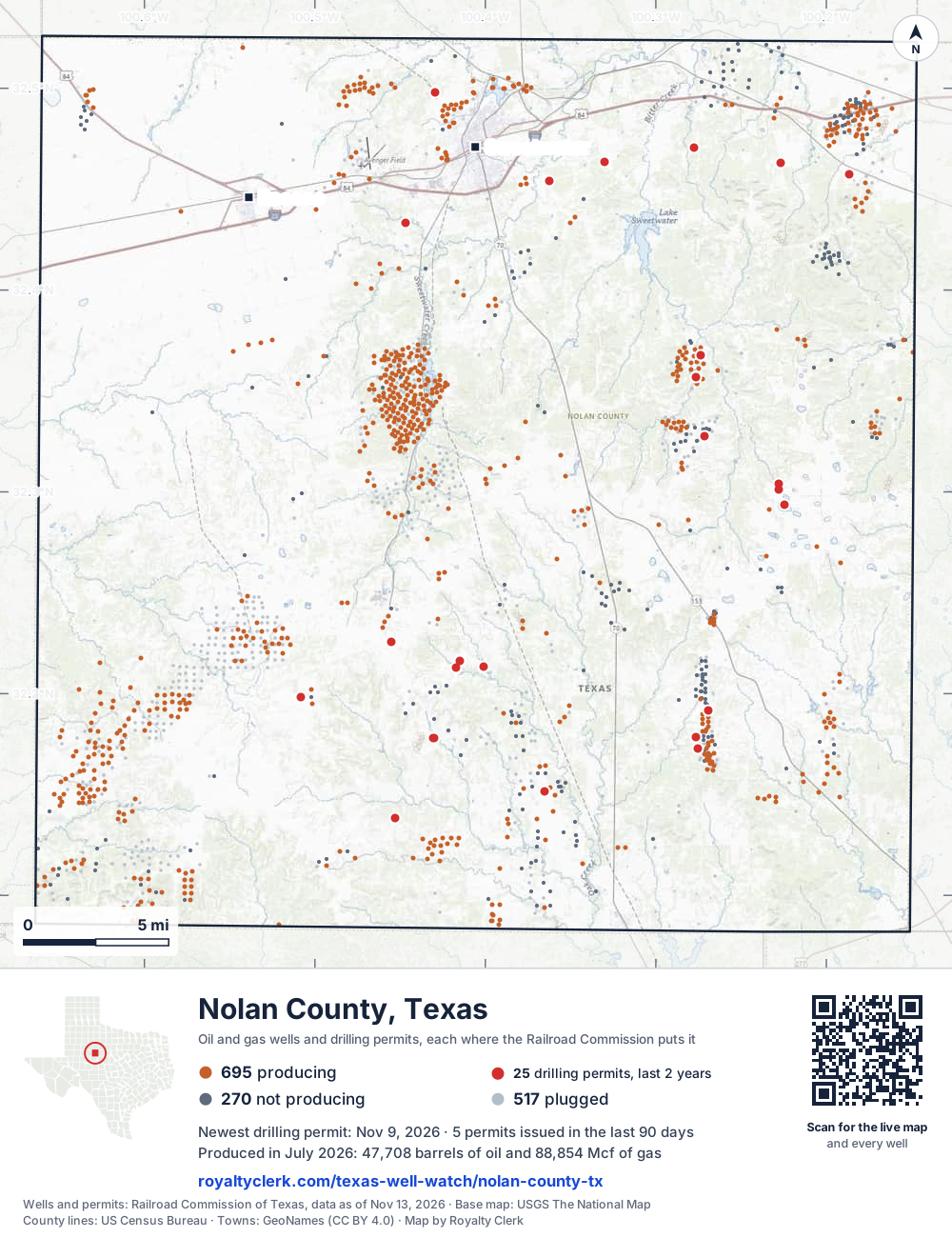
- Drilling locations25Permits issued in the last two years
- Producing wells695On a lease reporting production now
- Not producing270Shut in, inactive or no lease on record
- Plugged517The state's wellbore record says plugged
Sources: Railroad Commission of Texas well layers and permit files, US Census Bureau county outline, town points from GeoNames (CC BY 4.0), base map from USGS The National Map. A dot is a surface location; a horizontal well runs a mile or more from it.
1,482 wells with a location on the state's map and 25 drilling locations permitted in the last 24 months, each where the Railroad Commission puts it.
A permit is not a well.
Wells near each town in Nolan County
Wells within 10 miles of each town, on either side of the county line.
Use this map on your site
You may show this map on any site, unchanged. Keep the credit line and its link to Royalty Clerk under the map. The picture updates by itself as the state records new wells and permits.
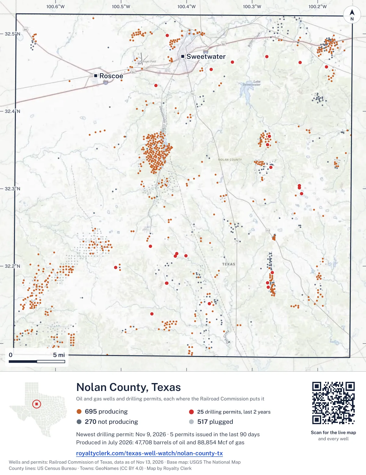
<a href="https://royaltyclerk.com/texas-well-watch/nolan-county-tx"><img src="https://royaltyclerk.com/maps/county-wells/nolan-county-tx.svg" alt="Map of Nolan County, Texas, with 1,482 oil and gas wells and 25 recent drilling locations as dots." width="1000" height="1300" loading="lazy" style="max-width:100%;height:auto;border:0"></a>
<p style="margin:4px 0 0;font-size:14px">Map: <a href="https://royaltyclerk.com/texas-well-watch/nolan-county-tx">Nolan County, Texas oil and gas wells</a> by Royalty Clerk, from Railroad Commission of Texas records</p>
The last twelve months
Month by month in Nolan County
| Month | Permits | Completions | First production |
|---|---|---|---|
| Nov 2026 | 3 | 0 | 0 |
| Oct 2026 | 2 | 0 | 0 |
| Aug 2026 | 2 | 1 | 0 |
| Jul 2026 | 3 | 1 | 0 |
| Jun 2026 | 3 | 1 | 0 |
| May 2026 | 1 | 3 | 0 |
| Apr 2026 | 2 | 0 | 0 |
| Jan 2026 | 1 | 2 | 1 |
| Dec 2025 | 1 | 0 | 0 |
Counted from November 17, 2025 to November 9, 2026, so the first and last months are partial. Source: Railroad Commission of Texas data sets.
Free, no sign-in
The newest drilling permits in Nolan County
| Issued | Lease and well | Operator | Drilling began | Depth, ft | API number | Coordinates | Permit |
|---|---|---|---|---|---|---|---|
| 2026-11-09 | BRIDGFORD 102 1recompletion · verticalPer Operating LLCAPI 42-353-33696 · permit 091963632.17815, -100.430837,400 ft | Per Operating LLC | |||||
| 2026-11-06 | BRIDGFORD 102 2Hnew drill · horizontalPer Operating LLCAPI 42-353-33774 · permit 091990132.17800, -100.430006,950 ft | Per Operating LLC | |||||
| 2026-11-04 | EAGLE CREEK 1recompletion · horizontalPer Operating LLCAPI 42-353-33085 · permit 091963832.13847, -100.453207,200 ft | Per Operating LLC | |||||
| 2026-10-21 | BIG EIGHT 1new drill · verticalWalter Exploration CompanyAPI 42-353-33773 · permit 091943732.29369, -100.224465,450 ft | Walter Exploration Company | |||||
| 2026-10-12 | THOMAS RANCH 1Hrecompletion · horizontalPer Operating LLCAPI 42-353-33447 · permit 091914332.19808, -100.508257,400 ft | Per Operating LLC | |||||
| 2026-08-07 | HANKS, BILLIE 'C' 2new drill · verticalGoodrock Natural Resources, LLCAPI 42-353-33772 · permit 091761532.17854, -100.276697,200 ft | Goodrock Natural Resources, LLC | |||||
| 2026-08-06 | HANKS, BILLIE 'C' 1new drill · verticalGoodrock Natural Resources, LLCAPI 42-353-33771 · permit 091760932.17285, -100.275517,200 ft | Goodrock Natural Resources, LLC | |||||
| 2026-07-24 | CP #26-136 CATHODIC PROTECTION 39new drill · verticalEnergy Transfer CompanyAPI 42-353-33770 · permit 091724832.46370, -100.32992600 ft | Energy Transfer Company | |||||
| 2026-07-21 | MRS KILGORE 1new drill · verticalTDC Engineering, Inc.API 42-353-33769 · permit 091616832.21298, -100.41716drilling began 2026-08-29 · 7,000 ft | TDC Engineering, Inc. | |||||
| 2026-07-08 | JOE YOUNG 9Rrecompletion · verticalScout Energy Management LLCAPI 42-353-33034 · permit 091688332.36789, -100.273825,900 ft | Scout Energy Management LLC | |||||
| 2026-06-26 | JOE YOUNG 3recompletion · verticalScout Energy Management LLCAPI 42-353-33014 · permit 091667332.35691, -100.276475,900 ft | Scout Energy Management LLC | |||||
| 2026-06-17 | AR-94 REPLACEMENT TINER 1new drill · verticalOneok West TX NGL PL, L.L.C.API 42-353-33765 · permit 091491732.46283, -100.22655300 ft | Oneok West TX NGL PL, L.L.C. | |||||
| 2026-06-15 | LIGHT CRUDE 1new drill · verticalTDC Engineering, Inc.API 42-353-33768 · permit 091573332.21330, -100.40082drilling began 2026-08-12 · 7,000 ft | TDC Engineering, Inc. | |||||
| 2026-05-22 | AAA-TEXAS 1recompletion · verticalGoodrock Natural Resources, LLCAPI 42-353-32788 · permit 091575332.19147, -100.269306,166 ft | Goodrock Natural Resources, LLC | |||||
| 2026-04-28 | EAST SHORE UNIT 2new drill · verticalWalter Exploration CompanyAPI 42-353-33767 · permit 091513932.30385, -100.22808drilling began 2026-07-07 · 4,600 ft | Walter Exploration Company | |||||
| 2026-04-21 | ORW MP 108.400 REPLACEMENT SOUKU 1new drill · verticalMagellan Pipeline Company, L.P.API 42-353-33766 · permit 091496932.47076, -100.27757drilling began 2026-08-11 · 450 ft | Magellan Pipeline Company, L.P. | |||||
| 2026-01-05 | ALDERMAN 1new drill · verticalLPR Energy, LLCAPI 42-353-33764 · permit 091203532.15139, -100.36530drilling began 2026-01-08 · 7,000 ft | LPR Energy, LLC | |||||
| 2025-12-04 | KCRA RECT 1new drill · verticalAtmos Energy Corp., Mid-Tex Div.API 42-353-33763 · permit 091158532.22562, -100.45529540 ft | Atmos Energy Corp., Mid-Tex Div. | |||||
| 2025-08-15 | EAST SHORE UNIT 1new drill · verticalWalter Exploration CompanyAPI 42-353-33762 · permit 090983332.30112, -100.22793drilling began 2025-09-10 · 4,600 ft | Walter Exploration Company | |||||
| 2025-07-23 | WA-190 1new drill · verticalAtmos Pipeline - TexasAPI 42-353-33761 · permit 090895932.49789, -100.42934500 ft | Atmos Pipeline - Texas | |||||
| 2025-04-24 | ORW MP 103.4 NEW SOUKUP 3new drill · verticalMagellan Pipeline Company, L.P.API 42-353-33760 · permit 090745532.45399, -100.36238550 ft | Magellan Pipeline Company, L.P. | |||||
| 2025-04-24 | ORW MP 113.6 NEW SOUKUP 2new drill · verticalMagellan Pipeline Company, L.P.API 42-353-33759 · permit 090745232.45747, -100.18670550 ft | Magellan Pipeline Company, L.P. | |||||
| 2025-04-01 | CHERRY WRIGHT 1new drill · verticalTDC Engineering, Inc.API 42-353-32638 · permit 090700232.21621, -100.41513drilling began 2025-04-07 · 6,473 ft | TDC Engineering, Inc. | |||||
| 2025-03-20 | BOYD, C.E. 59 LCS 759Rrecompletion · verticalClear Fork, IncorporatedAPI 42-353-32596 · permit 090670832.32770, -100.27171drilling began 2025-04-17 · 6,800 ft | Clear Fork, Incorporated | |||||
| 2025-01-23 | KCRA-5 1new drill · verticalAtmos Pipeline - TexasAPI 42-353-33758 · permit 090496332.43316, -100.44677325 ft | Atmos Pipeline - Texas | |||||
| 2024-10-09 | ARLEDGE 4recompletion · verticalDaylight Petroleum LLCAPI 42-353-33260 · permit 090305332.11092, -100.576087,500 ft | Daylight Petroleum LLC | |||||
| 2024-10-07 | ARLEDGE A 3recompletion · verticalDaylight Petroleum LLCAPI 42-353-33223 · permit 090305032.10107, -100.57232drilling began 2011-08-18 · 7,274 ft | Daylight Petroleum LLC | |||||
| 2024-10-04 | PRICE G 2recompletion · verticalDaylight Petroleum LLCAPI 42-353-33539 · permit 090305532.10245, -100.596937,460 ft | Daylight Petroleum LLC | |||||
| 2024-10-04 | ARLEDGE A 4recompletion · verticalDaylight Petroleum LLCAPI 42-353-33379 · permit 090305132.11183, -100.571697,500 ft | Daylight Petroleum LLC | |||||
| 2024-10-02 | RED DIAMOND 1new drill · verticalSojourner Drilling CorporationAPI 42-353-33757 · permit 090300132.37305, -100.16186drilling began 2024-11-30 · 6,000 ft | Sojourner Drilling Corporation | |||||
| 2024-09-05 | CATHODIC PROTECTION 9new drill · verticalEnergy Transfer CompanyAPI 42-353-33756 · permit 090241732.44535, -100.39615600 ft | Energy Transfer Company | |||||
| 2024-08-21 | SHEFFIELD 1new drill · verticalHeights Energy CorporationAPI 42-353-33755 · permit 090213232.31537, -100.21968drilling began 2025-05-01 · 5,600 ft | Heights Energy Corporation | |||||
| 2024-08-19 | DAVIS 145N 1recompletion · verticalGoodrock Natural Resources, LLCAPI 42-353-31860 · permit 090208632.21150, -100.342316,700 ft | Goodrock Natural Resources, LLC | |||||
| 2024-07-09 | ELISA 1recompletion · verticalScout Energy Management LLCAPI 42-353-33398 · permit 090105432.47835, -100.18967drilling began 2024-07-17 · 5,650 ft | Scout Energy Management LLC | |||||
| 2024-07-03 | HEP15 1new drill · verticalHolly Energy Partners-Op, L.P.API 42-353-33754 · permit 090093932.43573, -100.41219380 ft | Holly Energy Partners-Op, L.P. | |||||
| 2024-06-06 | WATKINS 2H UNIT 2Hrecompletion · horizontalRHB Exploration & Production,llcAPI 42-353-00820 · permit 090008532.48654, -100.170595,800 ft | RHB Exploration & Production,llc | |||||
| 2024-05-16 | HEATHER 1recompletion · verticalScout Energy Management LLCAPI 42-353-33364 · permit 089971332.48132, -100.190535,497 ft | Scout Energy Management LLC | |||||
| 2024-05-07 | MCELMURRAY 'CD' 1Drecompletion · verticalScout Energy Management LLCAPI 42-353-33411 · permit 089936832.48291, -100.187225,706 ft | Scout Energy Management LLC | |||||
| 2024-04-04 | WRIGHT 1re-entry · verticalLainco, Inc.API 42-353-30253 · permit 089853032.33931, -100.59563drilling began 2024-06-18 · 7,500 ft | Lainco, Inc. | |||||
| 2024-02-23 | ETC212 1new drill · verticalSunoco Pipeline L.P.API 42-353-33752 · permit 089735032.43902, -100.42595420 ft | Sunoco Pipeline L.P. | |||||
| 2024-02-23 | ETC204 1new drill · verticalSunoco Pipeline L.P.API 42-353-33751 · permit 089732032.42899, -100.41100420 ft | Sunoco Pipeline L.P. | |||||
| 2024-01-25 | ETC209 1new drill · verticalSunoco Pipeline L.P.API 42-353-33750 · permit 089671232.46215, -100.22600400 ft | Sunoco Pipeline L.P. | |||||
| 2024-01-12 | DAVIS 'A' 1recompletion · verticalGoodrock Natural Resources, LLCAPI 42-353-32464 · permit 089645732.23521, -100.32616drilling began 2024-02-29 · 5,800 ft | Goodrock Natural Resources, LLC | |||||
| 2023-12-19 | DAVIS 145N 2re-entry · verticalGoodrock Natural Resources, LLCAPI 42-353-31977 · permit 089601432.20846, -100.346266,725 ft | Goodrock Natural Resources, LLC | |||||
| 2023-12-15 | DAVIS 164 2re-entry · verticalGoodrock Natural Resources, LLCAPI 42-353-32083 · permit 089592332.21471, -100.349764,029 ft | Goodrock Natural Resources, LLC | |||||
| 2023-11-13 | BROOKS 1new drill · verticalMarshall R. Young Operating, LLCAPI 42-353-33749 · permit 089520132.31383, -100.23089drilling began 2023-11-25 · 5,800 ft | Marshall R. Young Operating, LLC | |||||
| 2023-11-13 | DAVIS 145N 1re-entry · verticalGoodrock Natural Resources, LLCAPI 42-353-31860 · permit 089515532.21150, -100.342316,700 ft | Goodrock Natural Resources, LLC | |||||
| 2023-11-13 | GROUP 4000 UNIT 'A' 15Areclass · verticalWinchester Energy, LLCAPI 42-353-32231 · permit 089500732.18925, -100.384554,200 ft | Winchester Energy, LLC | |||||
| 2023-09-08 | CRAIG 'A' 2recompletion · verticalGoodrock Natural Resources, LLCAPI 42-353-31704 · permit 089353532.13798, -100.369586,350 ft | Goodrock Natural Resources, LLC | |||||
| 2023-08-07 | ALDERMAN, RAY '65-B' 1recompletion · verticalGoodrock Natural Resources, LLCAPI 42-353-31910 · permit 089254732.14213, -100.38594drilling began 2023-07-11 · 6,743 ft | Goodrock Natural Resources, LLC |
A permit is permission to drill, not a well. Source: Railroad Commission of Texas drilling permit files.
Year by year
Drilling permits issued in Nolan County, by year
| Year | Permits issued |
|---|---|
| 2026 so far | 17 |
| 2025 | 8 |
| 2024 | 18 |
| 2023 | 7 |
Counted from the permit files we hold, which start in 2023; that first year may be partial. Source: Railroad Commission of Texas drilling permit files.
The latest
The most recent records
| Date | What, who and where |
|---|---|
| 2026-11-09 | Permit issued: Per Operating LLCBRIDGFORD 102 · A-1865 · permit 0919636 |
| 2026-11-06 | Permit issued: Per Operating LLCBRIDGFORD 102 · A-1865 · permit 0919901 |
| 2026-11-04 | Permit issued: Per Operating LLCEAGLE CREEK · A-1573 · permit 0919638 |
| 2026-10-21 | Permit issued: Walter Exploration CompanyBIG EIGHT · A-229 · permit 0919437 |
| 2026-10-12 | Permit issued: Per Operating LLCTHOMAS RANCH · A-66 · permit 0919143 |
| 2026-08-07 | Permit issued: Goodrock Natural Resources, LLCHANKS, BILLIE 'C' · A-1316 · permit 0917615 |
| 2026-08-06 | Permit issued: Goodrock Natural Resources, LLCHANKS, BILLIE 'C' · A-1316 · permit 0917609 |
| 2026-08-05 | Completed: Citation Oil & Gas Corp.SOUTHWEST NENA LUCIA UNIT |
| 2026-07-24 | Permit issued: Energy Transfer CompanyCP #26-136 CATHODIC PROTECTION · A-350 · permit 0917248 |
| 2026-07-24 | Completed: Clear Fork, IncorporatedBOYD, (CADDO CONGLOMERATE) UNIT · A-429 |
| 2026-07-21 | Permit issued: TDC Engineering, Inc.MRS KILGORE · A-74 · permit 0916168 |
| 2026-07-08 | Permit issued: Scout Energy Management LLCJOE YOUNG · A-372 · permit 0916883 |
| 2026-06-26 | Permit issued: Scout Energy Management LLCJOE YOUNG · A-403 · permit 0916673 |
| 2026-06-17 | Permit issued: Oneok West TX NGL PL, L.L.C.AR-94 REPLACEMENT TINER · A-1617 · permit 0914917 |
| 2026-06-15 | Permit issued: TDC Engineering, Inc.LIGHT CRUDE · A-1348 · permit 0915733 |
Coming up
First checks coming due in Nolan County
- BOYD, (CADDO CONGLOMERATE) UNIT, Clear Fork, Incorporatedby November 28, 2026
Follow it
Watch Nolan County, or one abstract
What do you want to follow?
Where the land is. Your deed or lease names it.
For example A-1119, or Bush, or T&P 38. Your deed or the tax bill has it.
Other counties
Drilling activity in other counties
Related
Related
- ToolTexas well watchPermit, completion, first production and when the first check is due.
- ToolIs this buyout offer fair?The offer as months of your income, what the acres mean, and the questions to ask.
- ToolIs this lease offer good?Bonus and royalty against the county, and a scan of the lease's clauses.
- Texas dataTexas operator changesWho took over whose leases in the last 24 months.
- ToolLate payment interestDeadlines and the interest a late payment earns.
- Texas dataTexas oil and gas atlas254 counties, every lease, operator and field.
FAQ
Questions people ask
How many wells were permitted in Nolan County in the last year?
The Railroad Commission issued 18 drilling permits in Nolan County in the twelve months to November 9, 2026, and recorded 8 completions and 1 first-production report. A permit is permission to drill, not a well.
How do I get an alert when a permit is issued near my land in Nolan County?
Choose your abstract on this page, or the whole county, and sign in. You get one email a week, only when something new is recorded after you sign up. The alert says whether an event is on an interest in your Mineral File, on a place you follow, or only nearby.
When is my first royalty check due after a new well?
Natural Resources Code section 91.402(a) says on or before 120 days after the end of the month of first sale of production from the well. The state's first-production month is the closest public marker, so the date on this page is the earliest, not a certainty.
Got a new well on your land?
The first check is due within 120 days after the end of the month of first sale.
Sources
Primary sources, opened on 29 September 2026. Statute text is the current version on statutes.capitol.texas.gov.