
Cooke County, Texas
Oil wells and drilling locations near Lindsay
- 1,226wells
- 19drilling locations in two years
- 179producing leases
Within 10 miles
Wells and drilling locations around Lindsay
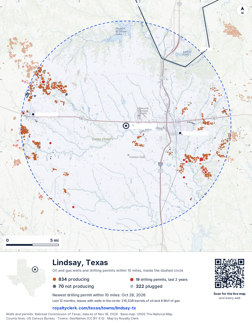
- Drilling locations19Permits issued in the last two years
- Producing wells834On a lease reporting production now
- Not producing70Shut in, inactive or no lease on record
- Plugged322The state's wellbore record says plugged
The dashed circle is 10 miles from the town's point (33.63594, -97.22279); the counts are for wells inside it. Sources: Railroad Commission of Texas well layers and permit files, US Census Bureau county outlines, town points from GeoNames (CC BY 4.0), base map from USGS The National Map.
Use this map on your site
You may show this map on any site, unchanged. Keep the credit line and its link to Royalty Clerk under the map. The picture updates by itself as the state records new wells and permits.
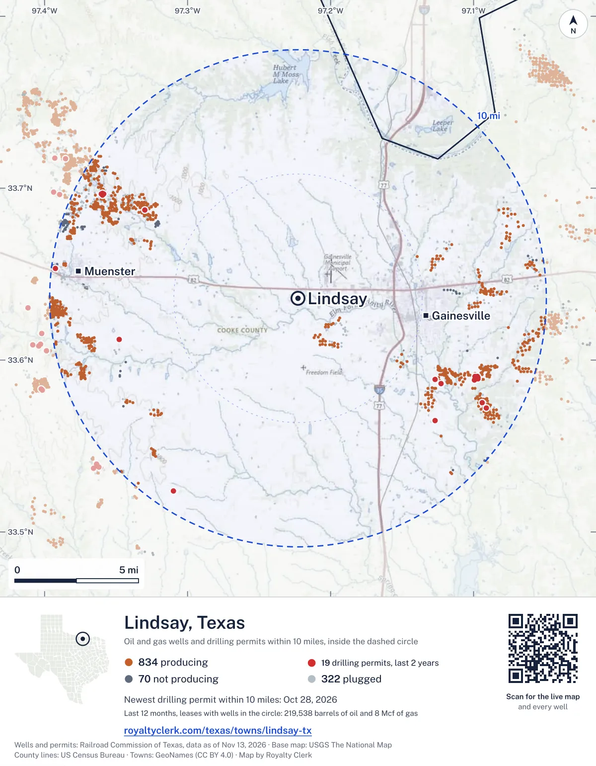
<a href="https://royaltyclerk.com/texas/towns/lindsay-tx"><img src="https://royaltyclerk.com/maps/town-wells/lindsay-tx.svg" alt="Map of Lindsay, Texas: 1,226 wells and 19 recent drilling locations within 10 miles, inside a dashed circle." width="1000" height="1284" loading="lazy" style="max-width:100%;height:auto;border:0"></a>
<p style="margin:4px 0 0;font-size:14px">Map: <a href="https://royaltyclerk.com/texas/towns/lindsay-tx">Lindsay, Texas oil and gas wells</a> by Royalty Clerk, from Railroad Commission of Texas records</p>
Which way it is heading
Where the new drilling is around Lindsay
What became of the 19 permits
- 6finished, on a lease that reports productionThe well was completed and its lease is reporting oil or gas to the state.
- 6drilling startedThe operator reported a start date. No completion is on file yet.
- 7still only a permitNothing after the permit is on file. Many permits wait a year or more, and some are never drilled.
Wells finished in the last two years: 5 south-east, 1 north-west of town.
A permit is permission to drill, not a well, and a well nearby says nothing about who owns the minerals under it. Direction is taken from the well's surface location. Source: Railroad Commission of Texas drilling permits and wellbore records.
When a new well starts paying
First checks coming due near Lindsay
- Trew, R. W. "D" well 21due by November 28, 2026
The date is the earliest the law allows a first payment to be late (Texas Natural Resources Code 91.402), worked out from the first month of production on file. It is not a promise of a check: title questions and unsigned division orders can hold one back. Work out a first-check date · What to do before the first check
In numbers
Oil and gas within 10 miles of Lindsay
- wells with a location on the state's map
- 1,226
- drilling permits in the last 24 months
- 19
- producing leases with a well in the circle
- 179
- operators running them
- 23
- oil and condensate those leases reported in their latest 12 months
- 219,538 bbl
- gas those leases reported in their latest 12 months
- 8 mcf
A lease counts when at least one of its wells is inside the circle; its whole production is counted, so a lease reaching beyond the circle counts in full.
In dollars
What the oil and gas near Lindsay sold for
- sale value of 12 months, before taxes and costs
- $16 million
- oil and condensate sold
- 215,669 bbl
- gas sold
- 0 mcf
- the middle lease: half sold more, half less
- $52,958
A 0.01 share (1%) of the middle producing lease near Lindsay comes to about $530 for the 12 months.
Sold volumes at the public monthly prices, before severance tax and any costs. A guide to the size, not what any owner was paid.
Sold volumes from each lease's monthly report to the Railroad Commission, times the month's West Texas Intermediate oil price and Henry Hub gas price (EIA). Real prices at the lease differ. A lease counts in full when one of its wells is near the town. Check a statement against what the lease sold
Drilling locations
The newest drilling permits near Lindsay
| Issued | Lease and well | Where | Operator |
|---|---|---|---|
| 2026-10-28 | SCHNIEDERJAN 1vertical · API 42-097-34874 · permit 0919730Felderhoff Production Company | 7.4 mi SE33.56493, -97.12678 on OpenStreetMap (opens in a new tab) | Felderhoff Production Company |
| 2026-09-11 | VESTAL 37vertical · API 42-097-34871 · permit 0918033V & H Oil, L.P. | 7.1 mi NW33.68727, -97.33000 on OpenStreetMap (opens in a new tab) | V & H Oil, L.P. |
| 2026-08-20 | TRUBENBACH 1vertical · API 42-097-34870 · permit 0917947Felderhoff Production Company | 7.4 mi W33.61188, -97.34783 on OpenStreetMap (opens in a new tab) | Felderhoff Production Company |
| 2026-08-07 | KLEMENT, ROBERT 1vertical · API 42-097-34869 · permit 0917640Felderhoff Production Company | 9.2 mi SW33.52403, -97.30994 on OpenStreetMap (opens in a new tab) | Felderhoff Production Company |
| 2026-07-28 | SMITH#1 12vertical · API 42-097-34868 · permit 0917384Triple G Well Service, Inc. | 7.8 mi SE33.58855, -97.09933 on OpenStreetMap (opens in a new tab) | Triple G Well Service, Inc. |
| 2026-06-10 | BONNER 23vertical · API 42-097-34865 · permit 0916271Felderhoff Production Company | 8.5 mi SE33.57525, -97.09396 on OpenStreetMap (opens in a new tab) | Felderhoff Production Company |
| 2026-06-10 | BONNER 22vertical · API 42-097-34864 · permit 0916270Felderhoff Production Company | 8.8 mi SE33.57218, -97.09098 on OpenStreetMap (opens in a new tab) | Felderhoff Production Company |
| 2026-03-05 | YARBROUGH 10vertical · API 42-097-34858 · permit 0913829Felderhoff Production Company | 6.7 mi SE33.58623, -97.12288 on OpenStreetMap (opens in a new tab) | Felderhoff Production Company |
| 2026-03-05 | YARBROUGH 'A' 1vertical · API 42-097-34857 · permit 0913798Felderhoff Production Company | 6.4 mi SE33.58879, -97.12688 on OpenStreetMap (opens in a new tab) | Felderhoff Production Company |
| 2026-01-06 | SMITH#1 10vertical · API 42-097-34854 · permit 0912514Triple G Well Service, Inc. | 7.8 mi SE33.59042, -97.09893 on OpenStreetMap (opens in a new tab) | Triple G Well Service, Inc. |
| 2025-12-12 | SMITH#1 11vertical · API 42-097-34849 · permit 0912118Triple G Well Service, Inc. | 7.8 mi SE33.58962, -97.09866 on OpenStreetMap (opens in a new tab) | Triple G Well Service, Inc. |
| 2025-10-08 | TREW,R.W. 'D' 21vertical · API 42-097-34835 · permit 0906722V & H Oil, L.P. | 9.0 mi NW33.69682, -97.36022 on OpenStreetMap (opens in a new tab) | V & H Oil, L.P. |
| 2025-10-08 | TREW,R.W. 'D' 19vertical · API 42-097-34834 · permit 0906719V & H Oil, L.P. | 8.9 mi NW33.69659, -97.35849 on OpenStreetMap (opens in a new tab) | V & H Oil, L.P. |
| 2025-10-08 | TREW,R.W. 'D' 18vertical · API 42-097-34833 · permit 0906717V & H Oil, L.P. | 8.9 mi NW33.69613, -97.35959 on OpenStreetMap (opens in a new tab) | V & H Oil, L.P. |
| 2025-08-21 | TREW,R.W. 'D' 20vertical · API 42-097-34832 · permit 0906715V & H Oil, L.P. | 8.9 mi NW33.69707, -97.35929 on OpenStreetMap (opens in a new tab) | V & H Oil, L.P. |
| 2025-07-23 | SMITH#1 9vertical · API 42-097-34843 · permit 0909368Triple G Well Service, Inc. | 7.9 mi SE33.59057, -97.09743 on OpenStreetMap (opens in a new tab) | Triple G Well Service, Inc. |
| 2025-07-14 | NOEL, ARIANNE A 3vertical · API 42-097-34841 · permit 0909194HWH Production, LLC | 9.9 mi W33.65327, -97.39242 on OpenStreetMap (opens in a new tab) | HWH Production, LLC |
| 2025-04-23 | SMITH#1 8vertical · API 42-097-34838 · permit 0907508Triple G Well Service, Inc. | 7.9 mi SE33.58910, -97.09684 on OpenStreetMap (opens in a new tab) | Triple G Well Service, Inc. |
| 2025-03-25 | SMITH#1 7vertical · API 42-097-34829 · permit 0906332Triple G Well Service, Inc. | 7.9 mi SE33.58993, -97.09683 on OpenStreetMap (opens in a new tab) | Triple G Well Service, Inc. |
| 2024-07-29 | KING-COFFMAN 1vertical · API 42-097-34823 · permit 0901549Felderhoff Production Company | 8.4 mi E33.60118, -97.08325 on OpenStreetMap (opens in a new tab) | Felderhoff Production Company |
| 2024-04-11 | SMITH 6vertical · API 42-097-34817 · permit 0898452Triple G Well Service, Inc. | 7.8 mi SE33.59240, -97.09768 on OpenStreetMap (opens in a new tab) | Triple G Well Service, Inc. |
| 2023-10-23 | BELL 6vertical · API 42-097-34409 · permit 0893948Reed Production, Inc. | 8.4 mi E33.59658, -97.08467 on OpenStreetMap (opens in a new tab) | Reed Production, Inc. |
| 2021-07-28 | LINN 01vertical · API 42-097-34745 · permit 0871463V & H Oil, L.P. | 9.7 mi W33.59210, -97.38301 on OpenStreetMap (opens in a new tab) | V & H Oil, L.P. |
| 2007-04-04 | BELL 9vertical · API 42-097-33878 · permit 0636106Reed Production, Inc. | 8.1 mi E33.59634, -97.09005 on OpenStreetMap (opens in a new tab) | Reed Production, Inc. |
A permit is permission to drill, not a well. Distances are from the town's point to the well's surface location. Source: Railroad Commission of Texas drilling permits.
Find your land
The surveys under the new drilling near Lindsay
- A-874 REDMAN, J N4 permits, newest July 28, 2026
- A-5 ANIBAL, B3 permits, newest October 8, 2025
- A-588 LAWSON, J2 permits, newest March 5, 2026
- A-950 STROUD, T B2 permits, newest January 6, 2026
- A-435 HAM, C K1 permit, newest October 28, 2026
- A-164 BBB&C RR CO1 permit, newest September 11, 2026
- A-55 BROWN, R R1 permit, newest August 20, 2026
- A-790 NAIL, H1 permit, newest August 7, 2026
Not in the list? Search every survey in the county by name or abstract number.
Producing leases
Top producing leases near Lindsay
- 1Almon19,218 bbl · 0 mcf a yearBLS Production Co., Inc. · Cooke County · 25 wells in the circle
- 2Fette -C-12,088 bbl · 0 mcf a yearWFW Production Company, Inc. · Cooke County · 28 wells in the circle
- 3Danglemeyer 'B'10,292 bbl · 0 mcf a yearHWH Production, LLC · Cooke County · 7 wells in the circle
- 4Smith #110,081 bbl · 0 mcf a yearTriple G Well Service, Inc. · Cooke County · 8 wells in the circle
- 5Bell5,806 bbl · 0 mcf a yearReed Production, Inc. · Cooke County · 15 wells in the circle
- 6Talbott5,339 bbl · 0 mcf a yearTriple G Well Service, Inc. · Cooke County · 11 wells in the circle
- 7Bell5,204 bbl · 0 mcf a yearReed Production, Inc. · Cooke County · 1 well in the circle
- 8Hellman, G. H.4,946 bbl · 8 mcf a yearFelderhoff Production Company · Cooke County · 29 wells in the circle
- 9Overstreet-Long Unit4,406 bbl · 0 mcf a yearSeitz, J. R. & Adam, Ltd. · Cooke County · 2 wells in the circle
- 10Danglemeyer 'C'4,323 bbl · 0 mcf a yearHWH Production, LLC · Cooke County · 8 wells in the circle
- 11Fomby4,016 bbl · 0 mcf a yearReed Production, Inc. · Cooke County · 7 wells in the circle
- 12Carr3,799 bbl · 0 mcf a yearTriple G Well Service, Inc. · Cooke County · 10 wells in the circle
- 13McDonnold, D. C. Et Al3,532 bbl · 0 mcf a yearBLS Production Co., Inc. · Cooke County · 2 wells in the circle
- 14Wyatt, W.m.3,469 bbl · 0 mcf a yearFelderhoff Production Company · Cooke County · 5 wells in the circle
- 15Towery3,033 bbl · 0 mcf a yearSeitz, J. R. & Adam, Ltd. · Cooke County · 1 well in the circle
- 16Bandy2,981 bbl · 0 mcf a yearSeitz, J. R. & Adam, Ltd. · Cooke County · 3 wells in the circle
- 17Narado2,860 bbl · 0 mcf a yearSeitz, J. R. & Adam, Ltd. · Cooke County · 2 wells in the circle
- 18Bonner, J. G.2,848 bbl · 0 mcf a yearFelderhoff Production Company · Cooke County · 22 wells in the circle
- 19Rose2,386 bbl · 0 mcf a yearTriple G Well Service, Inc. · Cooke County · 9 wells in the circle
- 20Yarbrough2,147 bbl · 0 mcf a yearFelderhoff Production Company · Cooke County · 7 wells in the circle
Whose name is on the check
Who buys the oil and gas near Lindsay
Oil and condensate
- PTT PREMIER TRADING AND TRAN LLC97 leases
- OKLAHOMA PETROLEUM ALLIES, LLC43 leases
- CP ENERGY, L.L.C.26 leases
- ENERGY TRANSFER MARKETING & TERM18 leases
- GULFMARK ENERGY, INC.7 leases
From each lease's newest Form P-4 filing with the Railroad Commission, which names its gatherers and purchasers. One lease can name several.
If your checks stopped
Leases near Lindsay that went quiet or changed hands
9 leases reported nothing for a year or more
Leases that reported within the last four years and then stopped. The newest to stop first.
- Rivoire · Jones, L. E. Operating, Inc.last report August 2025
- Wilson · Felderhoff Production Companylast report July 2025
- Wilson · Ski Production, LLClast report December 2024
- Judy, A., -A- · CR Reed Production, Inc.last report November 2024
- Gregory · BLS Production Co., Inc.last report March 2024
- Bugg, J. F. -A- · Brammer Petroleum, Inc.last report July 2023
- Felderhoff Consolidated · Whittington Energy Co.last report January 2023
- Johnson, J. H. · Seitz, J. R. & Adam, Ltd.last report December 2022
- Bell, Lucille K. · Brammer Petroleum, Inc.last report November 2022
11 leases got a new operator in two years
Checks often pause after a change while the new company sets up its owner records. The newest first; 10 shown.
- Hellman, G. H.FJH Oil Company to Felderhoff Production CompanyJuly 2026
- TalbottFelderhoff Production Company to Triple G Well Service, Inc.February 2026
- THS UnitMiller, Glenn J. to Miller Petroleum LLCAugust 2025
- StraussPeterson Oil and Gas LLC to WLH Production LLCJuly 2025
- WatsonSpade Energy L.L.C. to WLH Production LLCJuly 2025
- WatsonPeterson Oil and Gas LLC to Spade Energy L.L.C.June 2025
- Wilson, O.D & N Oil Co. to Davis, Kelly J.May 2025
- Bordovsky UnitXYZ Oil, Inc. to WLH Production LLCMarch 2025
- Harbolt(winger) Field UnitFelderhoff Production Company to Seitz, J. R. & Adam, Ltd.January 2025
- MartinFelderhoff Production Company to Seitz, J. R. & Adam, Ltd.January 2025
From the monthly production reports operators file with the Railroad Commission. The newest months fill in late, so a lease is listed only after 12 months with no report.
Year by year
Production of the leases near Lindsay, by year
| Year | Oil, bbl | Gas, mcf |
|---|---|---|
| 2026 so far | 140,045 | 4 |
| 2025 | 222,592 | 12 |
| 2024 | 223,048 | 12 |
| 2023 | 247,406 | 65 |
| 2022 | 268,194 | 60 |
| 2021 | 252,662 | 37 |
| 2020 | 247,649 | 36 |
Every lease with a well in the circle, producing now or not, as reported to the Railroad Commission. The newest months fill in as operators report.
The long view: in the state's records from January 1993 on, 213 of these leases reported 10,028,168 bbl of oil and condensate and 18,535 mcf of gas. Each lease page carries that lease's history back to January 1993.
Around it
Towns near Lindsay
- Gainesville5.2 mi E823 wells · 11 permits
- Muenster8.9 mi W1,969 wells · 29 permits
- Lake Kiowa13 mi E972 wells · 19 permits
- Saint Jo18 mi W2,221 wells · 19 permits
- Whitesboro18 mi E1,156 wells · 21 permits
- Collinsville19 mi E652 wells · 10 permits
- Sanger19 mi S389 wells · 0 permits
- Pilot Point22 mi SE67 wells · 0 permits
- Krum26 mi S1,944 wells · 23 permits
- Southmayd26 mi E754 wells · 20 permits
Lindsay is in ZIP code 76250: its wells and permits
All of Cooke County: leases, operators and production · Cooke County well map
Press and community kit
Writing about Lindsay? Take what you need
Three facts to quote
- 1,226 oil and gas wells on the state's map lie within 10 miles of Lindsay: 834 on producing leases, 70 not producing and 322 plugged.
- The Railroad Commission of Texas issued 11 drilling permits within 10 miles of Lindsay in the last 12 months, the newest dated October 28, 2026.
- The 179 producing leases with a well in that circle, run by 23 operators, reported 219,538 barrels of oil and 8 thousand cubic feet of gas over their latest 12 months.
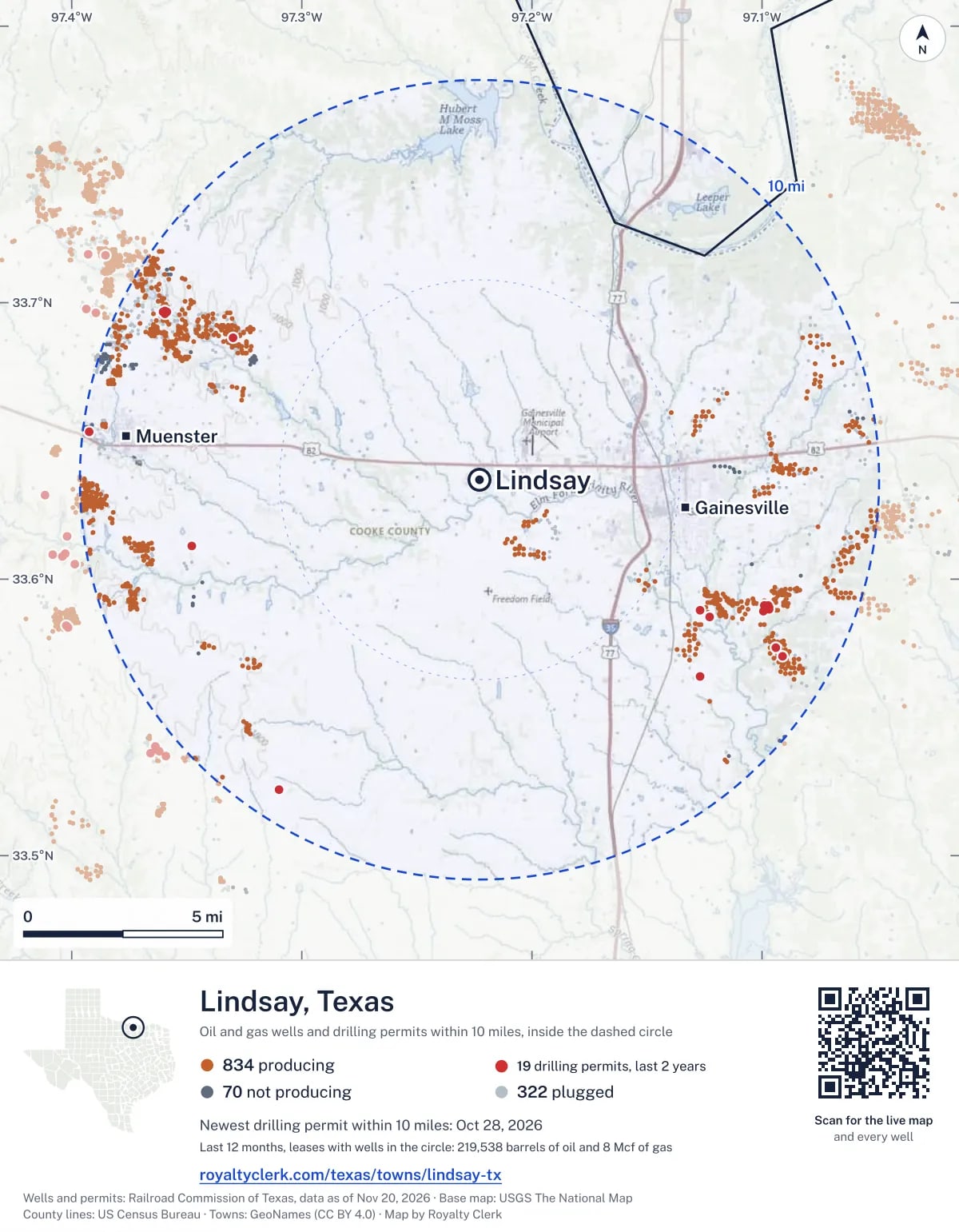
The map picture
The page's map with its legend and credit, as a JPEG.

The live map on your page
A frame that loads its picture first and the live map on a tap. No cookies.
How to cite
Railroad Commission of Texas records of the wells and drilling permits within 10 miles of Lindsay, mapped by Royalty Clerk (https://royaltyclerk.com/texas/towns/lindsay-tx), data as of November 15, 2026.
Under a map or a chart: Source: Railroad Commission of Texas · Map: Royalty Clerk, with a link to this page.
The figures say where the state's records put wells and permits, not who owns the land or the minerals. Kits for other Texas towns
Follow it
Watch the 10 miles around Lindsay
Watching a place says nothing about who owns the land or the minerals there. For the whole county, or one survey, use the Cooke County well watch.
FAQ
Questions people ask
How many oil and gas wells are near Lindsay?
1,226 wells with a location on the Railroad Commission's map lie within 10 miles of Lindsay: 834 on leases that are producing, 70 not producing and 322 plugged. The state also issued 19 drilling permits with a well location in that circle in the last 24 months.
What are the coordinates on this page?
Latitude and longitude of the well's surface location in NAD83, the coordinates map apps use. They come from the Railroad Commission's well layers as published, and from its drilling permit files, which are published in the older NAD27 and converted here. Paste them into any map app. A horizontal well's bottom hole can be a mile or two away from its surface location.
Do I own minerals under a well near Lindsay?
A well nearby says nothing about who owns the minerals under it. The county's mineral roll lists who is paid on each producing lease. Search a name to see whether the Cooke County roll lists it.
Is drilling near Lindsay picking up or slowing down?
Drilling permits near Lindsay are rising: 11 permits in the last 12 months, 8 in the 12 months before. They are spread around town, with no side clearly ahead. The nearest is 6.4 miles south-east of the town's point. A permit is permission to drill, not a well.
When does a new well near Lindsay start paying royalties?
Texas law gives the payor 120 days after the end of the month of first sale to send the first payment (Natural Resources Code 91.402). The next date on file for a lease near Lindsay is November 28, 2026. The date is the earliest a first payment becomes late, not a promise: a title question or an unsigned division order can hold a check back.
How much are the oil and gas near Lindsay worth?
The 179 producing leases with a well within 10 miles sold about $16 million of oil and gas in their newest 12 months on file, at the public monthly prices and before taxes and costs. That is what the leases sold, not what a tract of land or a mineral interest is worth: an owner is paid a share of one lease.
My checks from a lease here stopped. Why?
The usual reasons: the lease stopped producing, a new operator took it over, or the operator put the payments in suspense over a title or address question. Near Lindsay, 9 leases went quiet and 11 changed operator; both lists are on this page.
Own land or minerals near Lindsay?
The next first check near Lindsay falls due by November 28, 2026. See whether a county roll lists your name, and get an email when a permit or a new well is filed near you.
Sources
Primary sources, opened on 29 September 2026. Statute text is the current version on statutes.capitol.texas.gov.