
Texas county · RRC district 04
Cameron County, Texas oil and gas
- 0producing leases
- 5wells on the map
- 1drilling location in two years
Oil wells and drilling locations in Cameron County
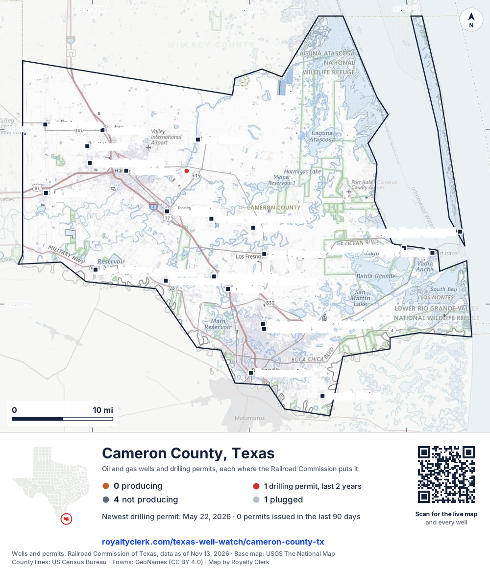
- Drilling locations1Permits issued in the last two years
- Producing wells0On a lease reporting production now
- Not producing4Shut in, inactive or no lease on record
- Plugged1The state's wellbore record says plugged
Sources: Railroad Commission of Texas well layers and permit files, US Census Bureau county outline, town points from GeoNames (CC BY 4.0), base map from USGS The National Map. A dot is a surface location; a horizontal well runs a mile or more from it.
5 wells with a location on the state's map (0 producing, 4 not producing, 1 plugged) and 1 drilling location permitted in the last 24 months, each where the Railroad Commission puts it.
Use this map on your site
You may show this map on any site, unchanged. Keep the credit line and its link to Royalty Clerk under the map. The picture updates by itself as the state records new wells and permits.
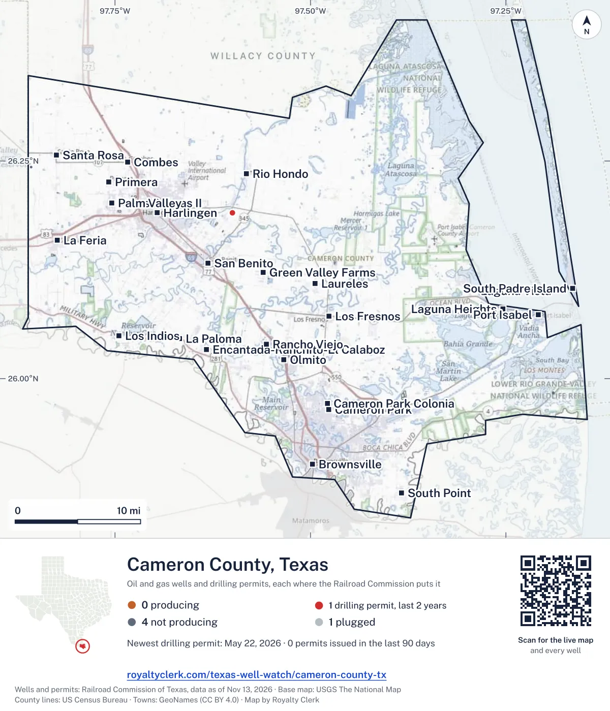
<a href="https://royaltyclerk.com/texas/counties/cameron-county-tx"><img src="https://royaltyclerk.com/maps/county-wells/cameron-county-tx.svg" alt="Map of Cameron County, Texas, with 5 oil and gas wells and 1 recent drilling locations as dots." width="1000" height="1166" loading="lazy" style="max-width:100%;height:auto;border:0"></a>
<p style="margin:4px 0 0;font-size:14px">Map: <a href="https://royaltyclerk.com/texas/counties/cameron-county-tx">Cameron County, Texas oil and gas wells</a> by Royalty Clerk, from Railroad Commission of Texas records</p>
Wells near a town: Combes · Green Valley Farms · Harlingen · La Feria · Laguna Heights · Laguna Vista · Las Palmas II · Laureles · Los Indios · Palm Valley · Port Isabel · Primera · Rio Hondo · San Benito · Santa Rosa · South Padre Island · Newest drilling permits in Cameron County · Wells by ZIP code
Cameron County reported no oil or gas in the last 12 months. That ranks 222nd of 225 Texas counties by oil.
County dossier
August 2026 is still coming in. About 89% of Texas leases have reported it so far, so this page counts through July 2026 until it is fully reported.
- Producing leases
- 0of 5 on record
- Operators
- 0
- Fields
- 0
Own minerals in Cameron County?
A family member owned minerals here?
Search their name: a family member who owned minerals hereWhere it sits
This county
- Wells on record
- 5on leases with production reports
- Data through
- Jul 2026
Five years of output in Cameron County
Oil output in Cameron County: 0 bbl in the last 12 months
0 bbl through Jul 2026. Peak Nov 2021: 54 bbl.
Gas output in Cameron County: 0 mcf in the last 12 months
0 mcf through Jul 2026. Peak Jul 2023: 2,292 mcf.
SourceTexas Railroad Commission Production Data Query, county totals, through Jul 2026, file dated Oct 20, 2026.
Cite or embed this chart
Free to use for Cameron County, Texas, with a credit and a link. Copy what you need.
Credit line
Source: Royalty Clerk analysis of Texas Railroad Commission filings, https://royaltyclerk.com/texas/counties/cameron-county-tx, data to July 2026.
The chart on your own page
Free to embed on any site. Keep the “Source: Royalty Clerk” link under the chart.
See the code
<iframe
  src="https://royaltyclerk.com/embed/counties/cameron-county-tx"
  title="Royalty Clerk: oil and gas production, Cameron County, Texas"
  width="100%"
  height="400"
  style="border:0"
  loading="lazy"></iframe>
<p style="margin:4px 0 0;font-size:14px">Source: <a href="https://royaltyclerk.com/texas/counties/cameron-county-tx" target="_blank">Royalty Clerk</a></p>
<script>
window.addEventListener("message", function (e) {
  if (e.origin !== "https://royaltyclerk.com" || !e.data || e.data.type !== "rc-embed-height") return;
  var frames = document.getElementsByTagName("iframe");
  for (var i = 0; i < frames.length; i++) {
    if (frames[i].contentWindow === e.source && e.data.height > 0) frames[i].style.height = Number(e.data.height) + "px";
  }
});
</script>
Cameron County oil and gas production by year, 1993 to 2025
Every full year we hold, 1993 to 2025. The highest year for oil since 1993 was 2011, at 3,940 bbl. The highest year for gas was 1993, at 2,527,110 mcf.
| Year | Oilbbl | Gasmcf |
|---|---|---|
| 2025 | 0 | 0 |
| 2024 | 42 | 4,776 |
| 2023 | 109 | 17,418 |
| 2022 | 137 | 8,563 |
| 2021 | 690 | 20,810 |
| 2020 | 780 | 26,902 |
| 2019 | 599 | 30,504 |
| 2018 | 755 | 83,432 |
| 2017 | 632 | 86,927 |
| 2016 | 588 | 165,227 |
| 2015 | 923 | 203,873 |
| 2014 | 389 | 276,469 |
| 2013 | 501 | 462,692 |
| 2012 | 1,772 | 991,248 |
| 2011 | 3,940 | 1,021,427 |
| 2010 | 765 | 133,071 |
| 2009 | 701 | 133,850 |
| 2008 | 730 | 103,263 |
| 2007 | 668 | 102,920 |
| 2006 | 932 | 167,249 |
| 2005 | 1,201 | 188,866 |
| 2004 | 1,471 | 272,882 |
| 2003 | 780 | 853,585 |
| 2002 | 720 | 1,109,254 |
| 2001 | 2,084 | 692,407 |
| 2000 | 2,287 | 1,185,329 |
| 1999 | 1,967 | 1,040,491 |
| 1998 | 2,679 | 1,328,850 |
| 1997 | 2,786 | 995,386 |
| 1996 | 2,564 | 1,062,121 |
| 1995 | 3,023 | 1,180,795 |
| 1994 | 3,244 | 1,809,591 |
| 1993 | 3,569 | 2,527,110 |
SourceTexas Railroad Commission production records, added up by county and calendar year. Oil includes condensate; gas includes casinghead gas. The year in progress is left out until it is complete.
The biggest leases in Cameron County
Under each volume: change on the year before.
- No lease in this list matches. Clear the filter, or search the whole record.
Showing 0 of 0.
Other leases on record in Cameron County
SourceTexas Railroad Commission Production Data Query.
Who runs the leases, and what they produce
Operators in Cameron County, by oil
Nothing reported in this period.
Fields in Cameron County, by oil
Nothing reported in this period.
More operators here
Search this county →Recent drilling permits in Cameron County
WILDCAT #7
new drill · WWM Operating, LLC · Cameron County
Permit 0915604 · May 22, 2026